Lisboa Mapa Transporte Público
Lisbon Public Transport Map
2020
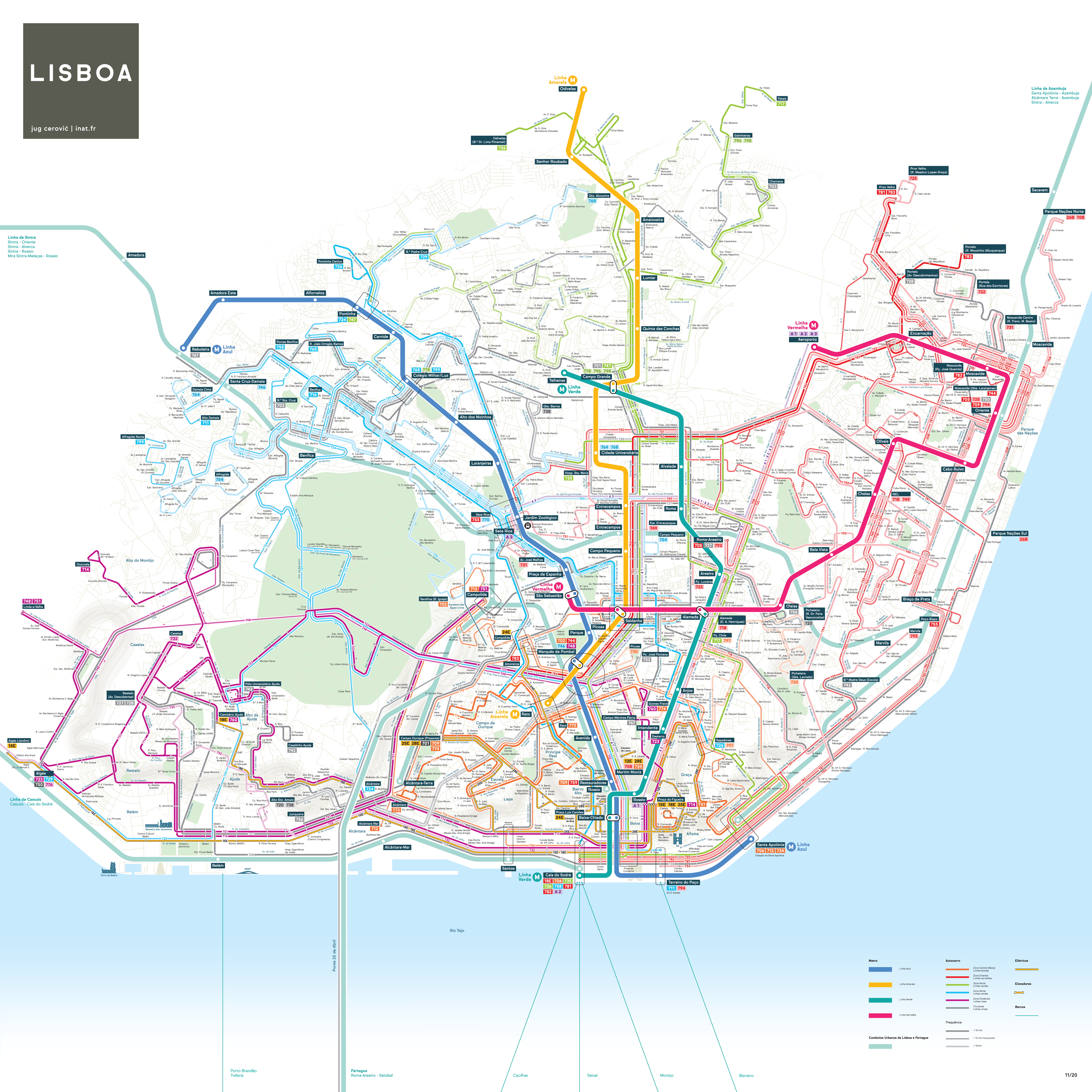
Lisbon Multimodal Public Transport Map
Metro, trams, buses, funiculars, ferries and trains.
Metro de Lisboa + Carris + Comboios de Portugal + Fertagus + Transtejo & Soflusa
Bus lines use official colors and are classified in 3 categories according to frequency:
- High frequency
- High frequency in peak hours
- Low frequency
All bus lines are shown with all stops and stop names.
The map also features all streets as well as some elevation shading.
The map is tilted 15° so that the Tejo is horizontal and Baixa vertical.
Typeface: Sul Sans by R-Typography