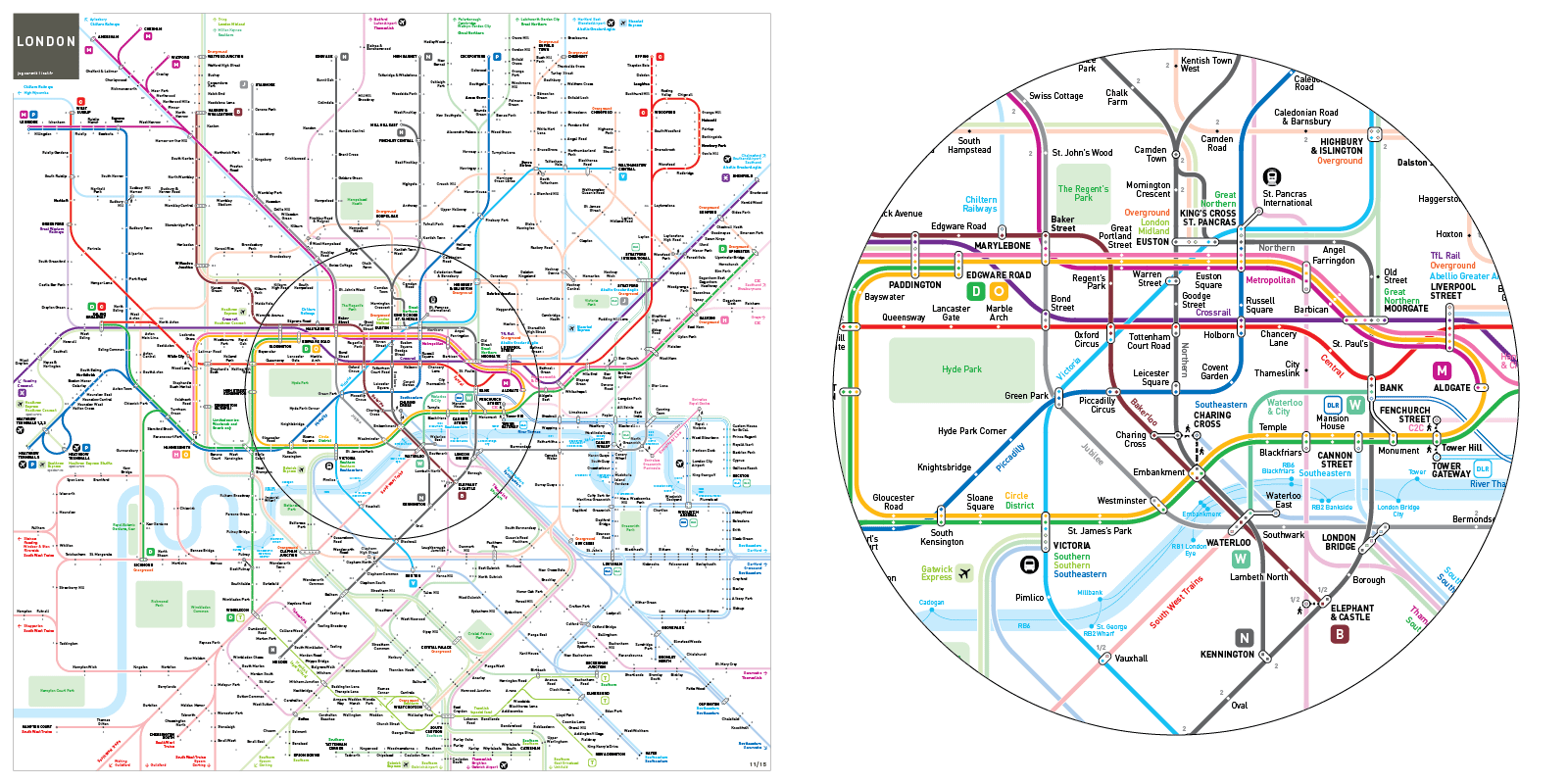
London Underground and Rail Map

TfL: Underground, Docklands Light Railway, Overground, TfL Rail,
National Rail Lines: Thameslink, South Western Railway, Southern, Southeastern, C2C, Greater Anglia, Great Northern, Great Western Railway, West Midlands Trains, Chiltern Railways
Airport Rail Links: Heathrow Express, Heathrow Connect, Stansted Express, Gatwick Express
inat Metro Mapping Standard
2014
Print Shop

Art prints, posters, scarves, pillows...
DESIGN NOTES
Geography in the central zone
Inside the Circle line loop, where the underground network scale and the walking distances are related, the schematic map is close to geography.
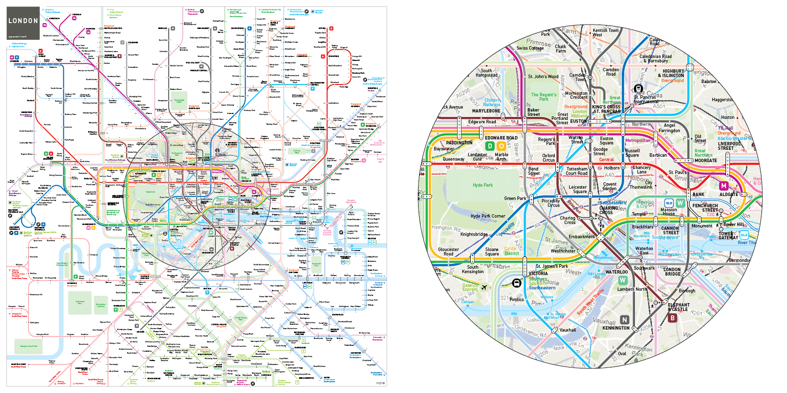
Service frequency hierarchy
High frequency services(Underground and DLR ): bright shades.
Low frequency services (Overground, TfL Rail, National Rail Franchises): light shades.
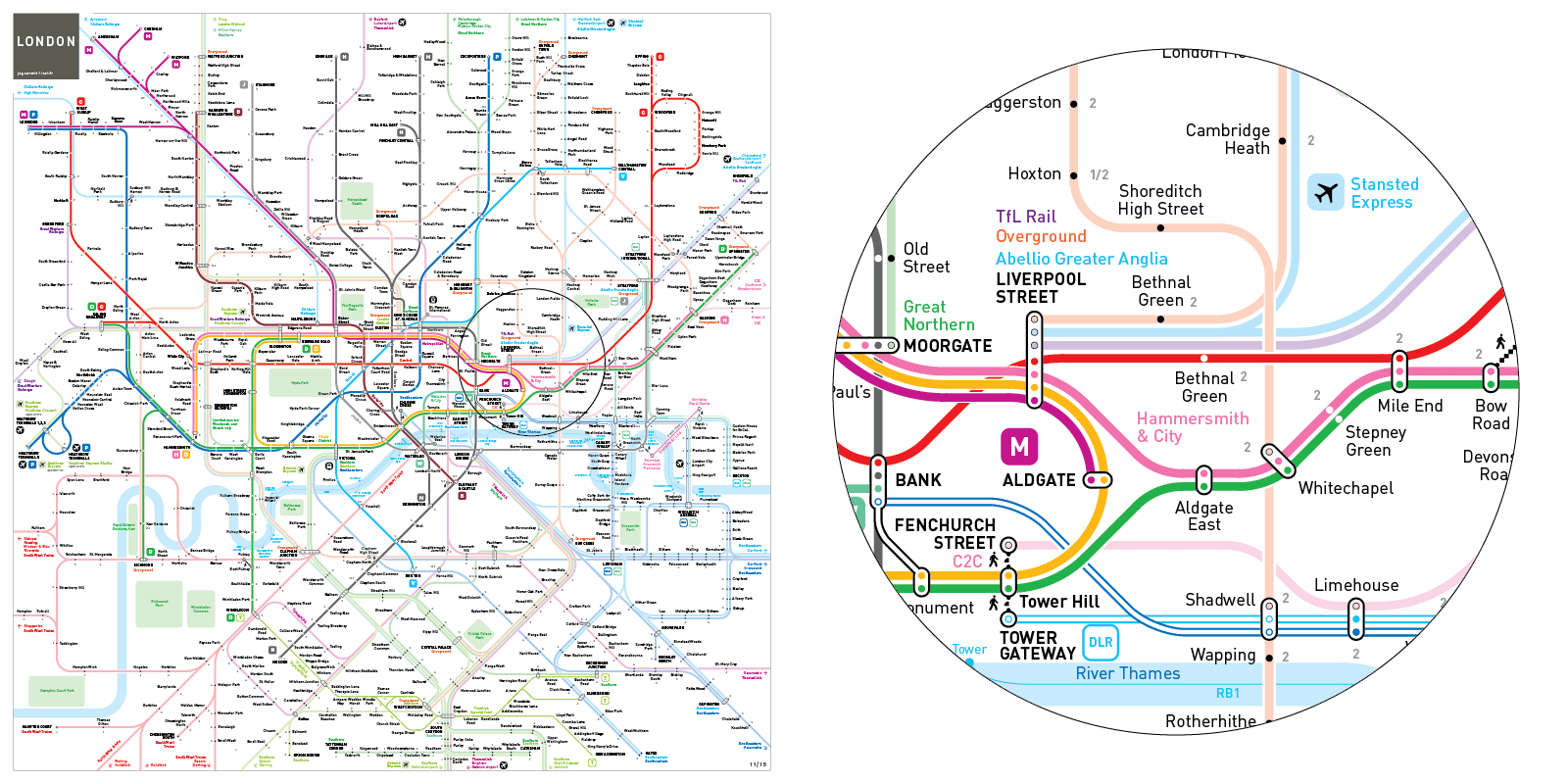
Separated DLR routes
3 shades of blue for 3 termini: Bank, Tower Gateway, and Stratford.
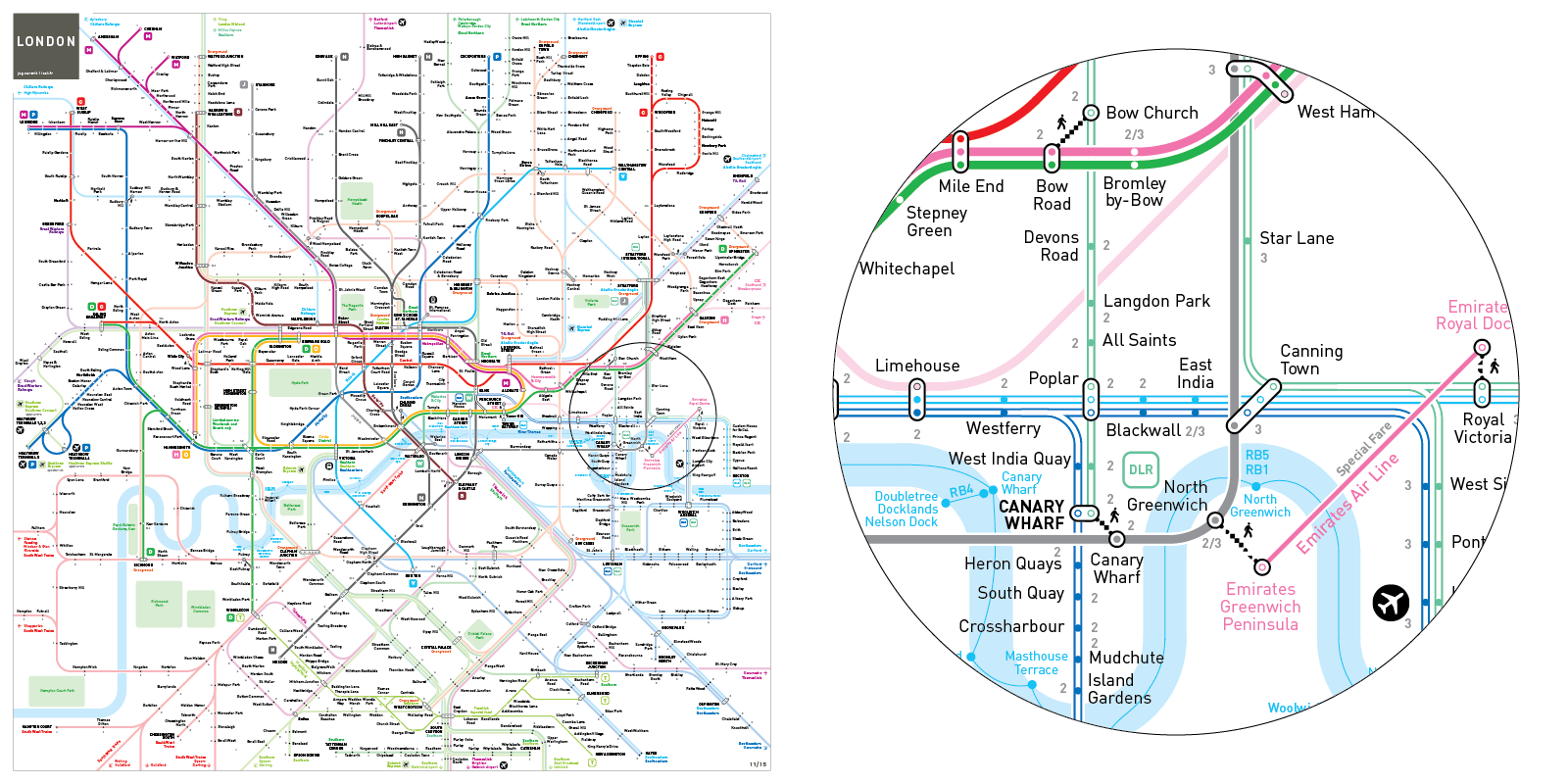
Airport rail links
Heathrow (Picadilly Line, Heathrow Express and Heatrow Connect to Paddington)
Gatwick ( Thameslink, Gatwick Express to Victoria)
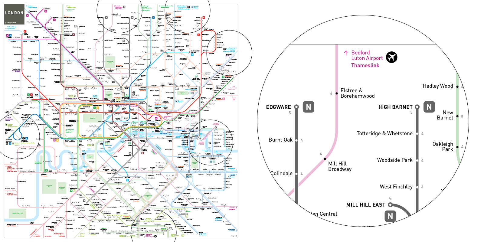
Luton (Thameslink)
Stansted (Stansted express to Liverpool Street)
London City (DLR to Bank and Stratford)
Southend (Greater Anglia to Liverpool Street)
Out of system street grade transfers (out of the central area)
Walking distance street level transfers are portrayed on the map.
![]()
Crossrail
Provision is made for the future integration of the Crossrail line.
NIGHT TUBE MAP
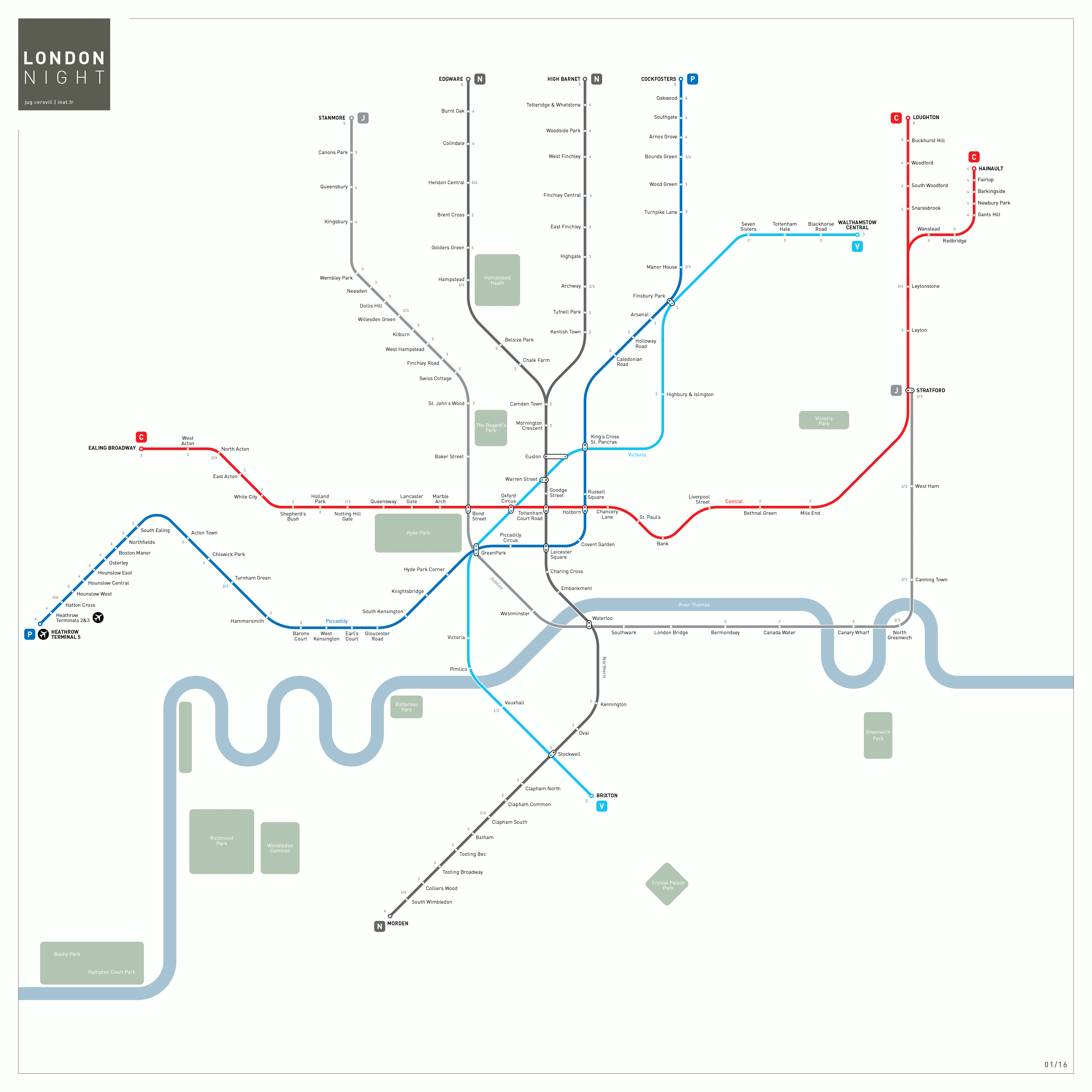
The Night tube service will operate on Friday and Saturday nights on 5 lines:
Jubilee
Victoria
Central (From Ealing Broadway to Loughton/Hainault)
Northern (From Edgware/High Barnet to Morden via Charing Cross)
Piccadilly (From Cockfosters to Heathrow Terminal 5)
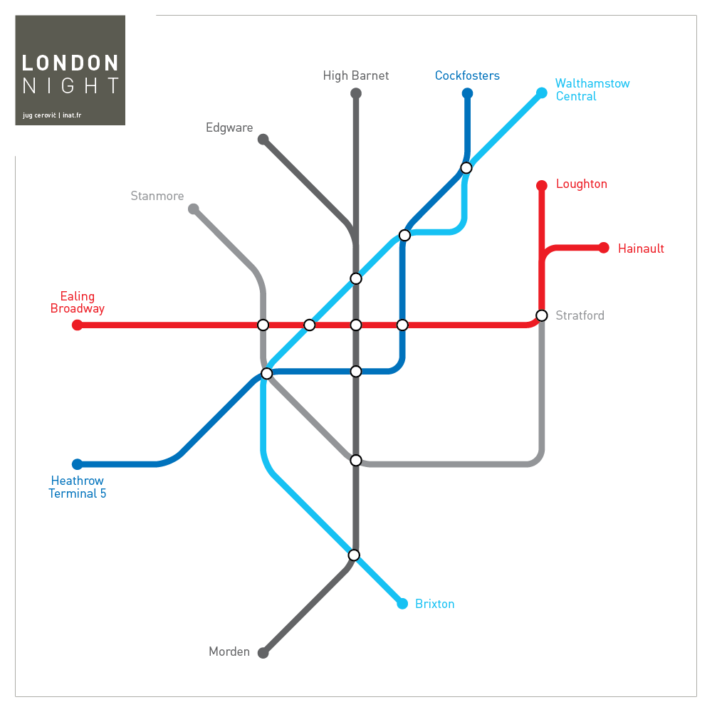
Night tube simplified diagram:
Media Coverage
Here's another unofficial tube map that might be better than the real thing.
CityMetric
June 2015