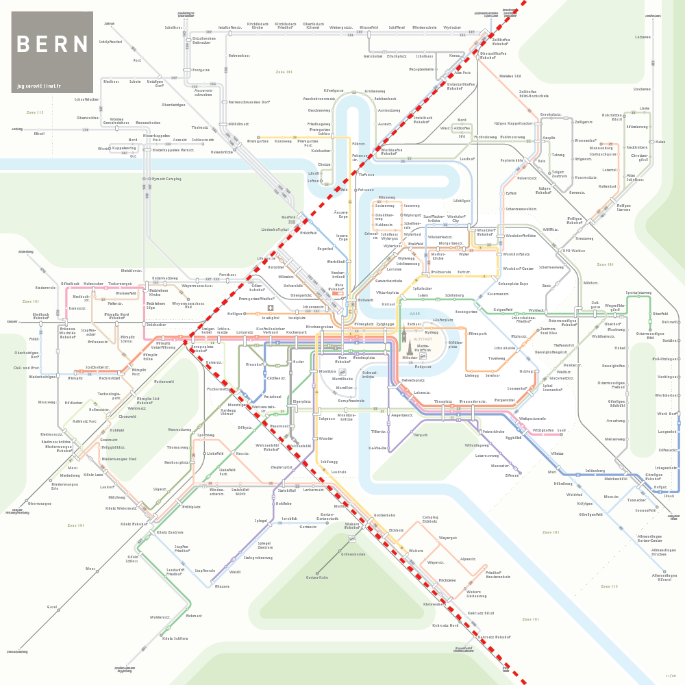
Netzplan Bern
![]()
Bern Public Transport Map
2021
![]()
![]()
Design Process
![]()
Automation
Once the map design is complete the network is generated and updated directly from geo-localized data.
This morphing from geographic to schematic was realized using Geo.Zpheres software developed by our partners at Hitouch AG in Schaffhausen, Switzerland.
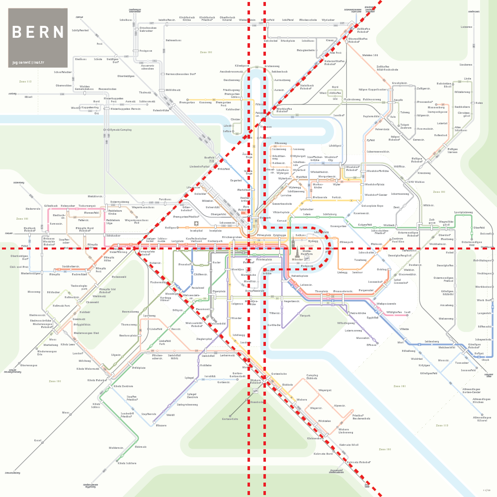
Structure
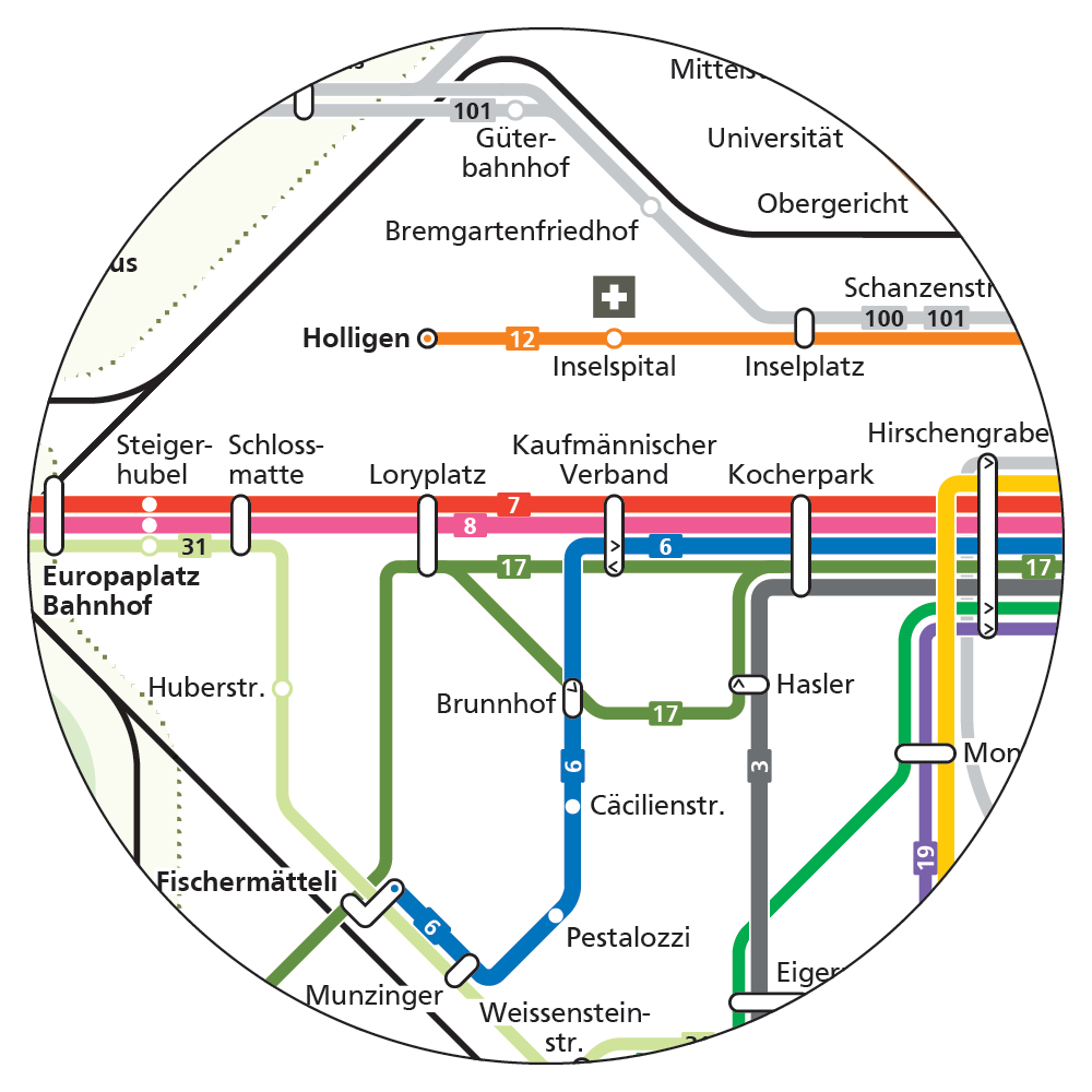
Bahnhof, the main transport hub, is placed at the exact center of the layout.
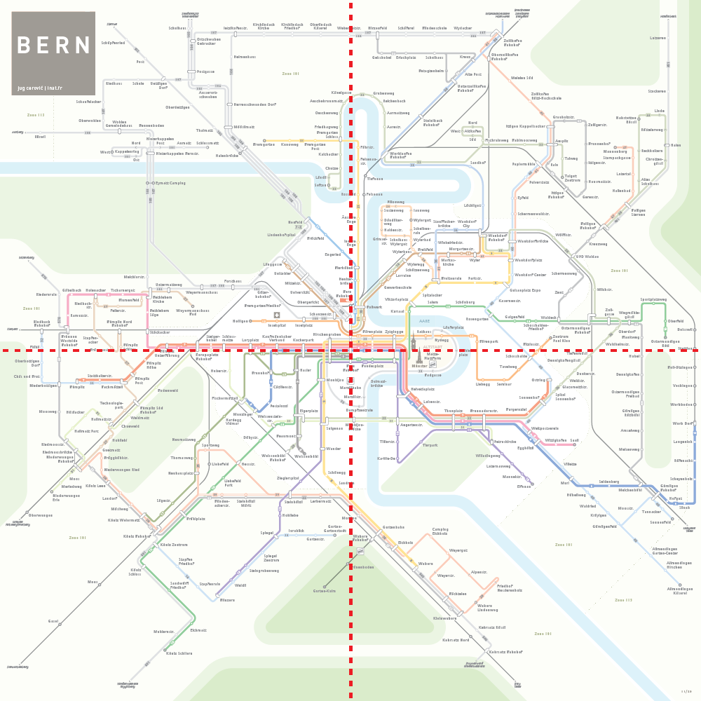
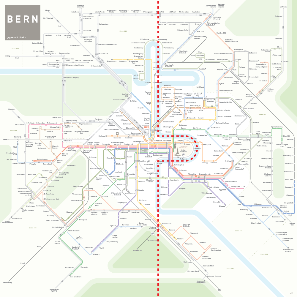
The Altstadt bend of the Aare is at the center, North and South of the bend the river is aligned on the same vertical axis.
Rail lines are aligned on 2 diagonal lines that bound the city center, North: Bremgartenstrasse, South: Weissensteinstrasse / Seftigenstrasse.
These key elements provide a solid and intuitive structure to the map.
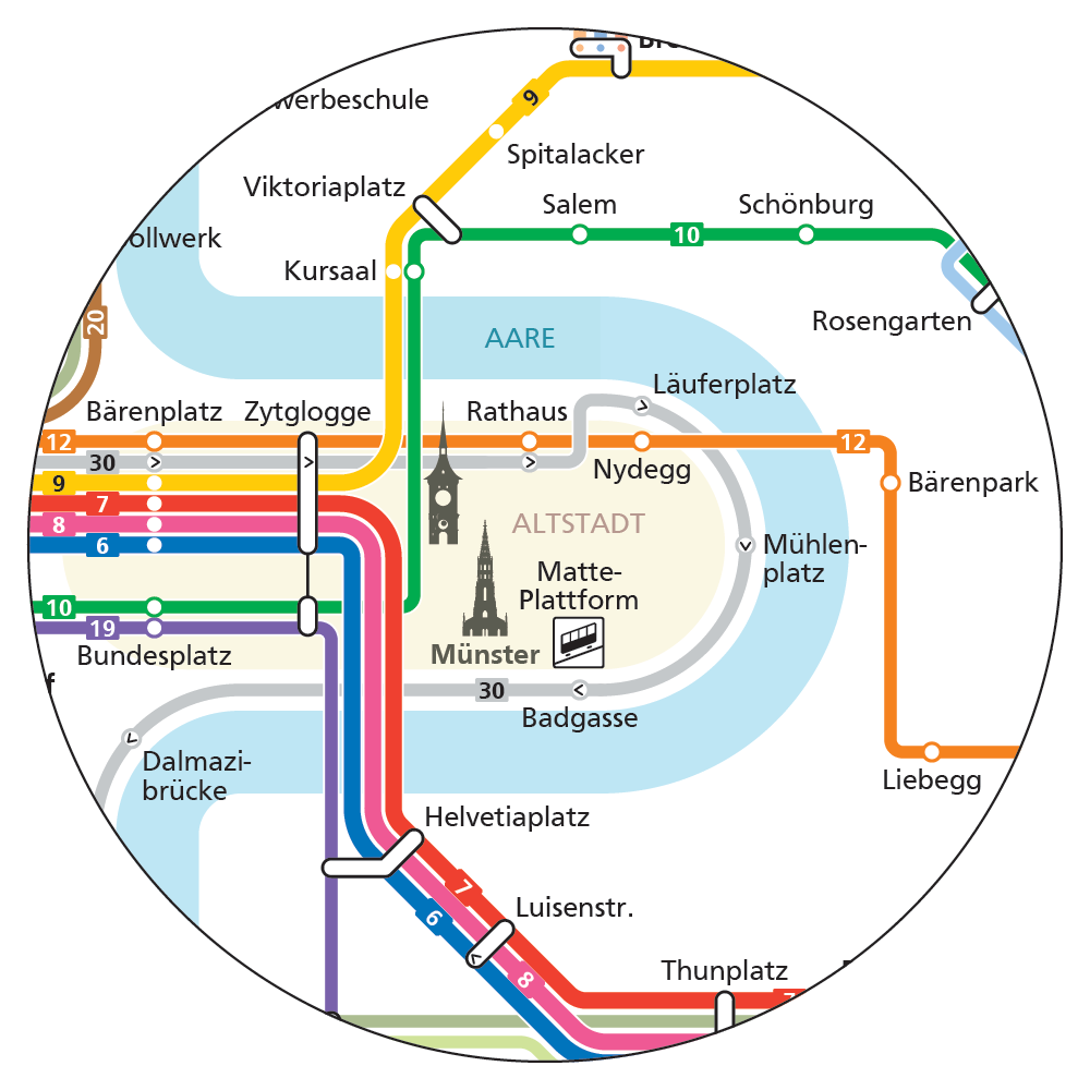
Details
The elongated Altstadt is highlighted by the bend of the Aare with a few landmarks inside.
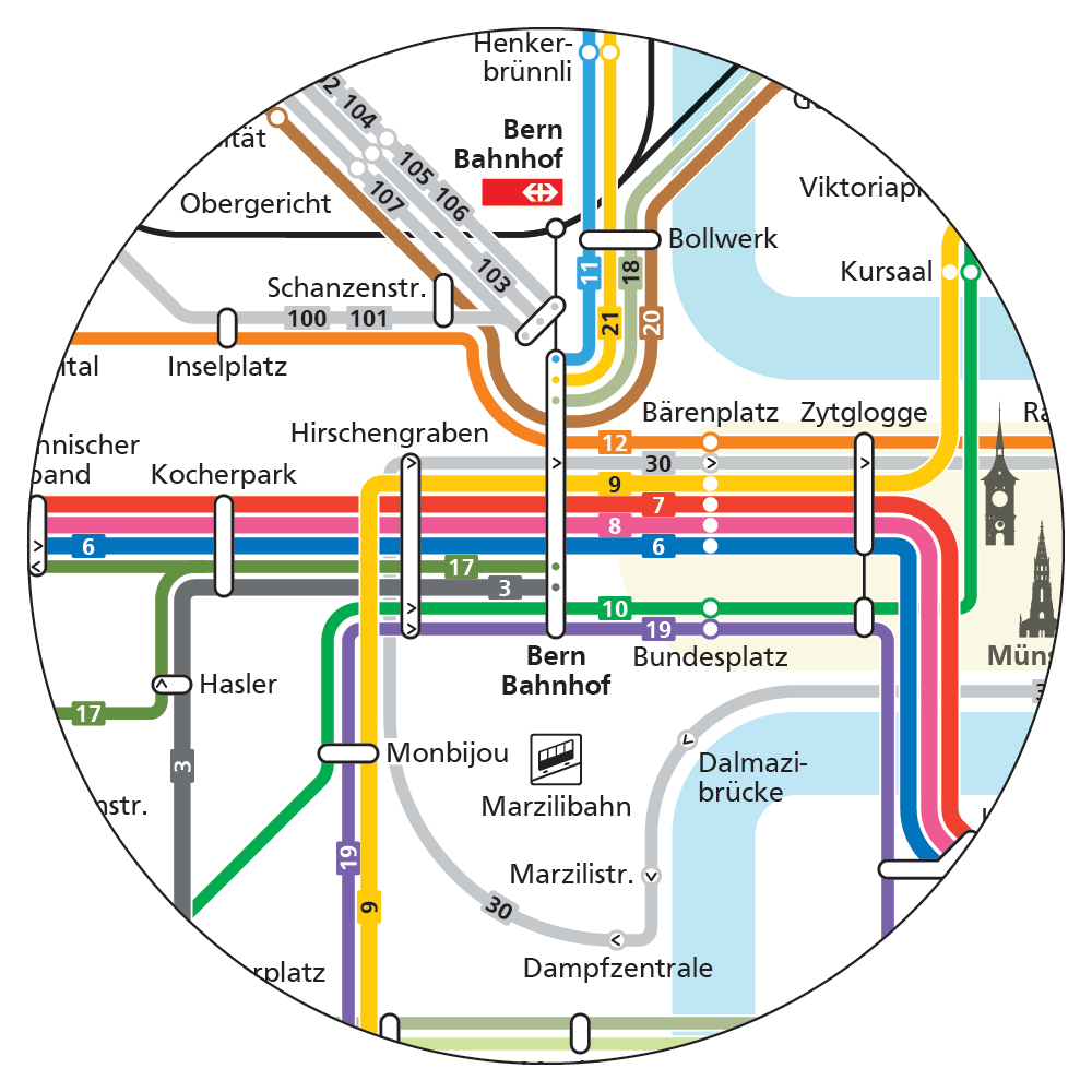
At Bahnhof lines are neatly organized so you can follow routes without ambiguity. Trams (thicker lines) are different from buses (thinner lines).
On the main East-West tram corridor, stations and North-South tram lines are evenly spaced.