Works
Public Transport Maps
Network Wayfinding Systems
Digital Mapping Platforms
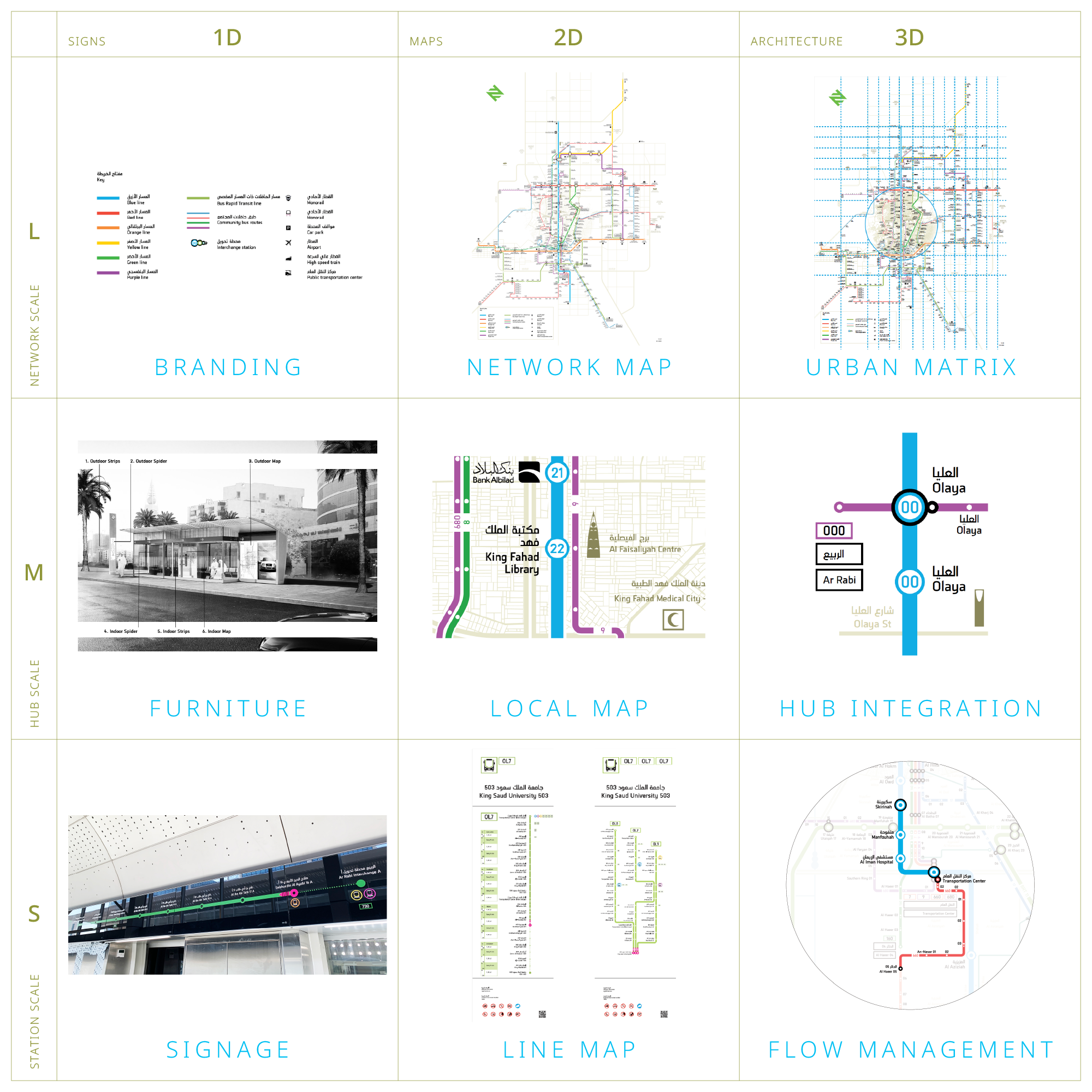
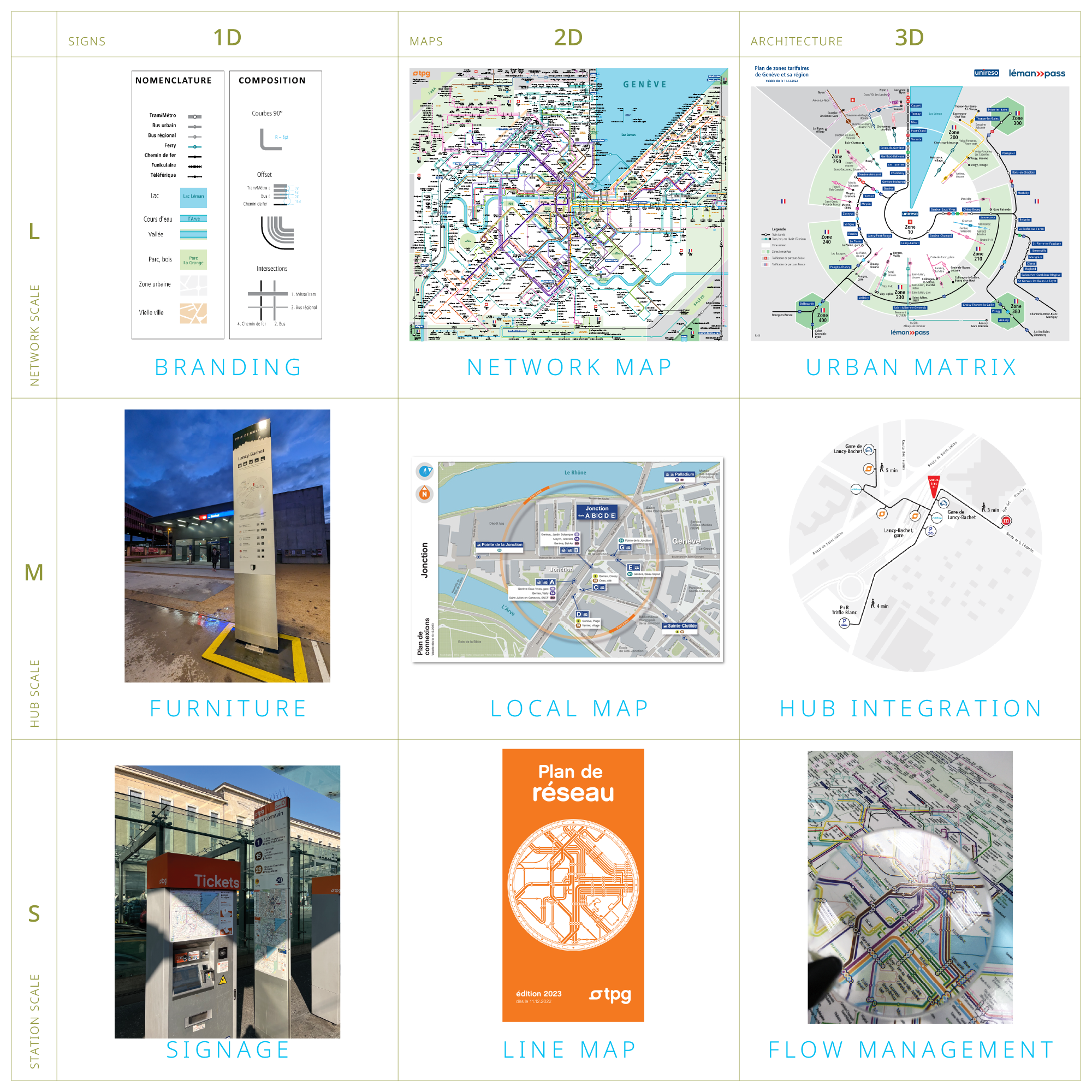
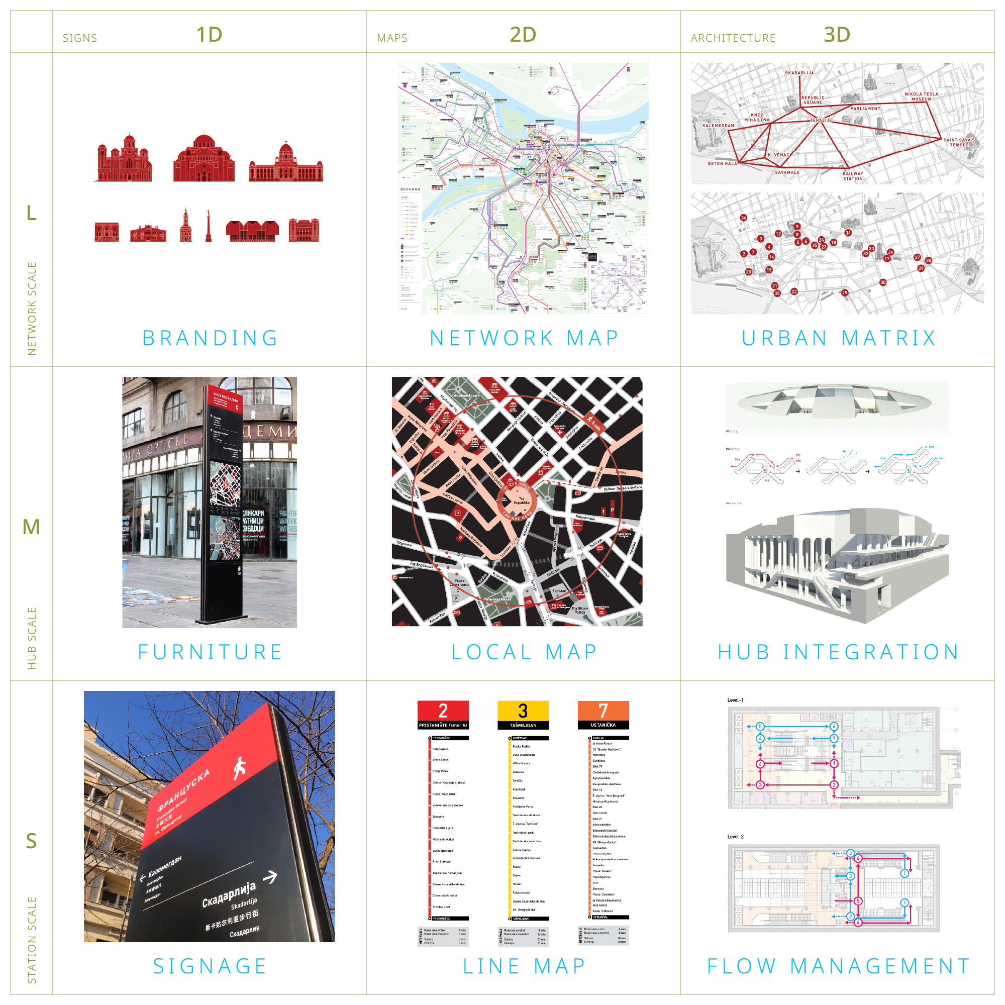
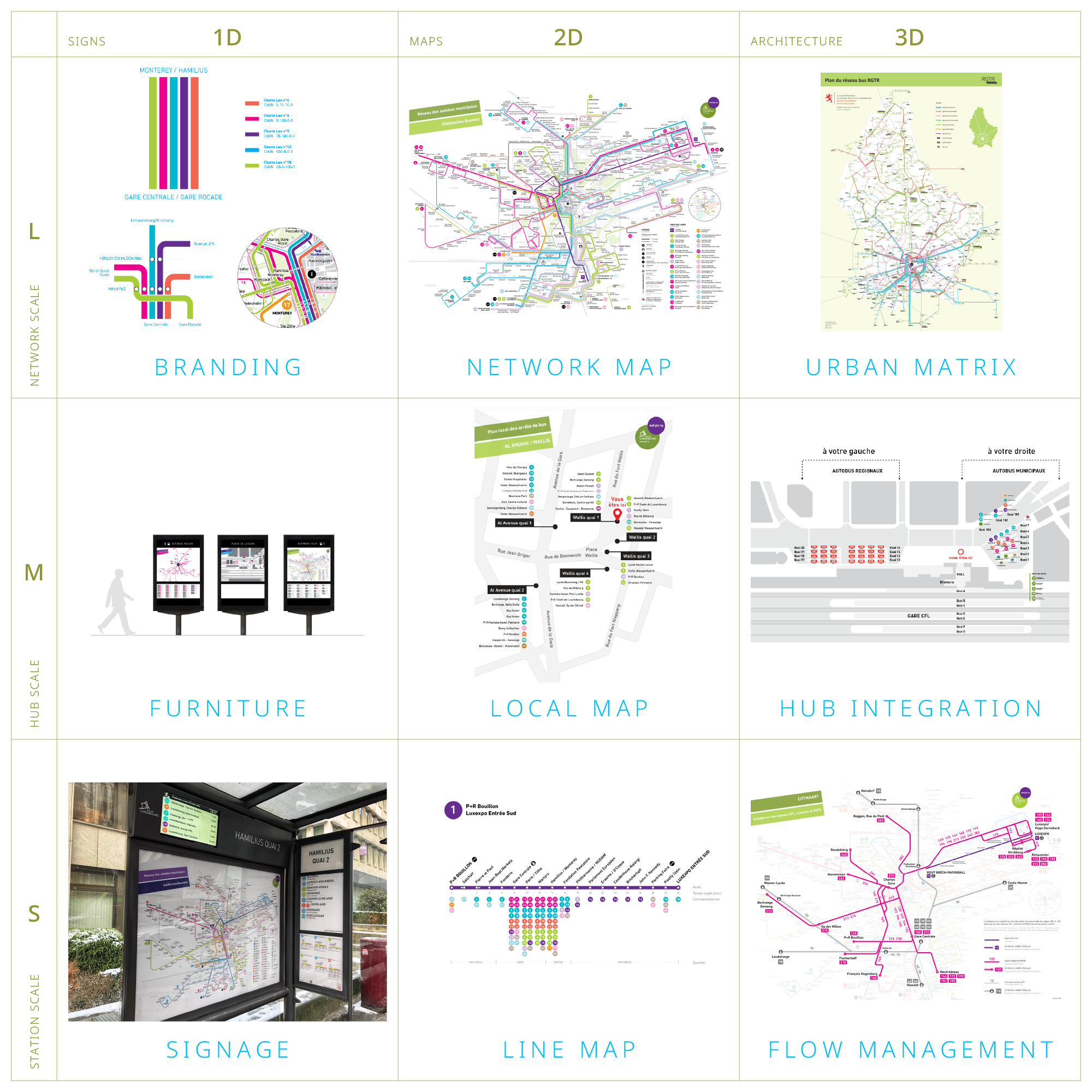
Wayfinding Systems
Research and Innovation :
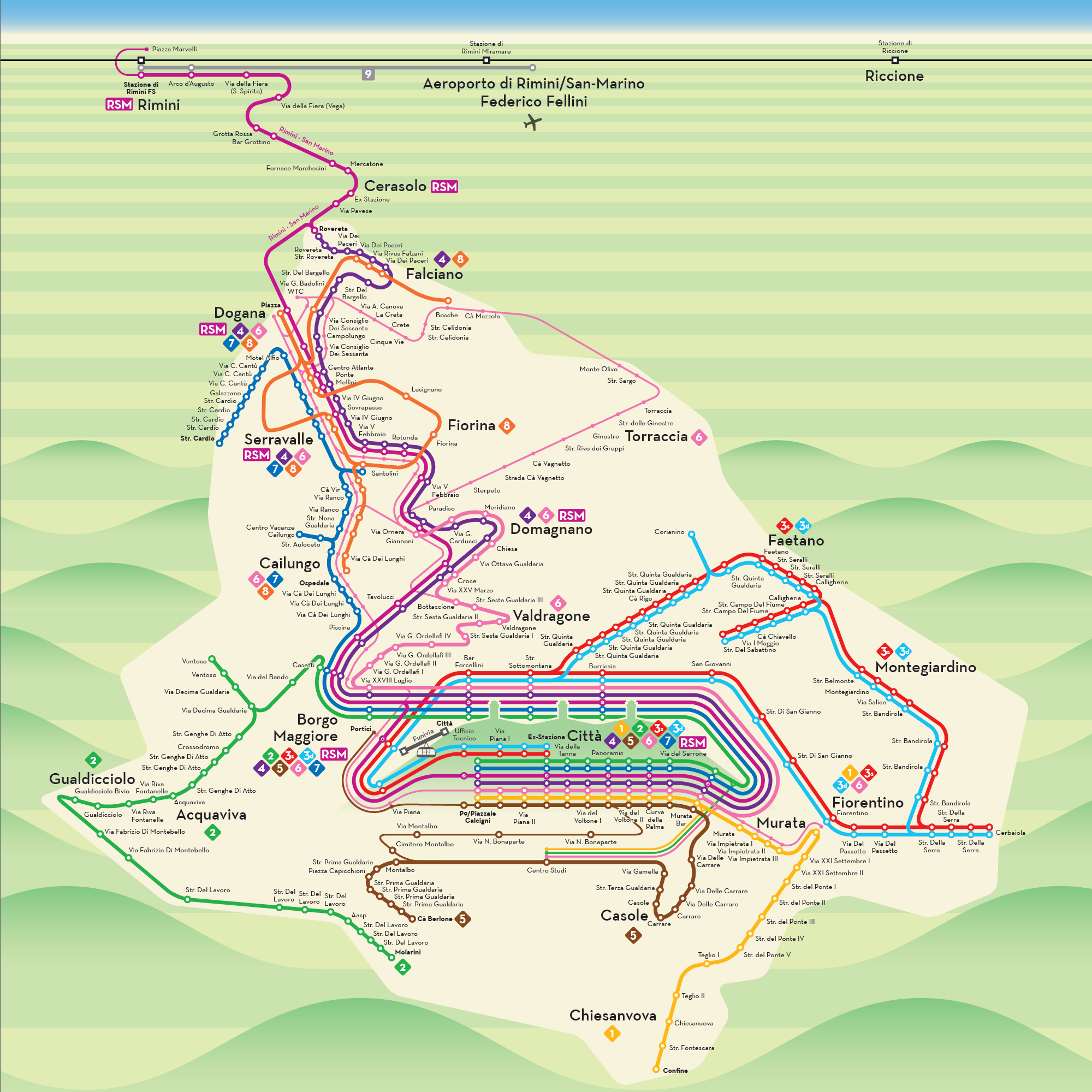
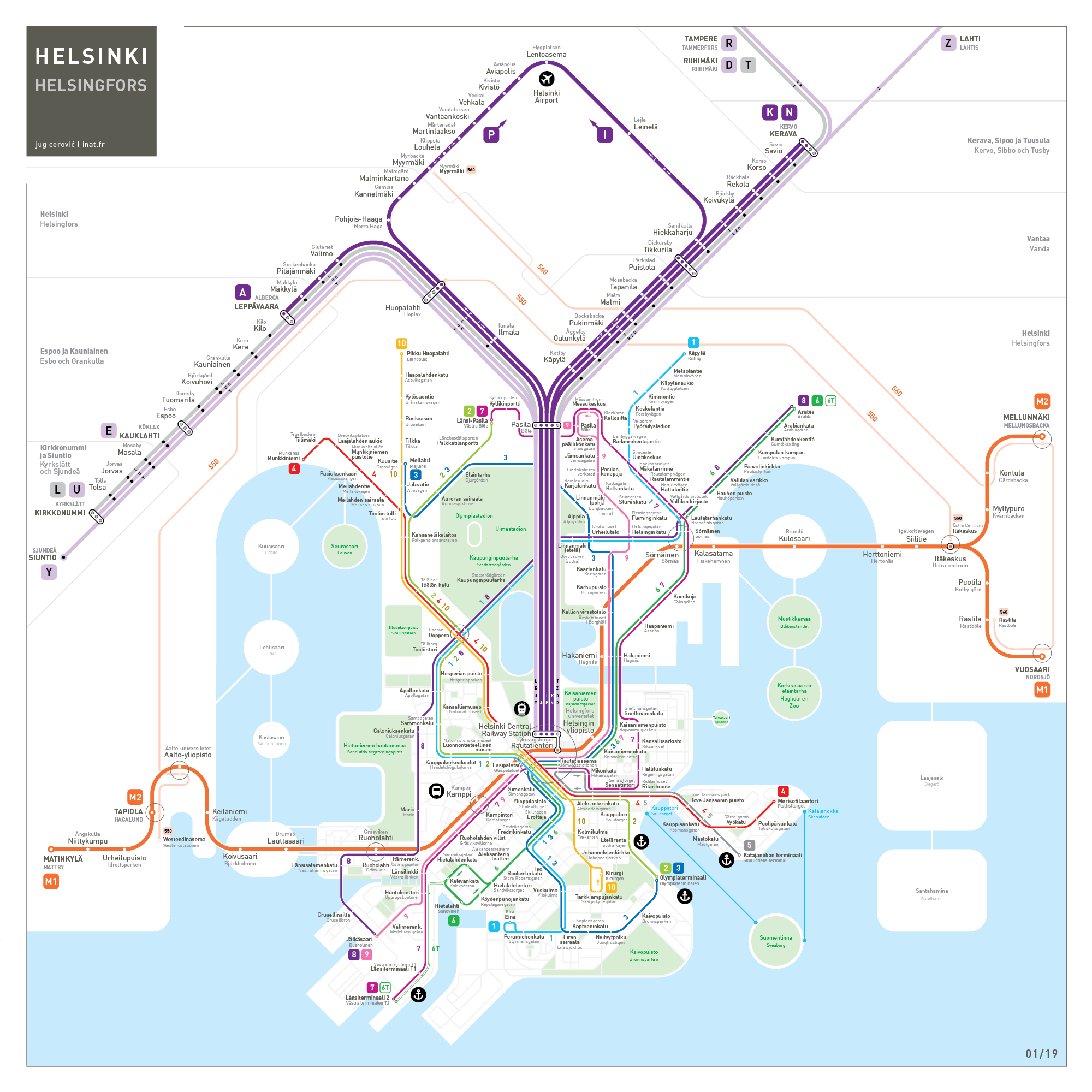
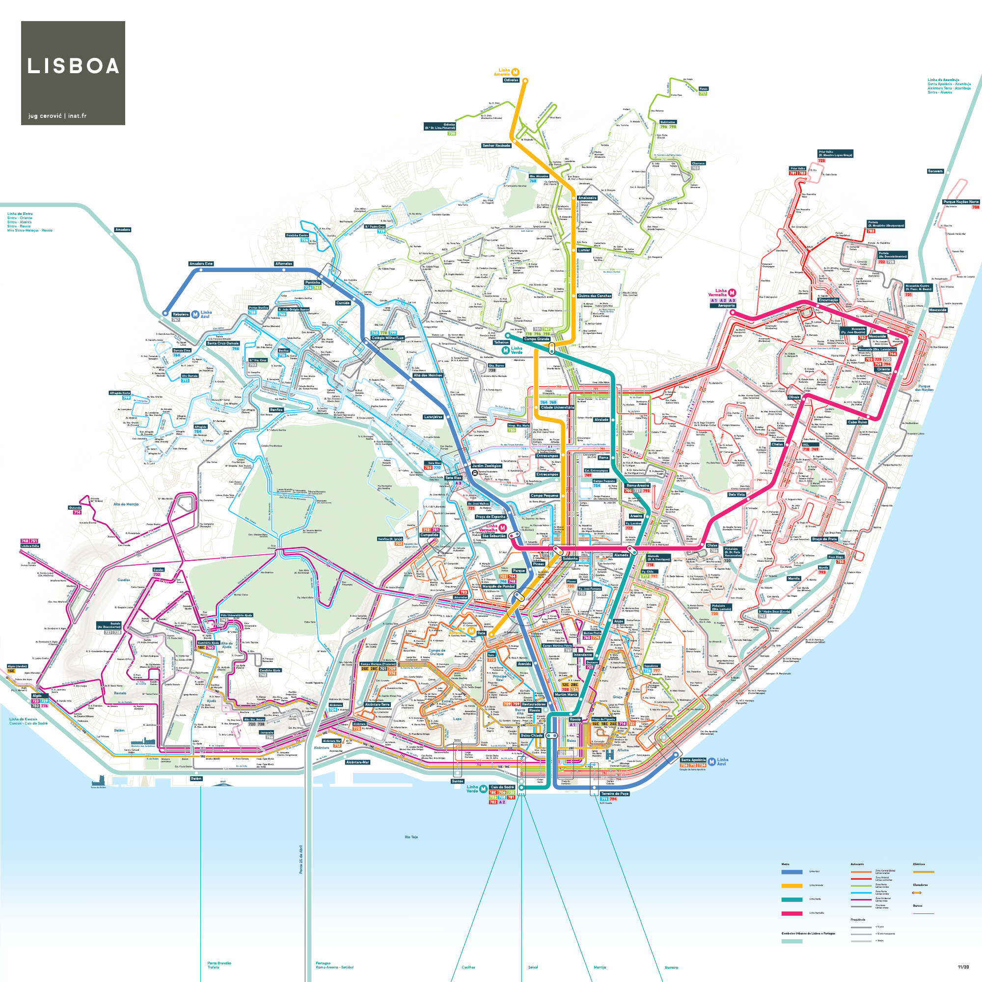
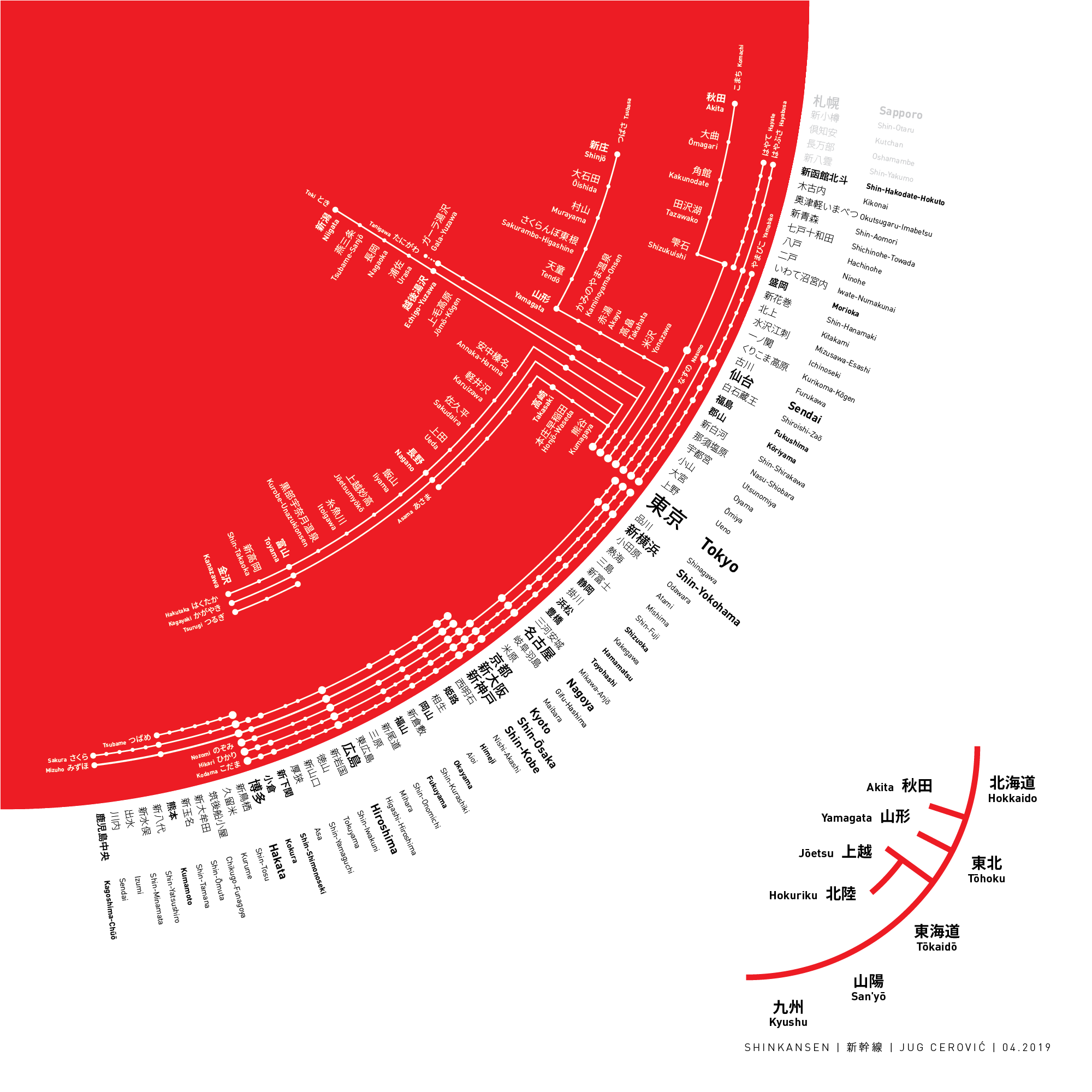
Metro MapsSchematic Maps
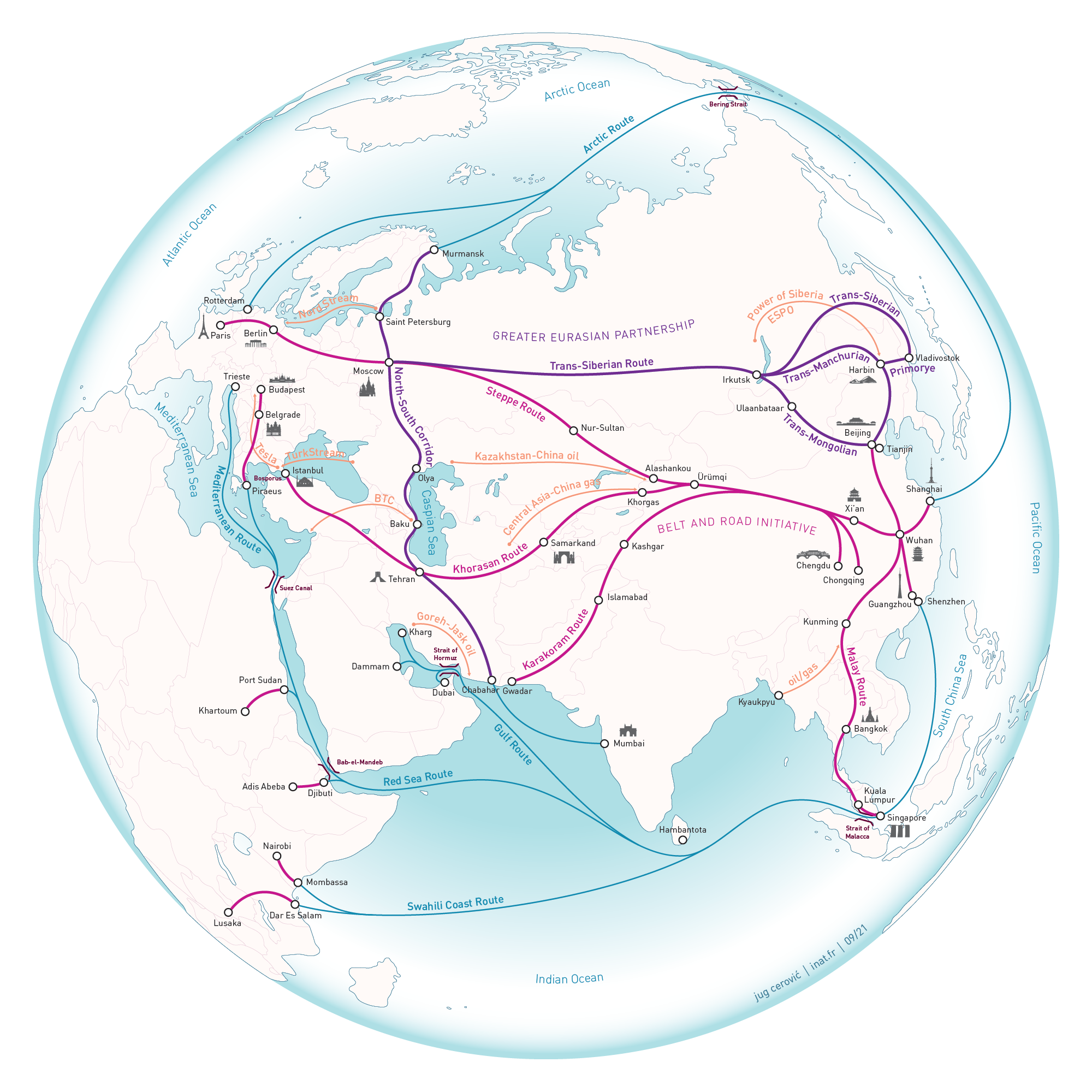
Geographic Maps
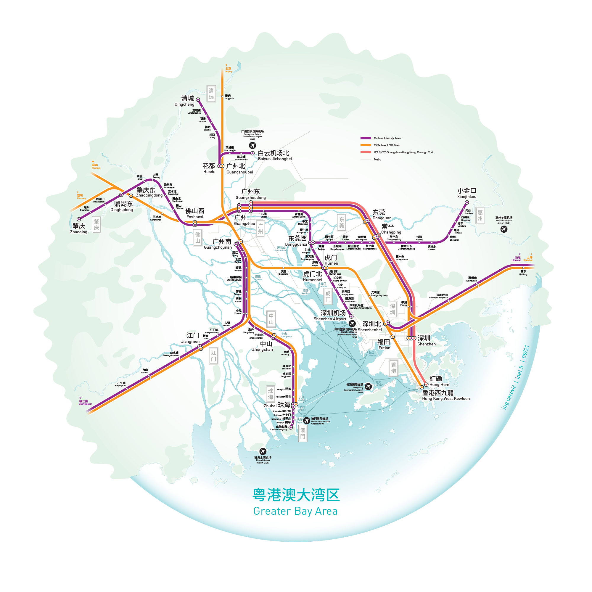
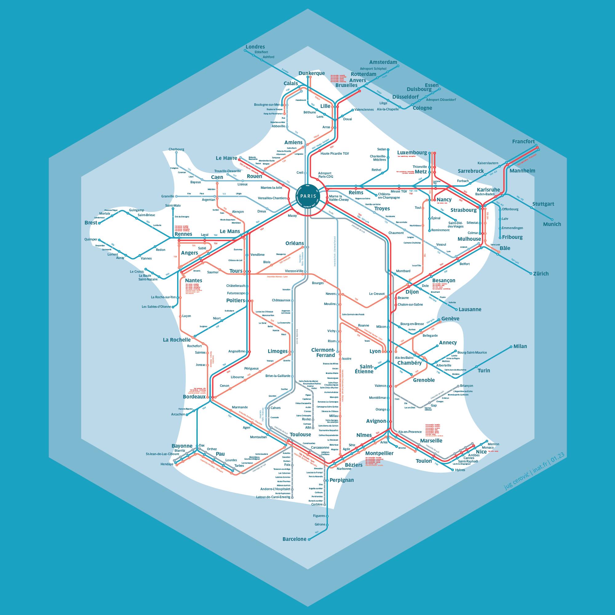
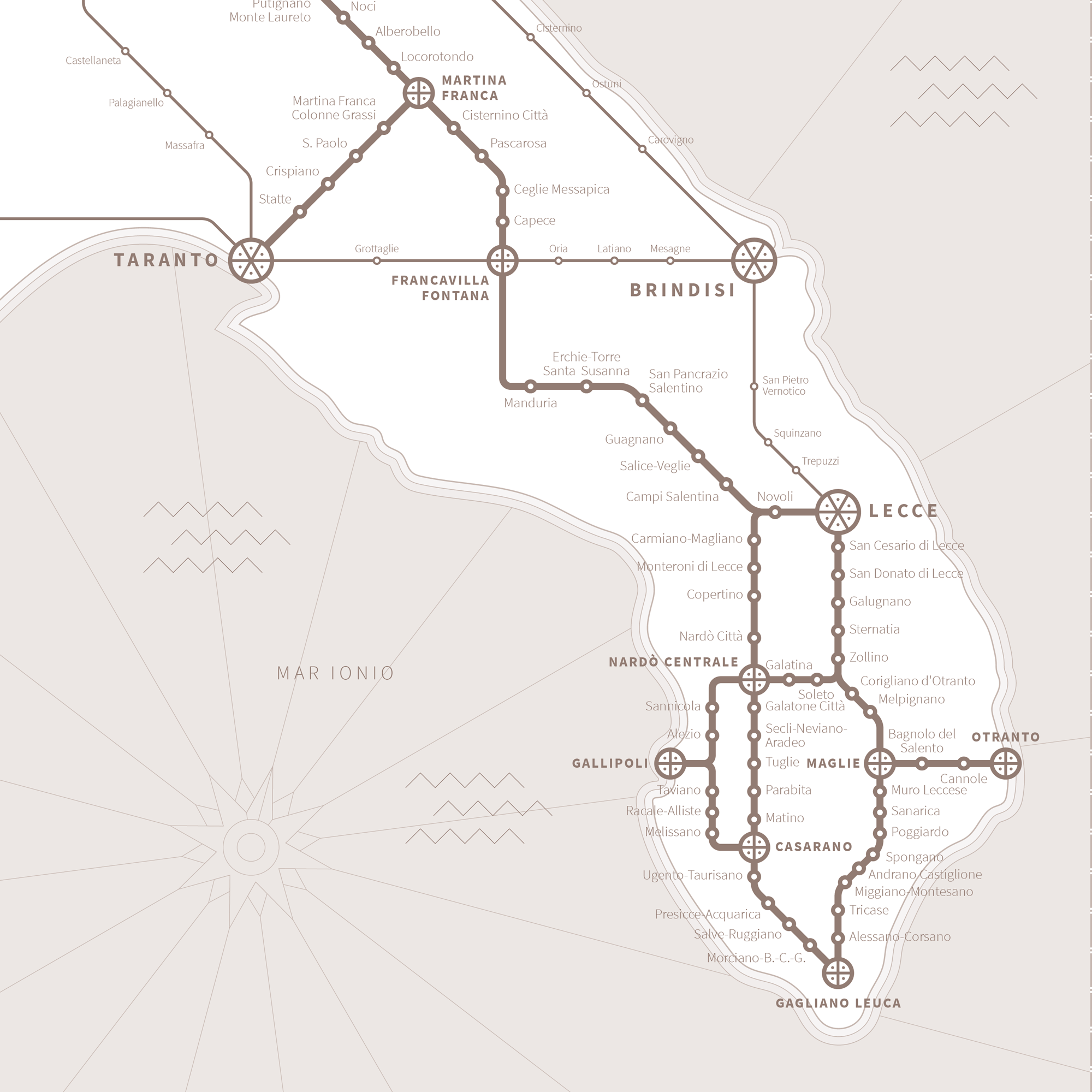
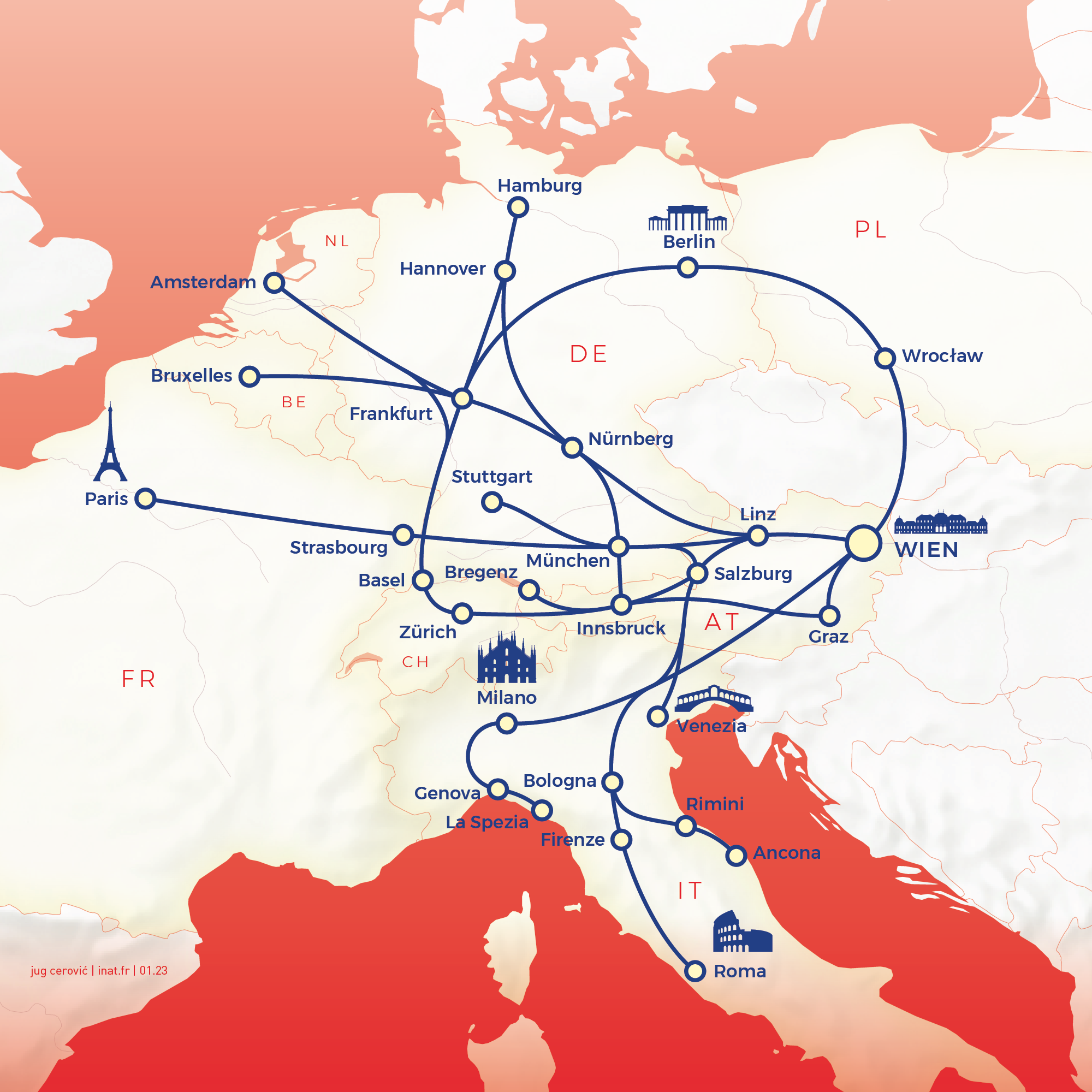
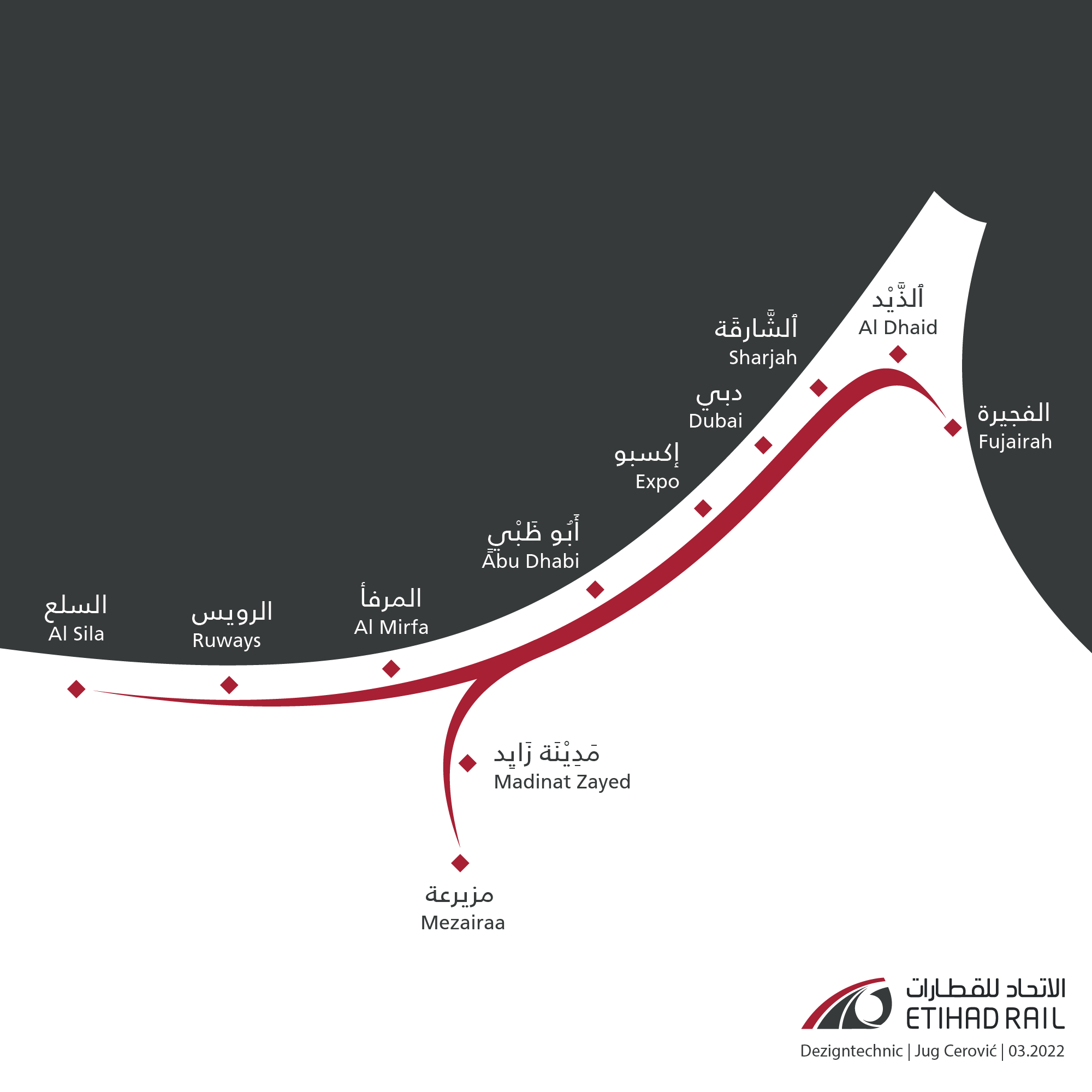
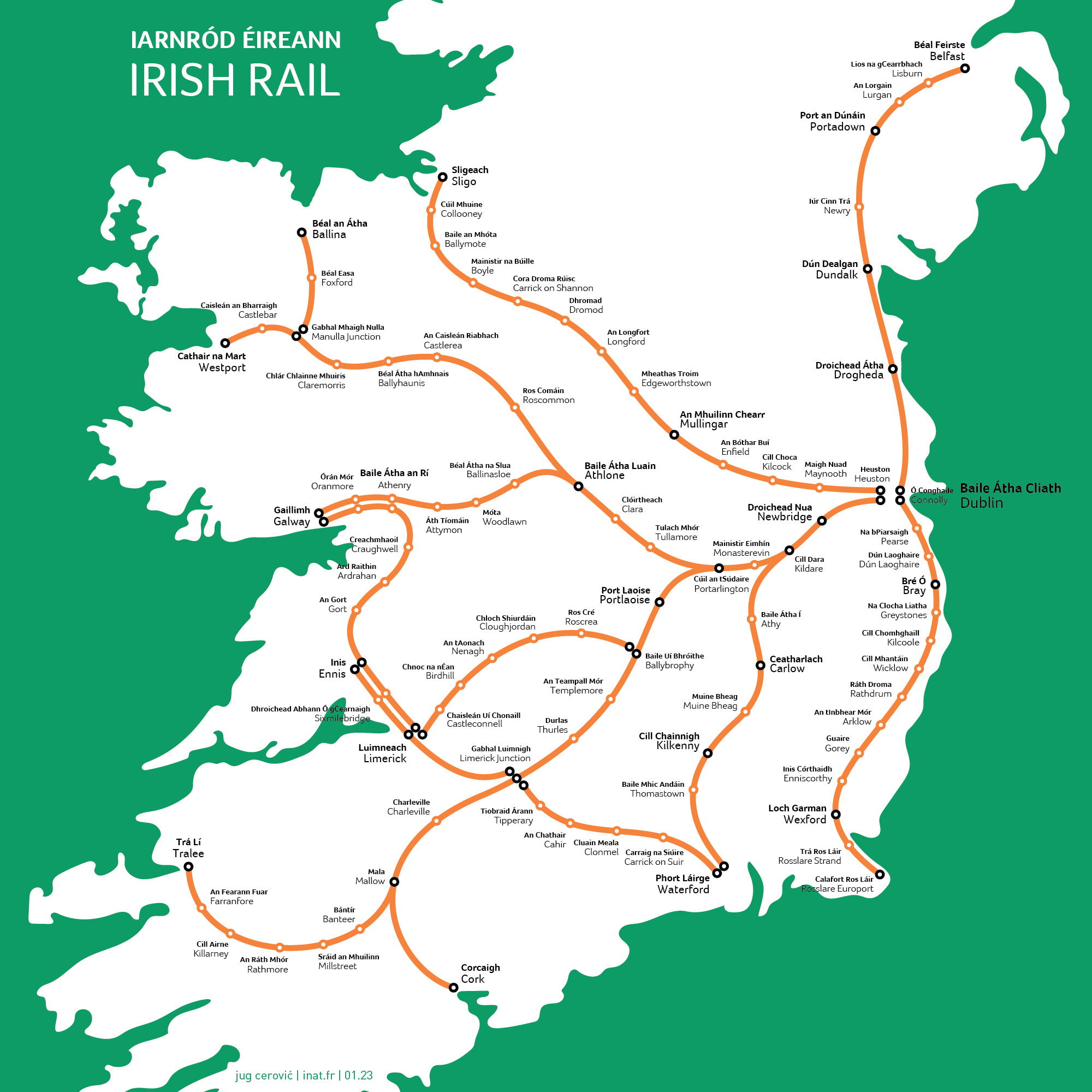
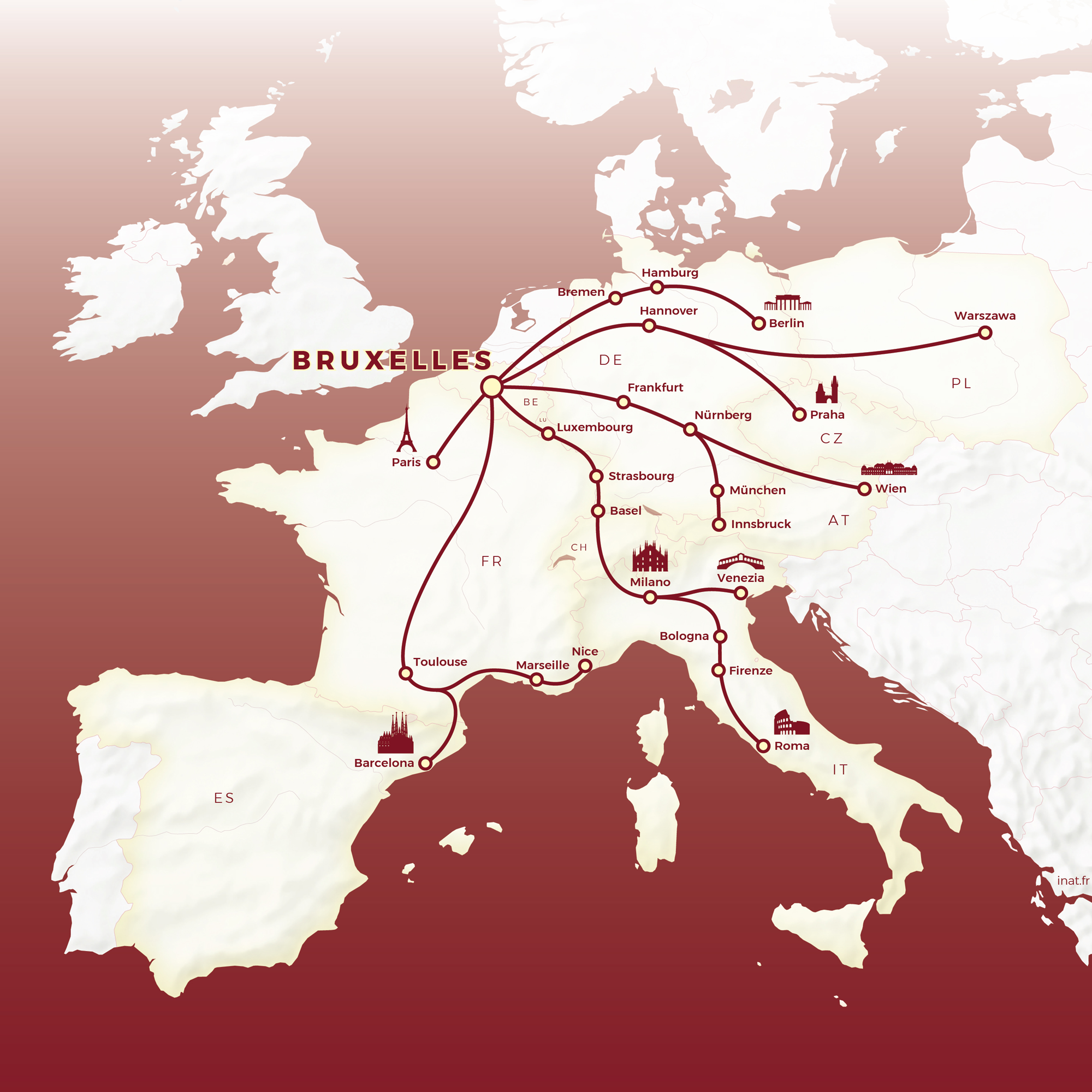
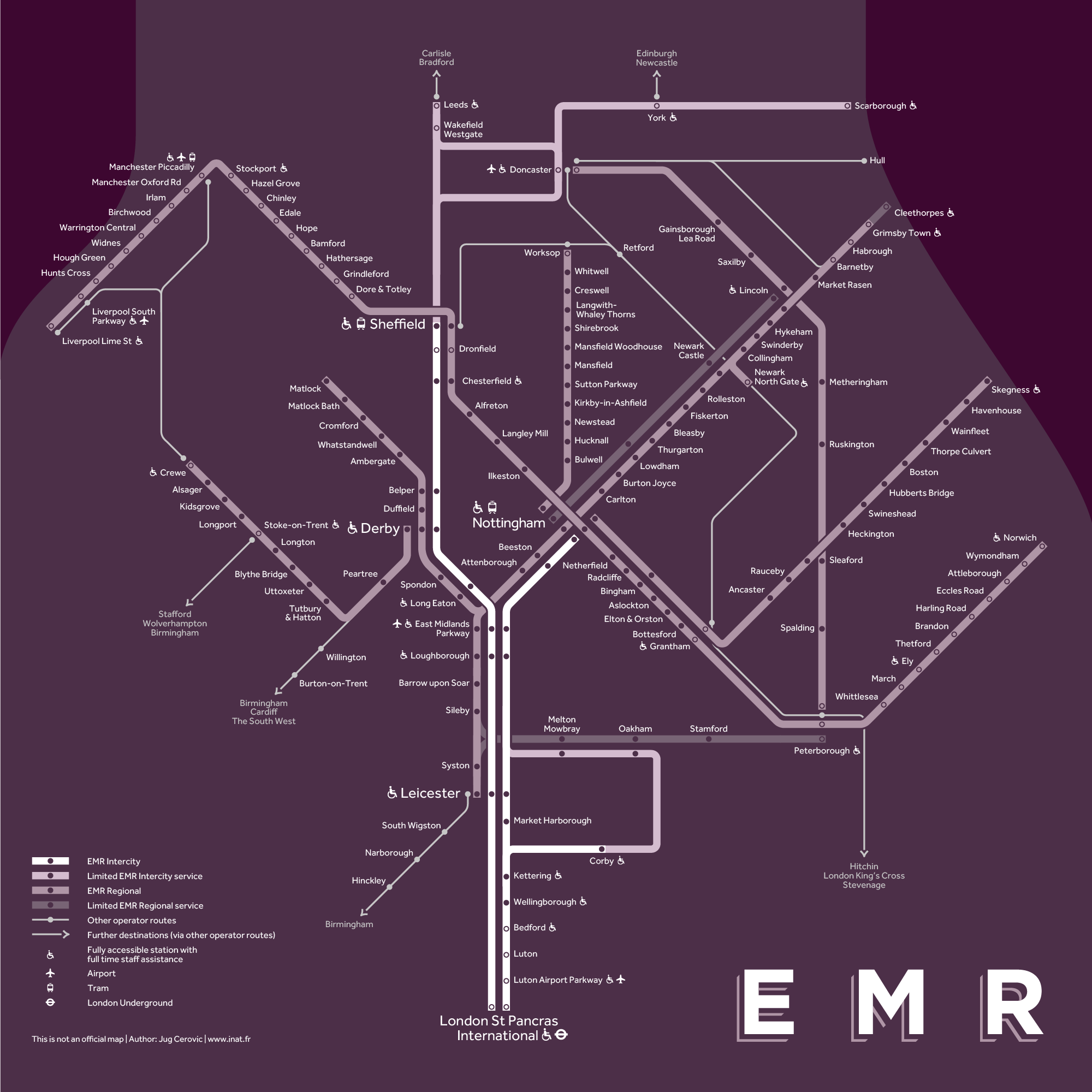
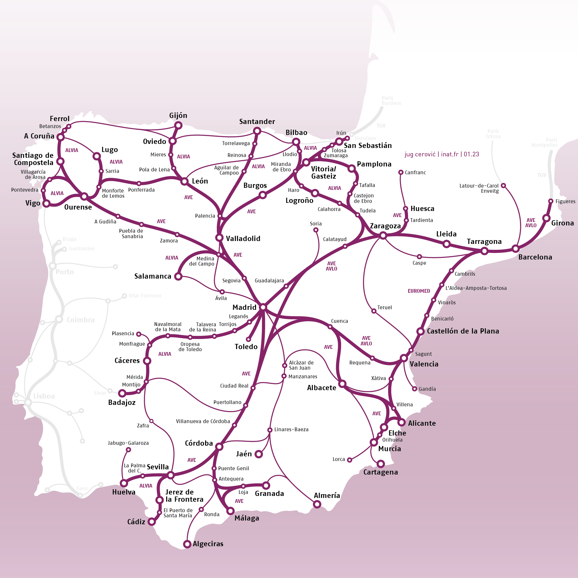
Rail Maps
Books
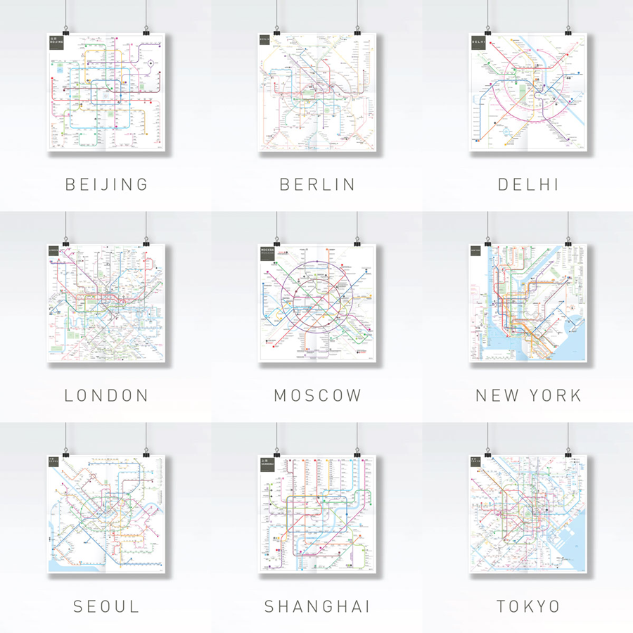
Featured Works
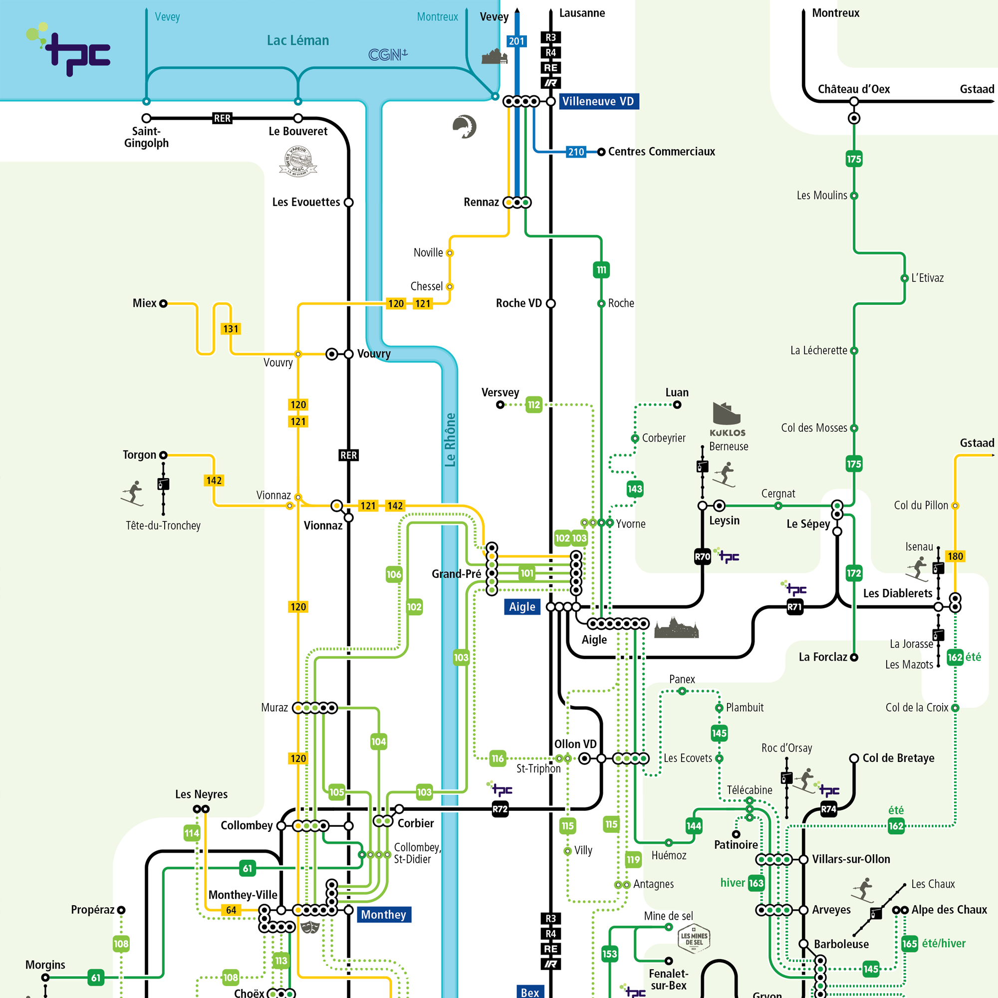
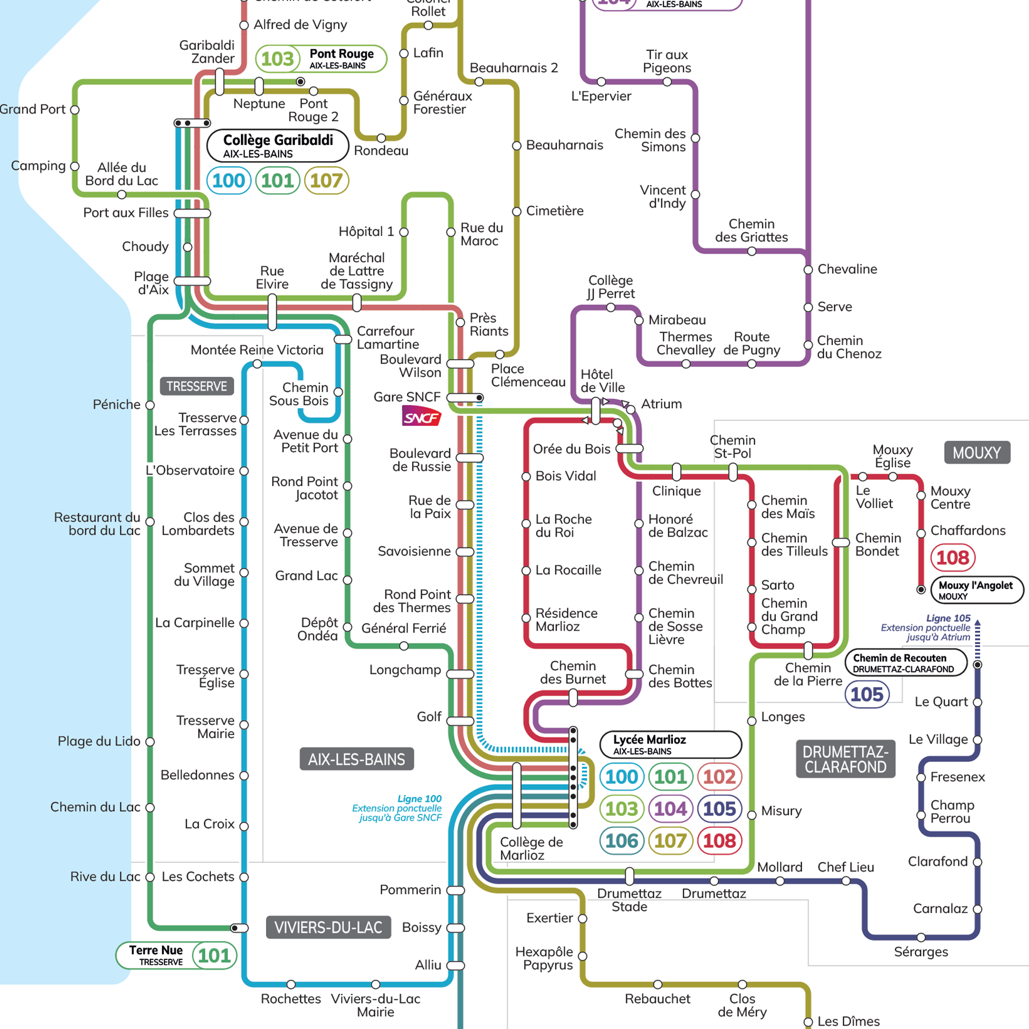
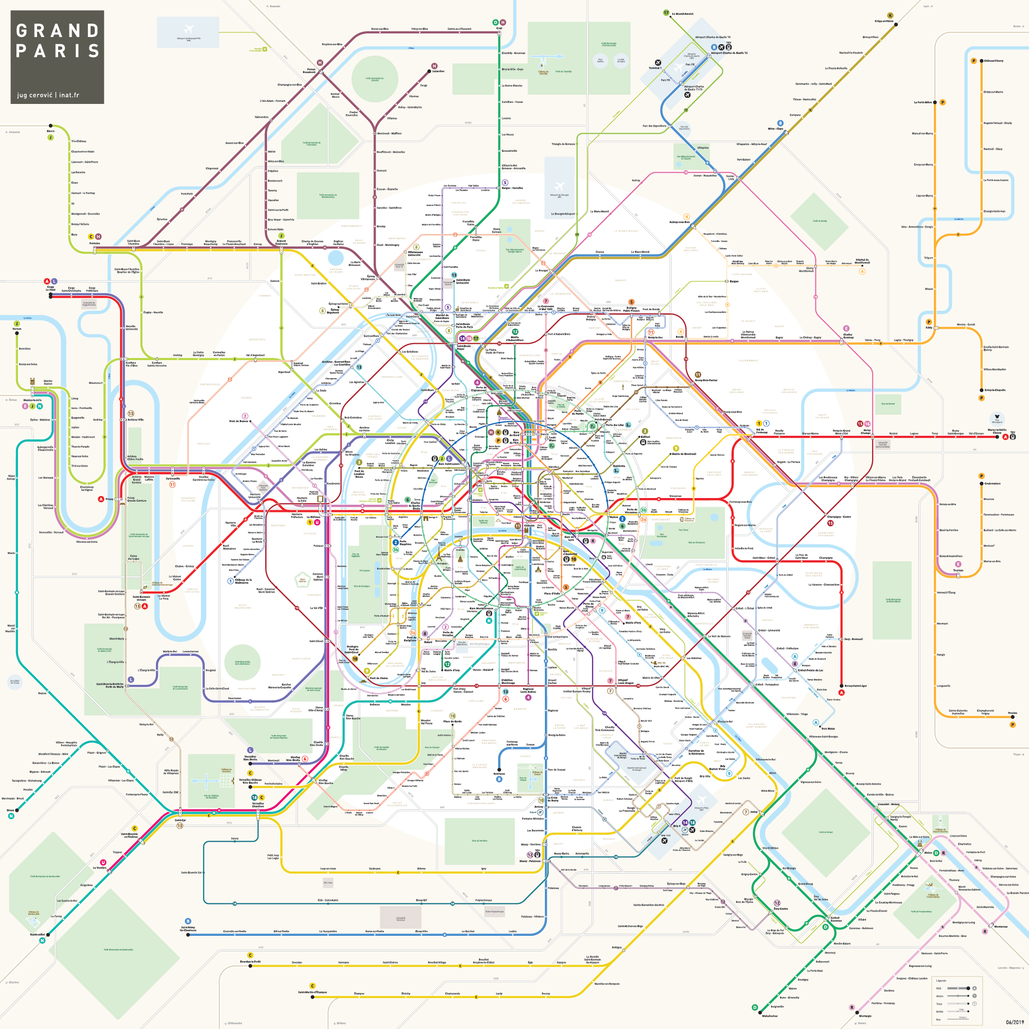
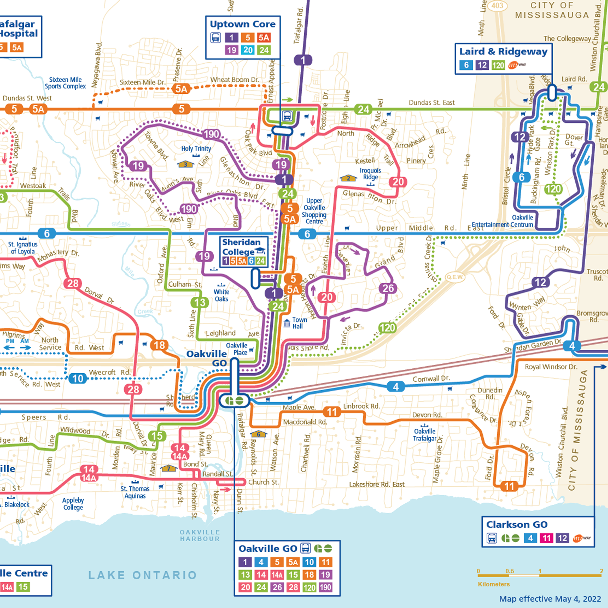
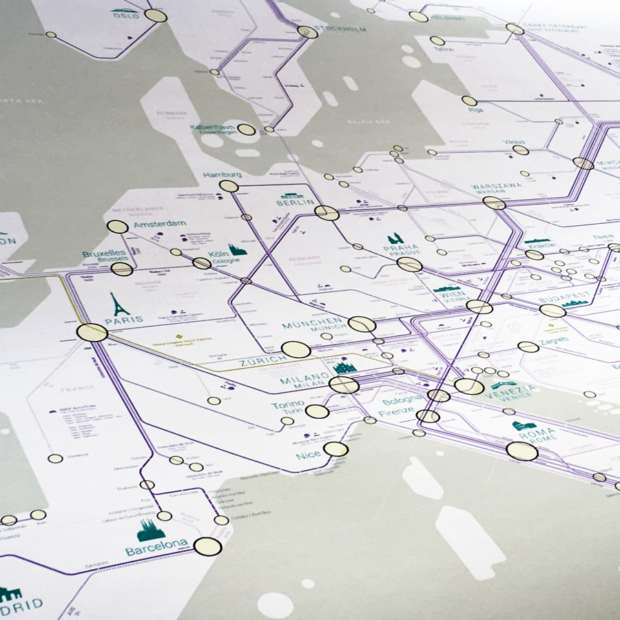
Public Transport Maps
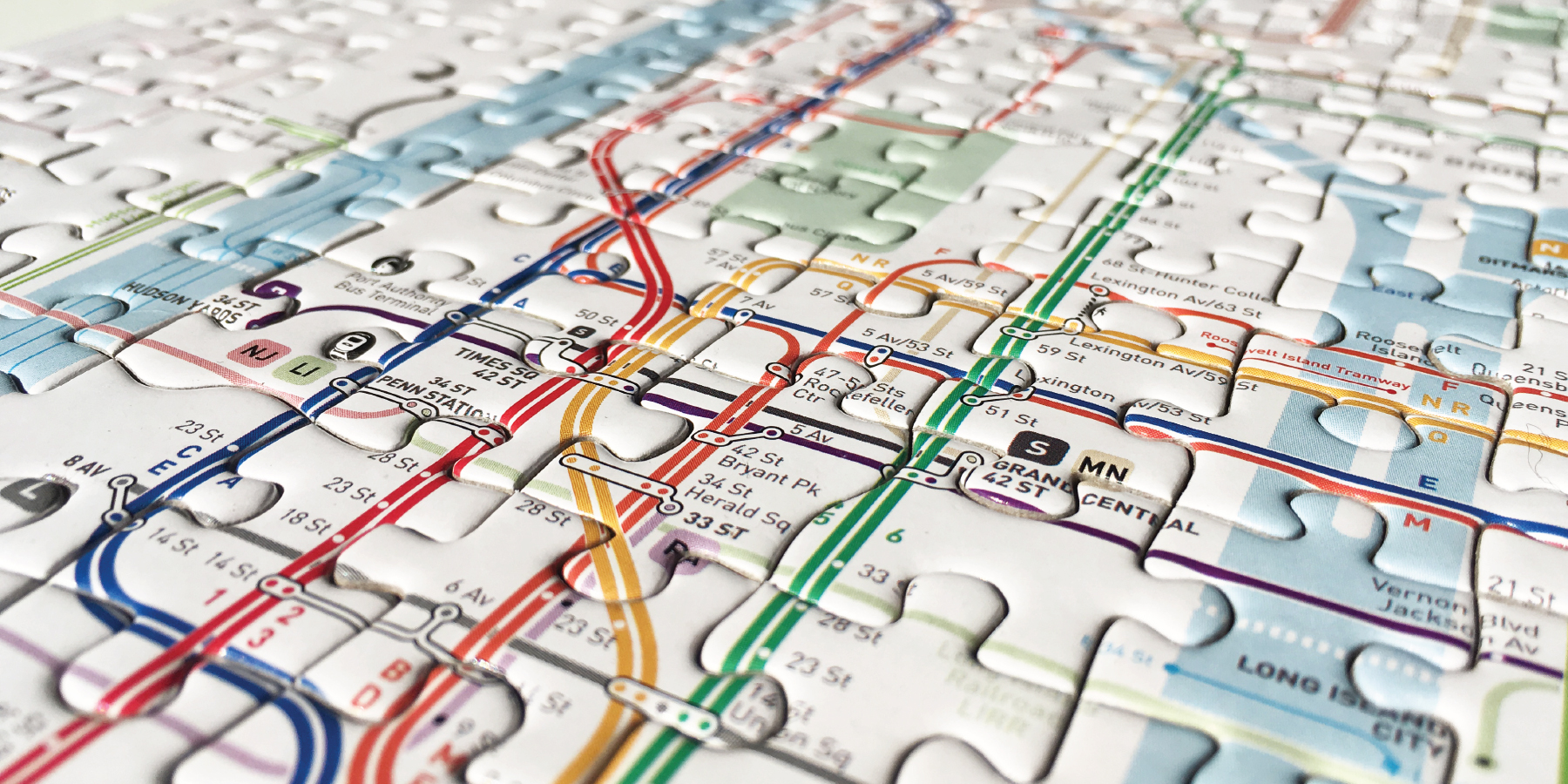
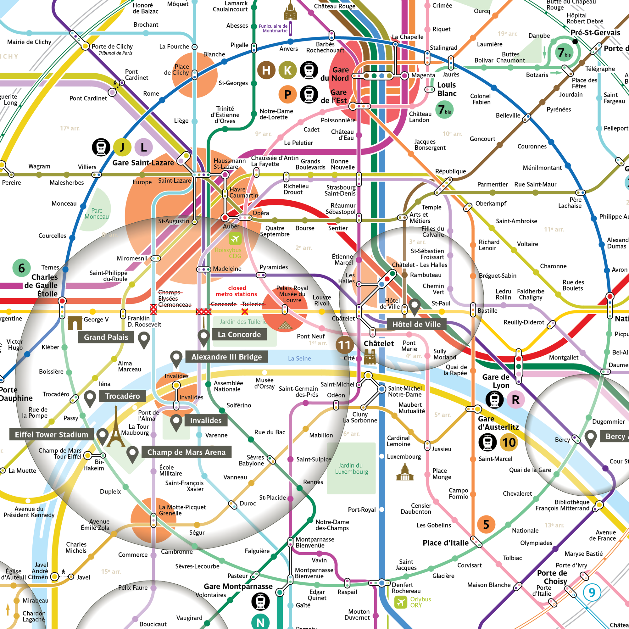
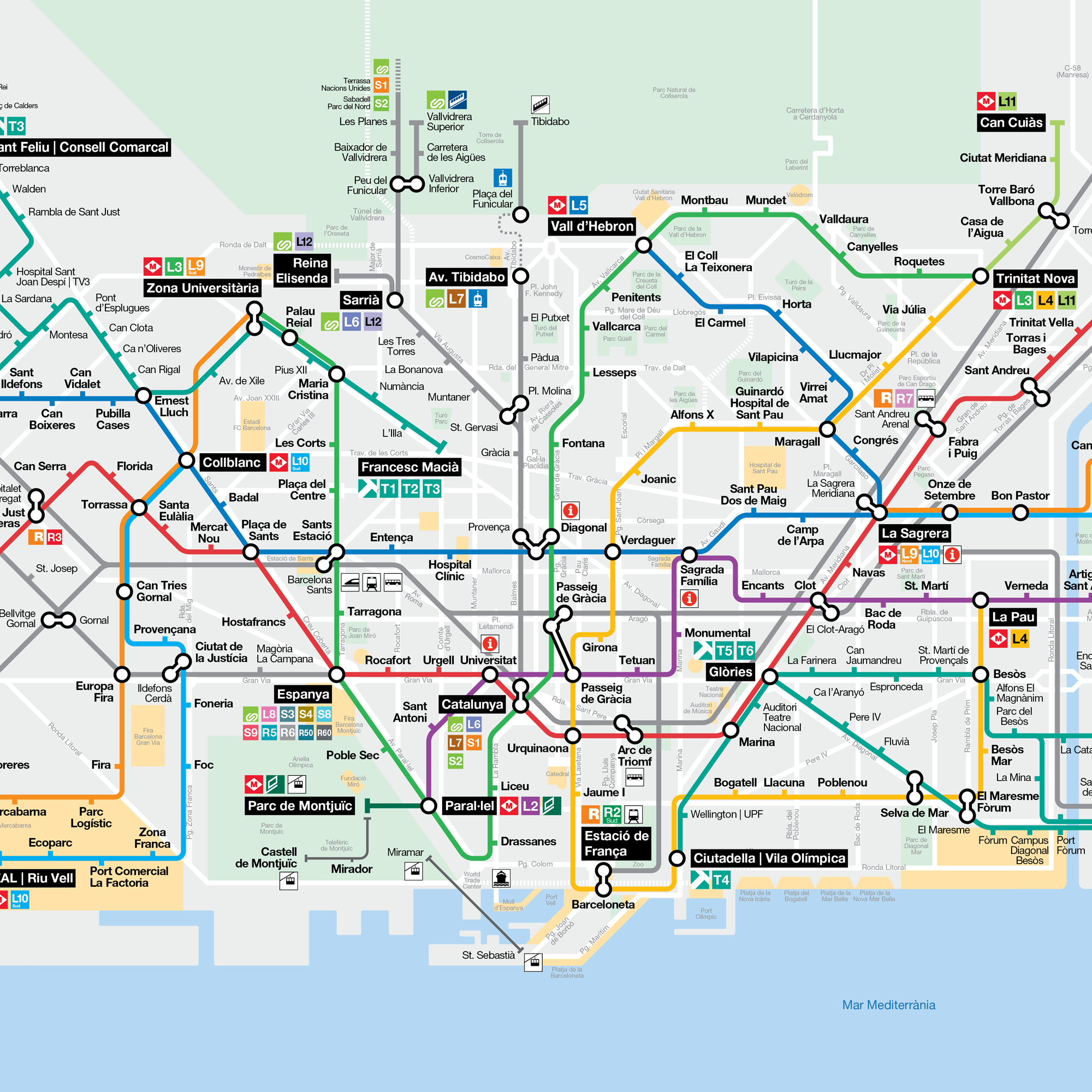
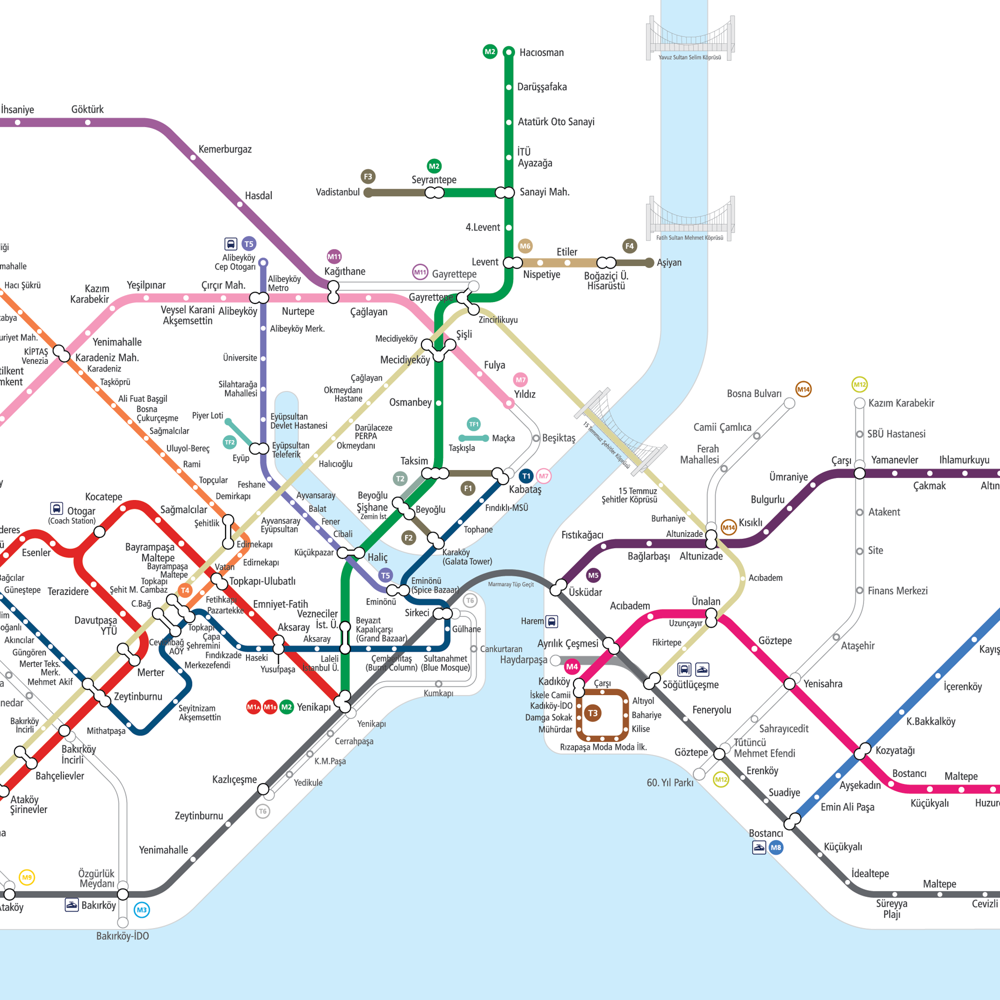
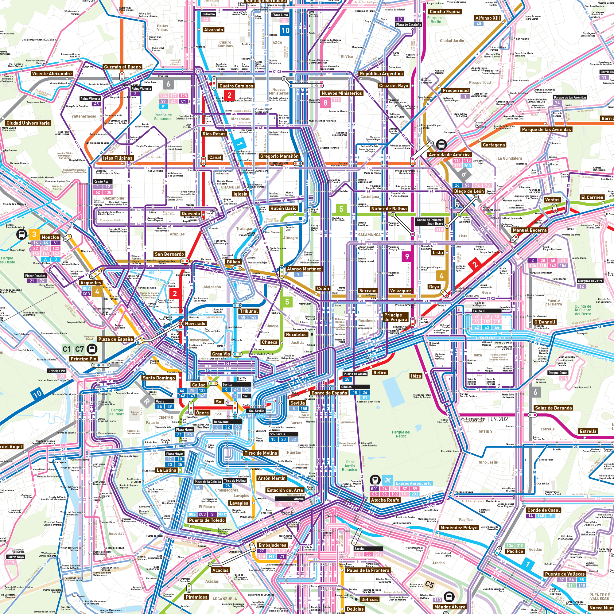
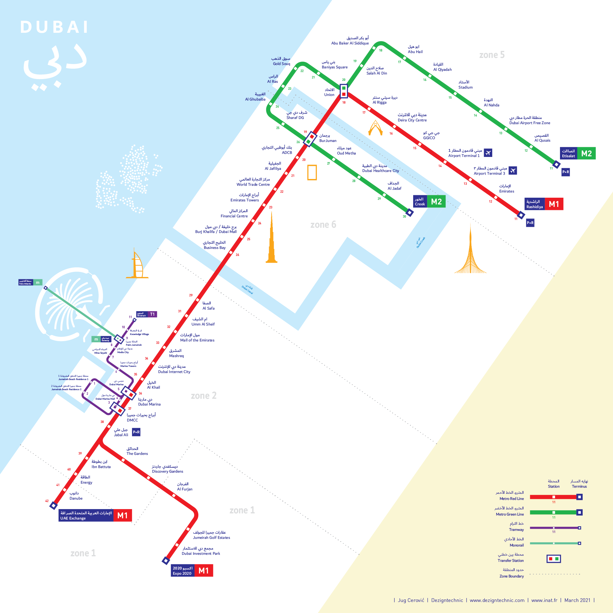
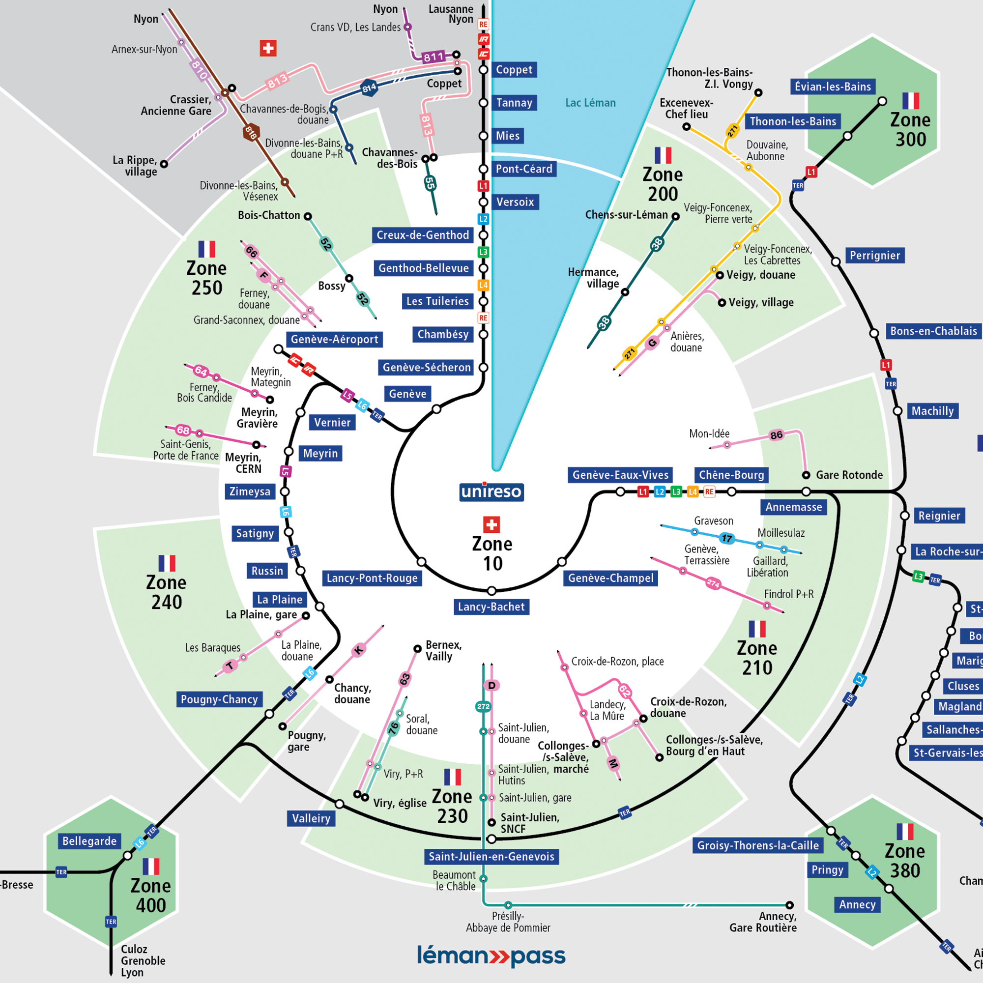
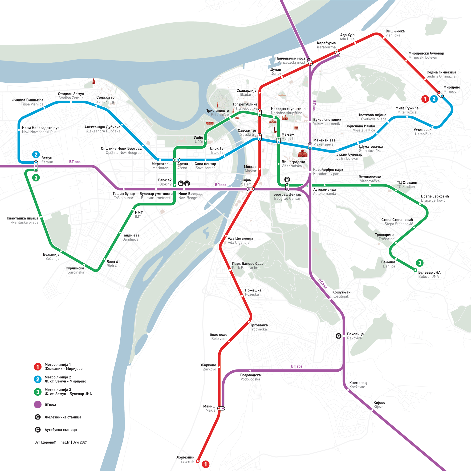
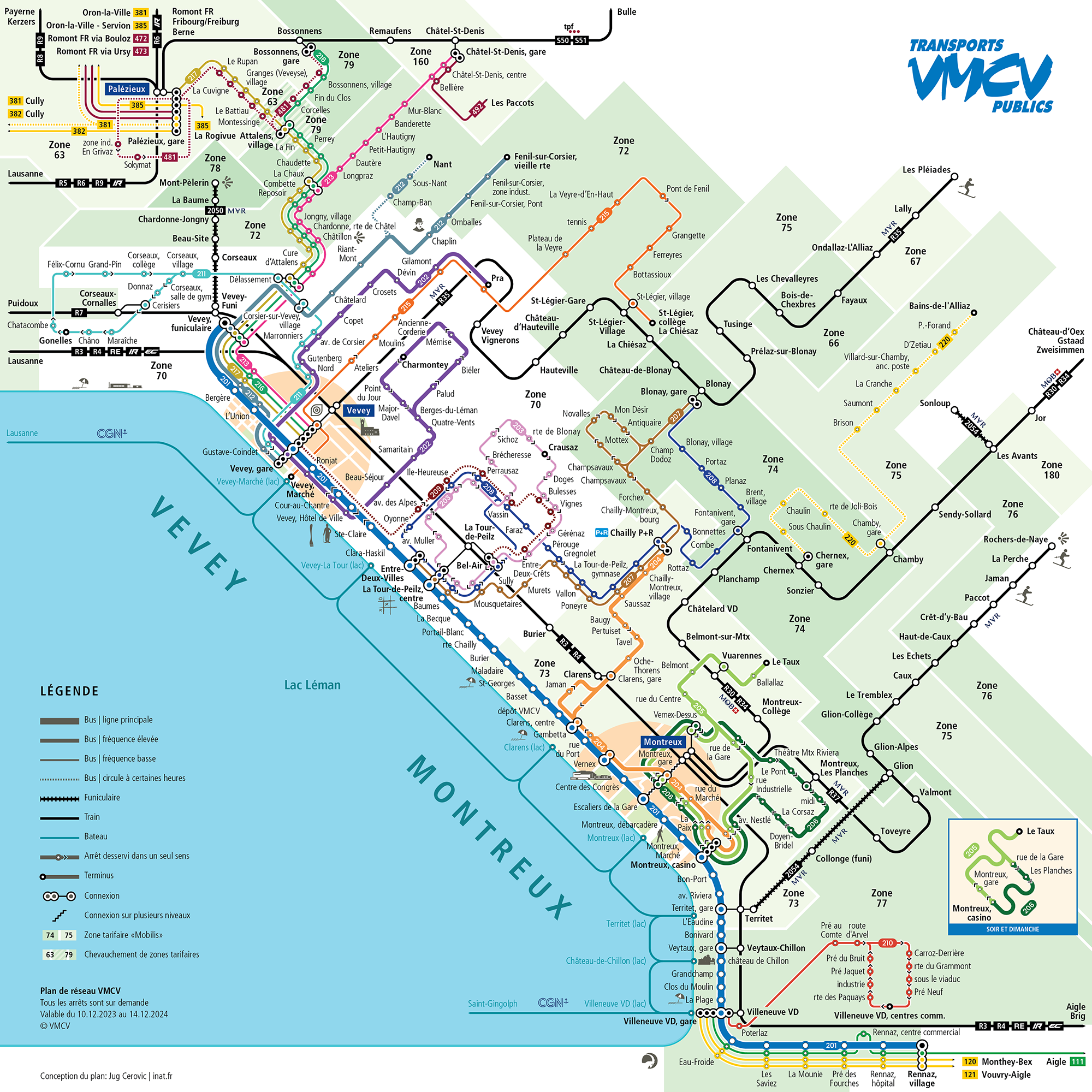
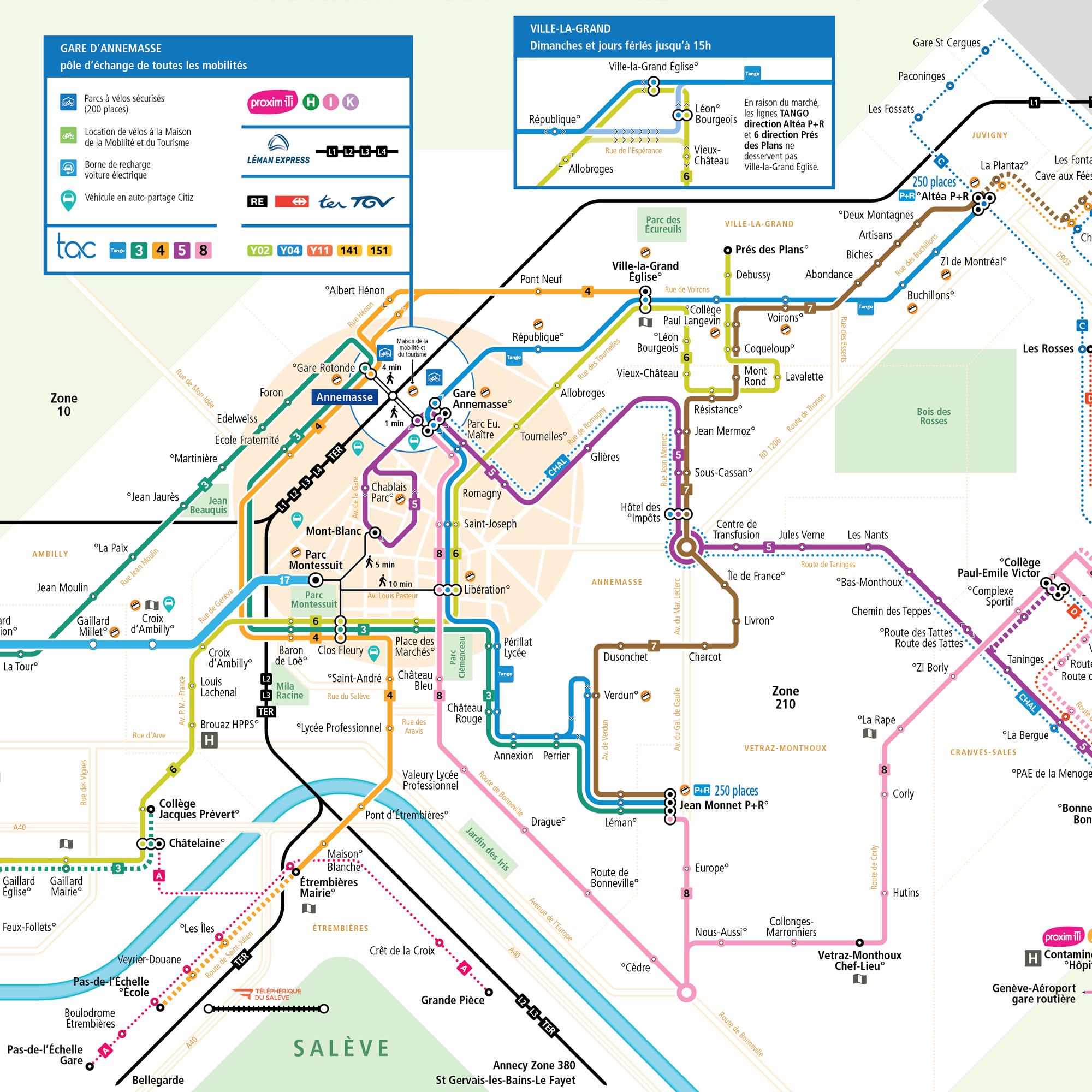
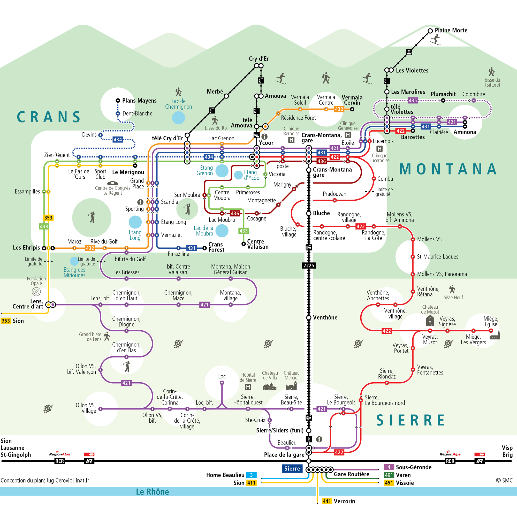
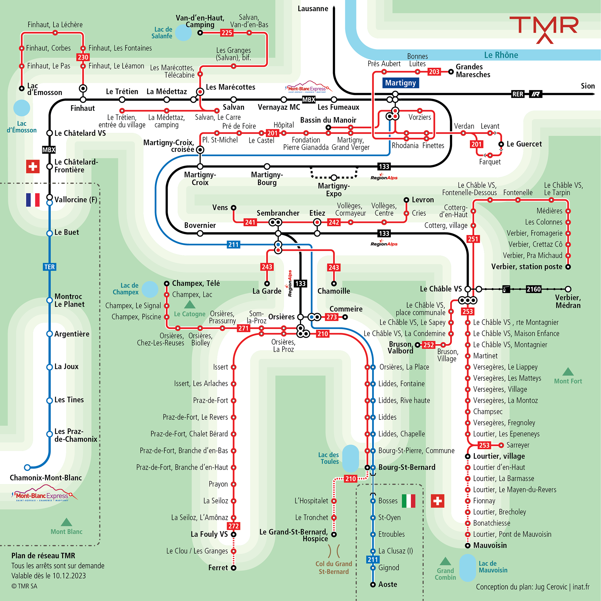
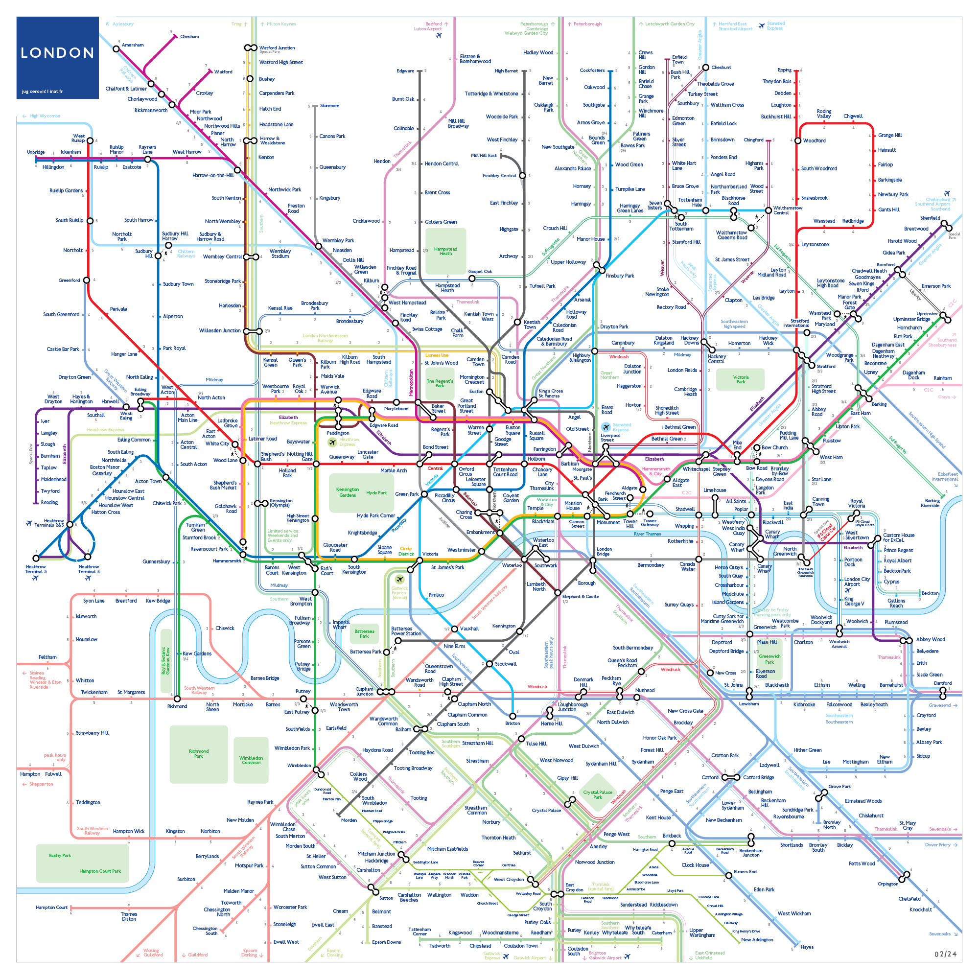
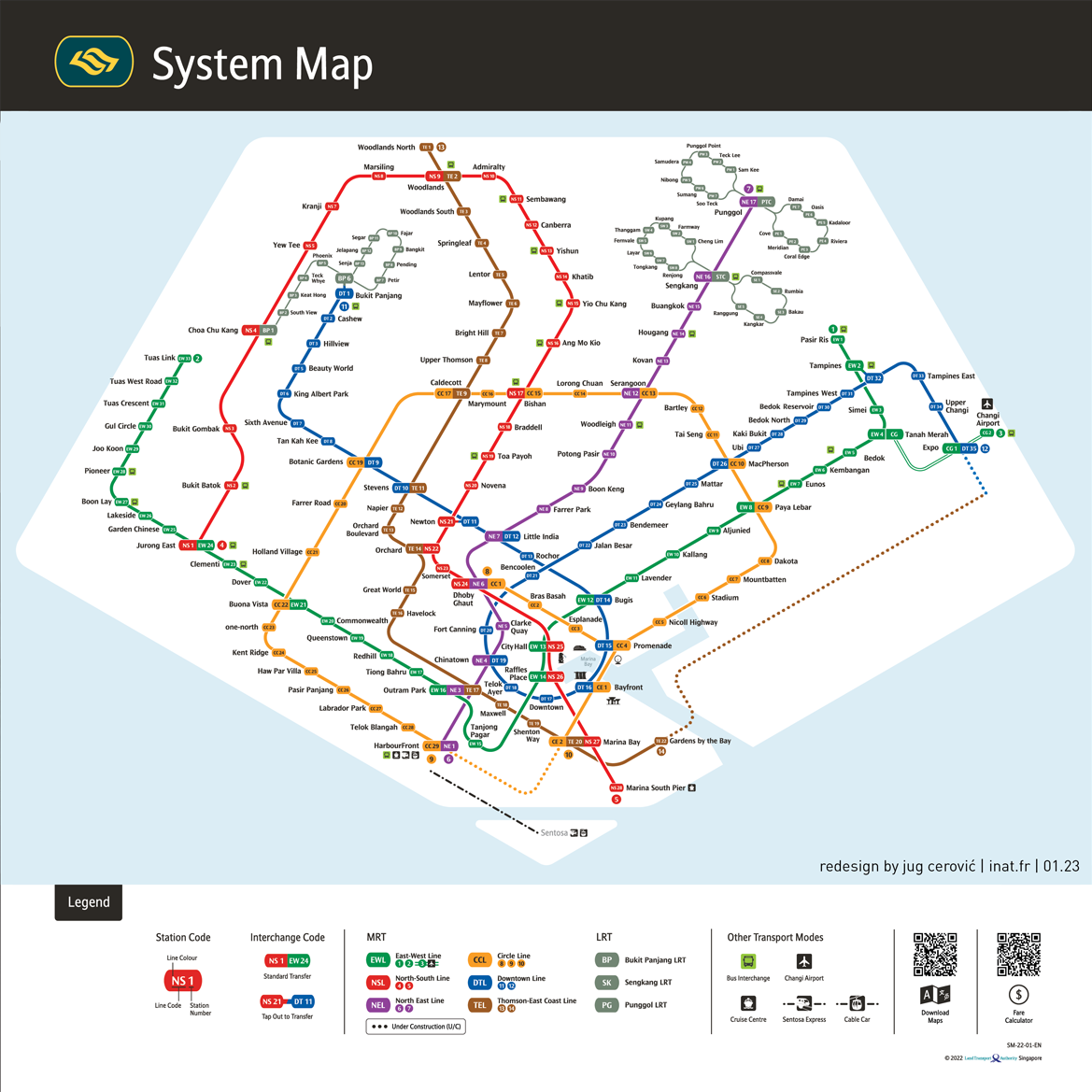
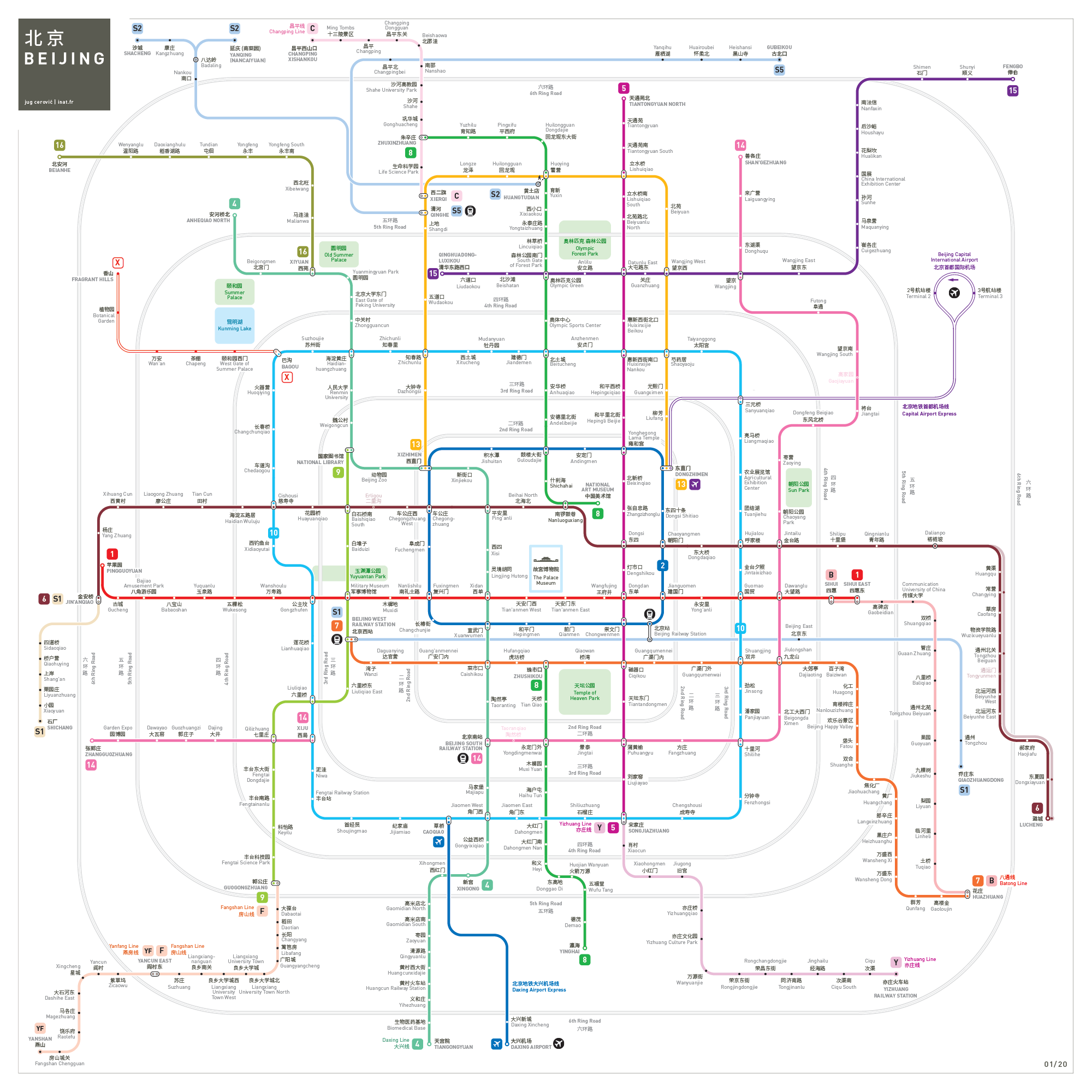
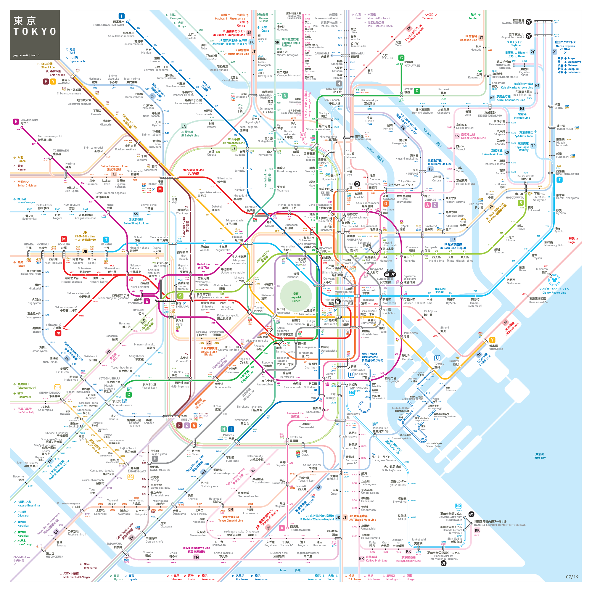
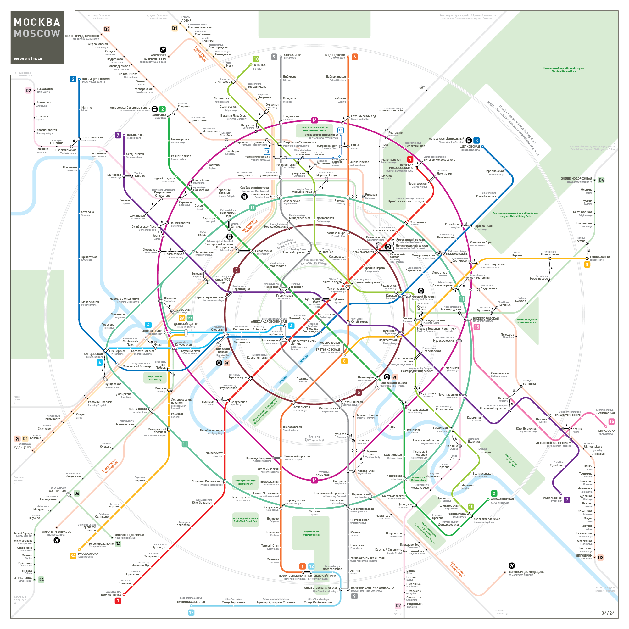
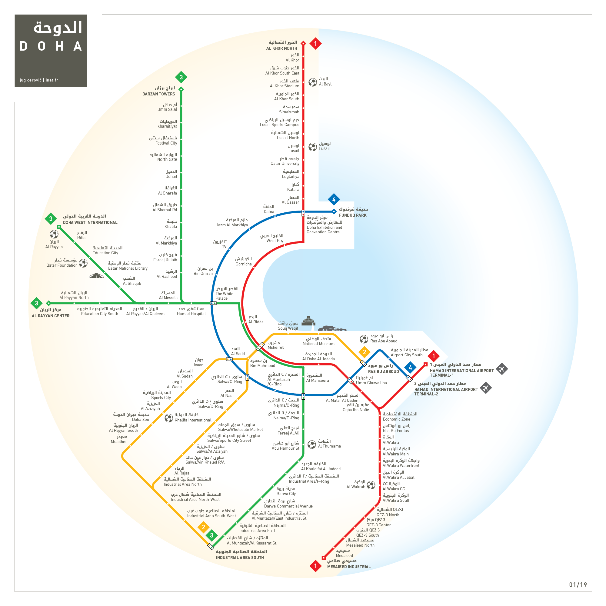
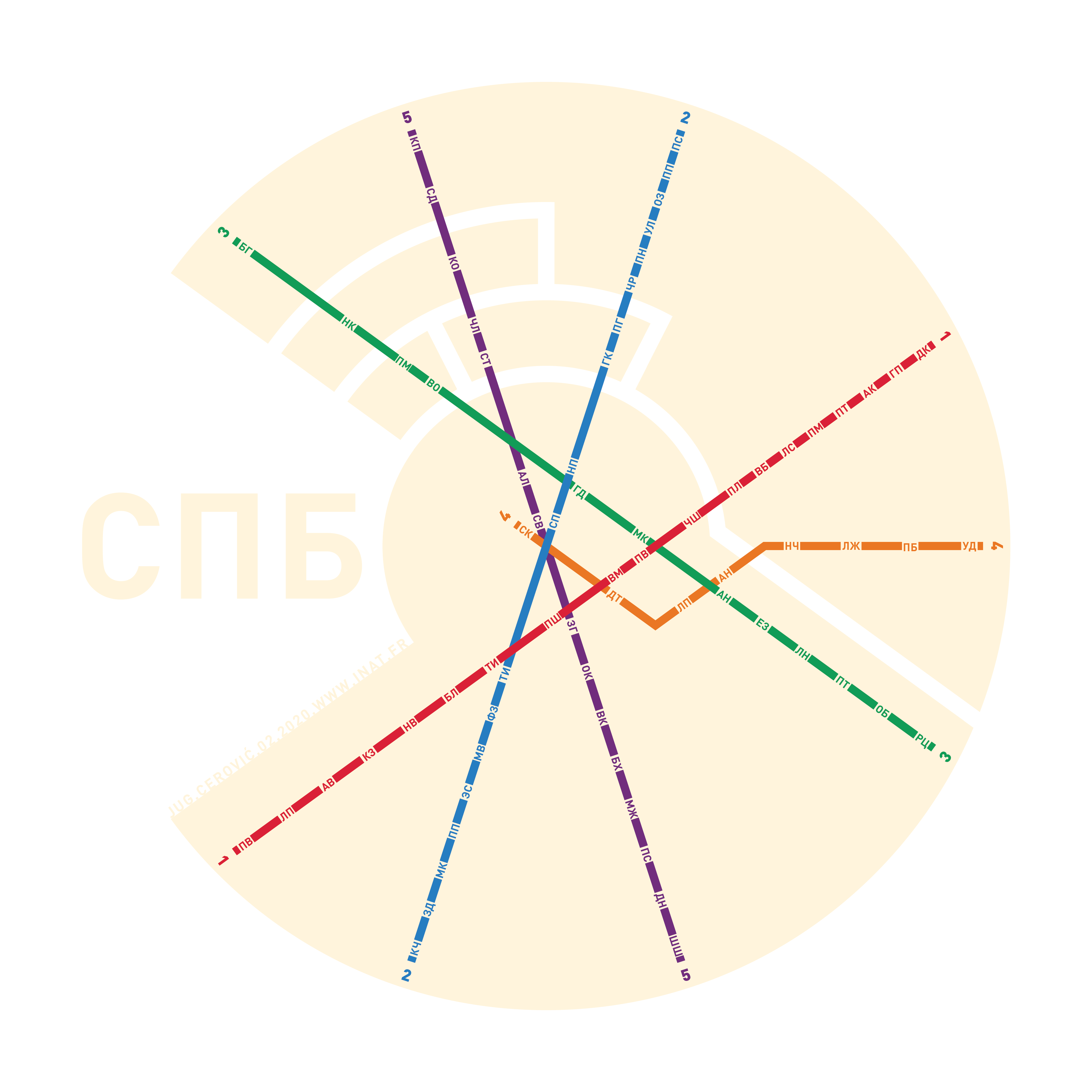
The map is the network.
A network exists only so far as it is represented in its totality on a map, otherwise it remains a virtual sum of vehicles and infrastructure.
We design iconic maps for public transport operators around the world.

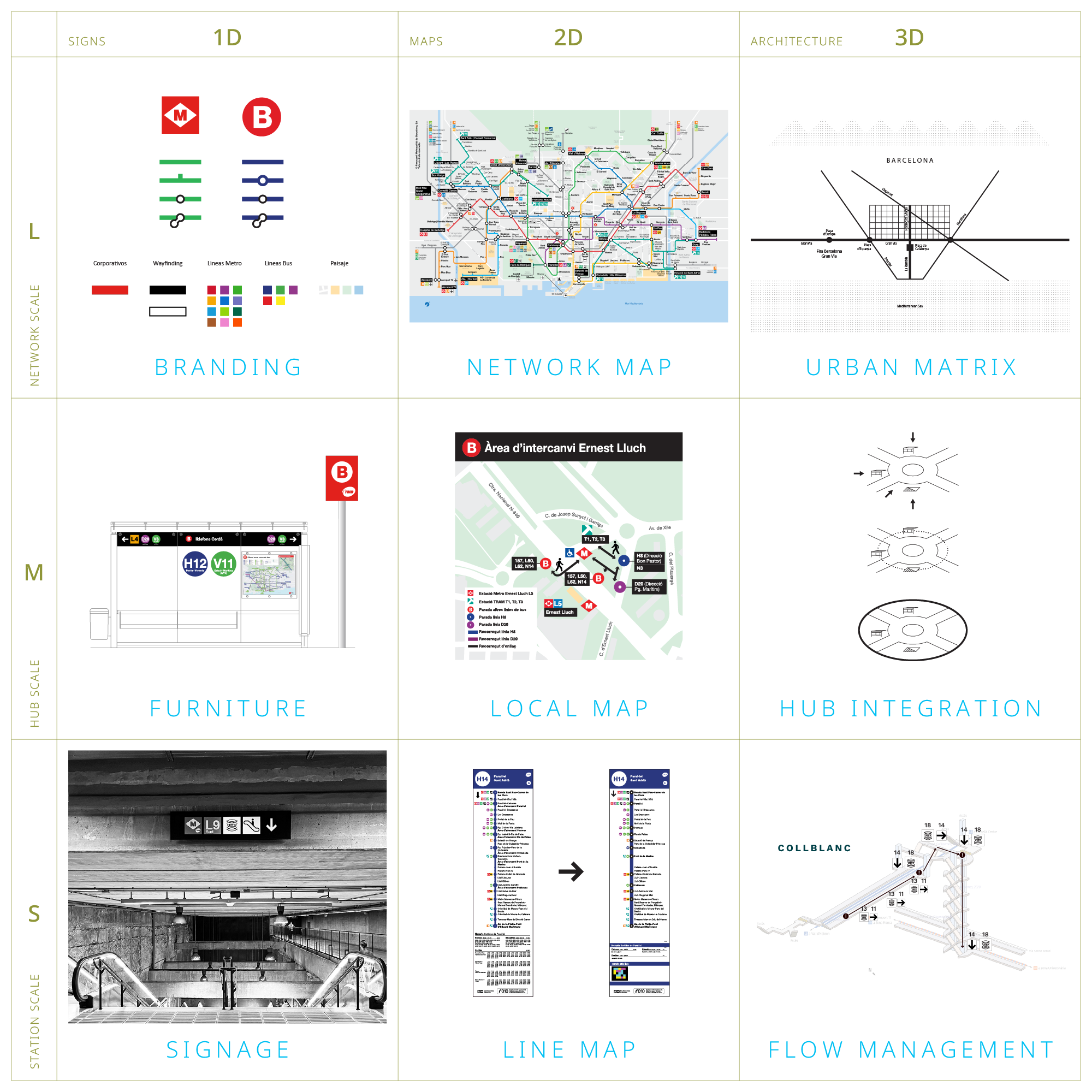
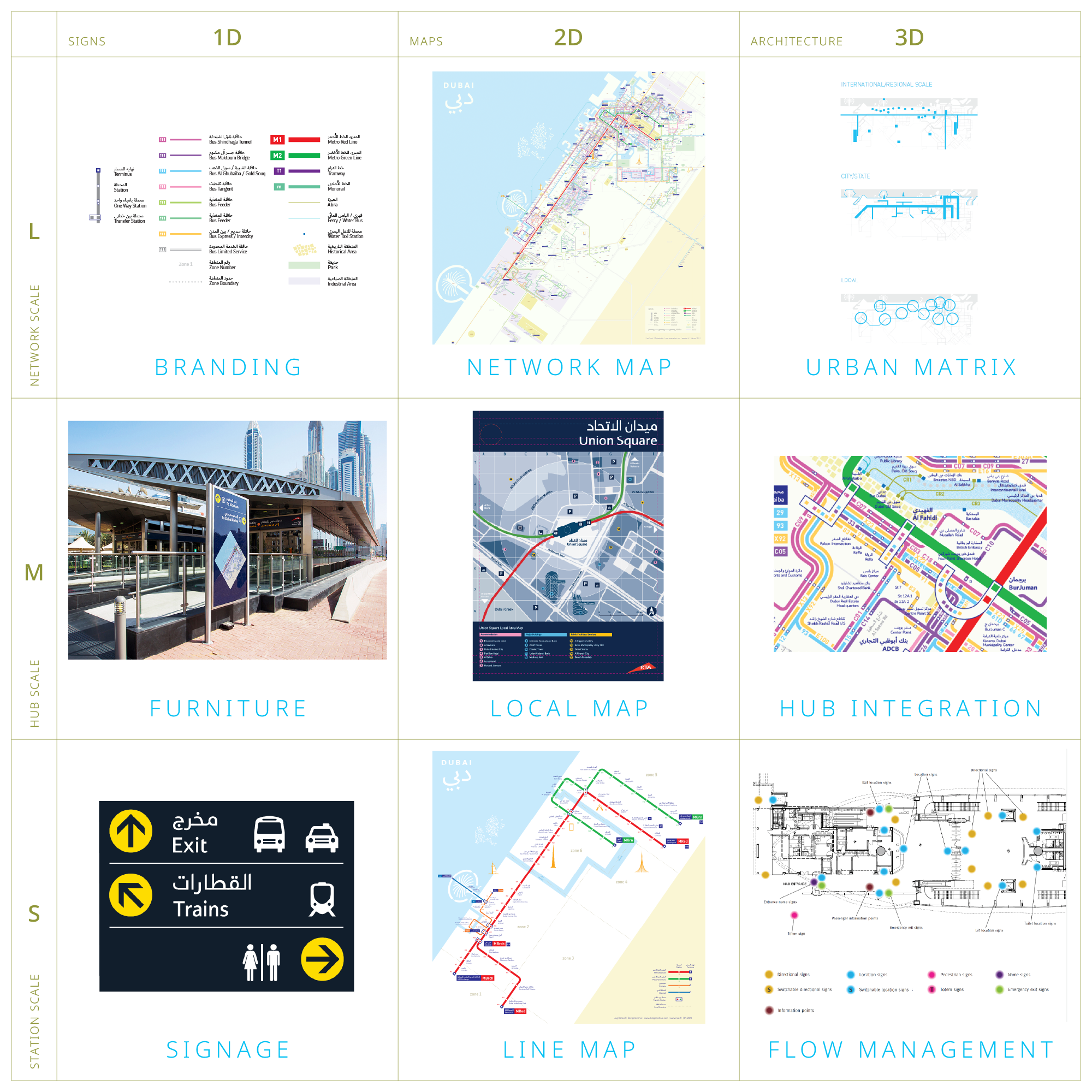
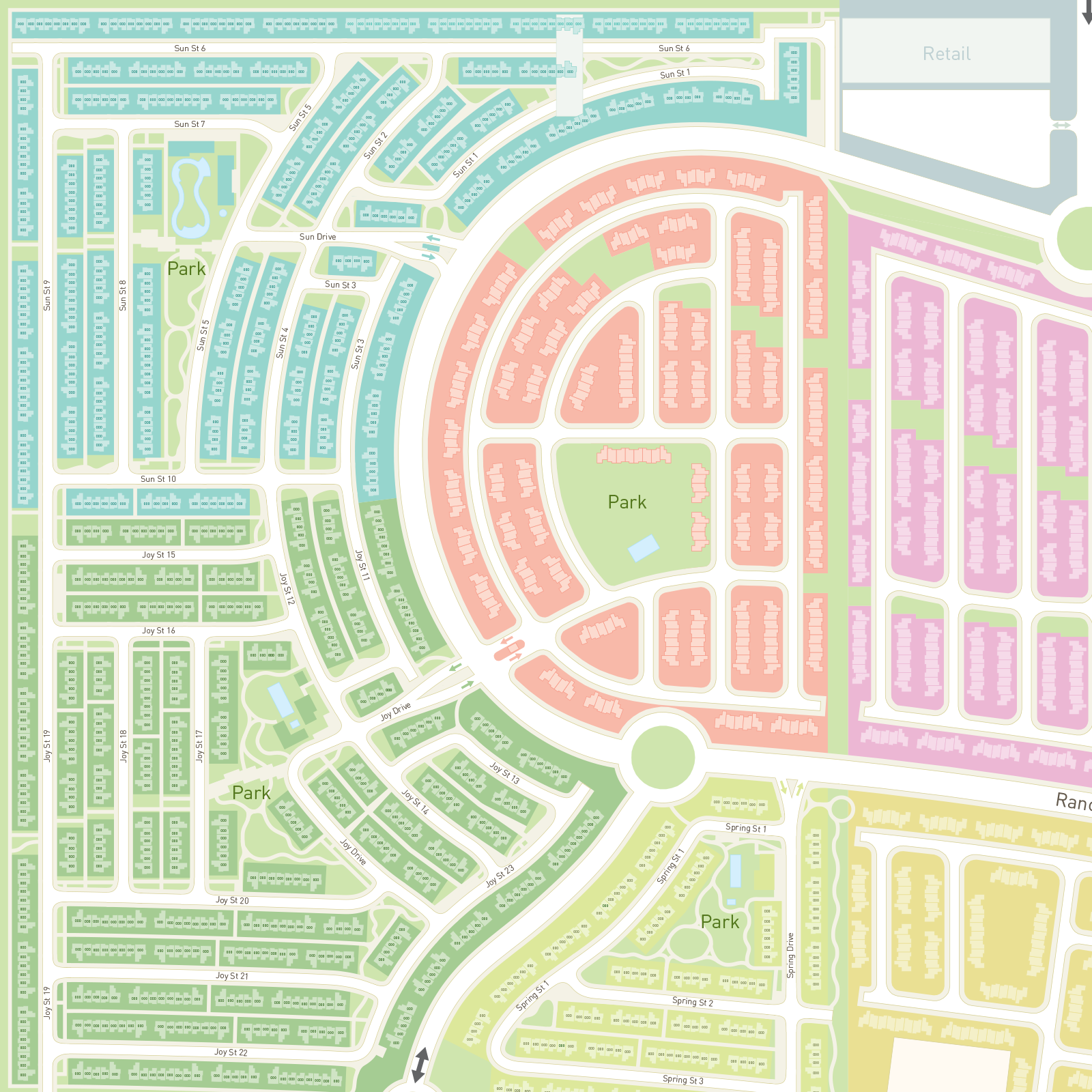
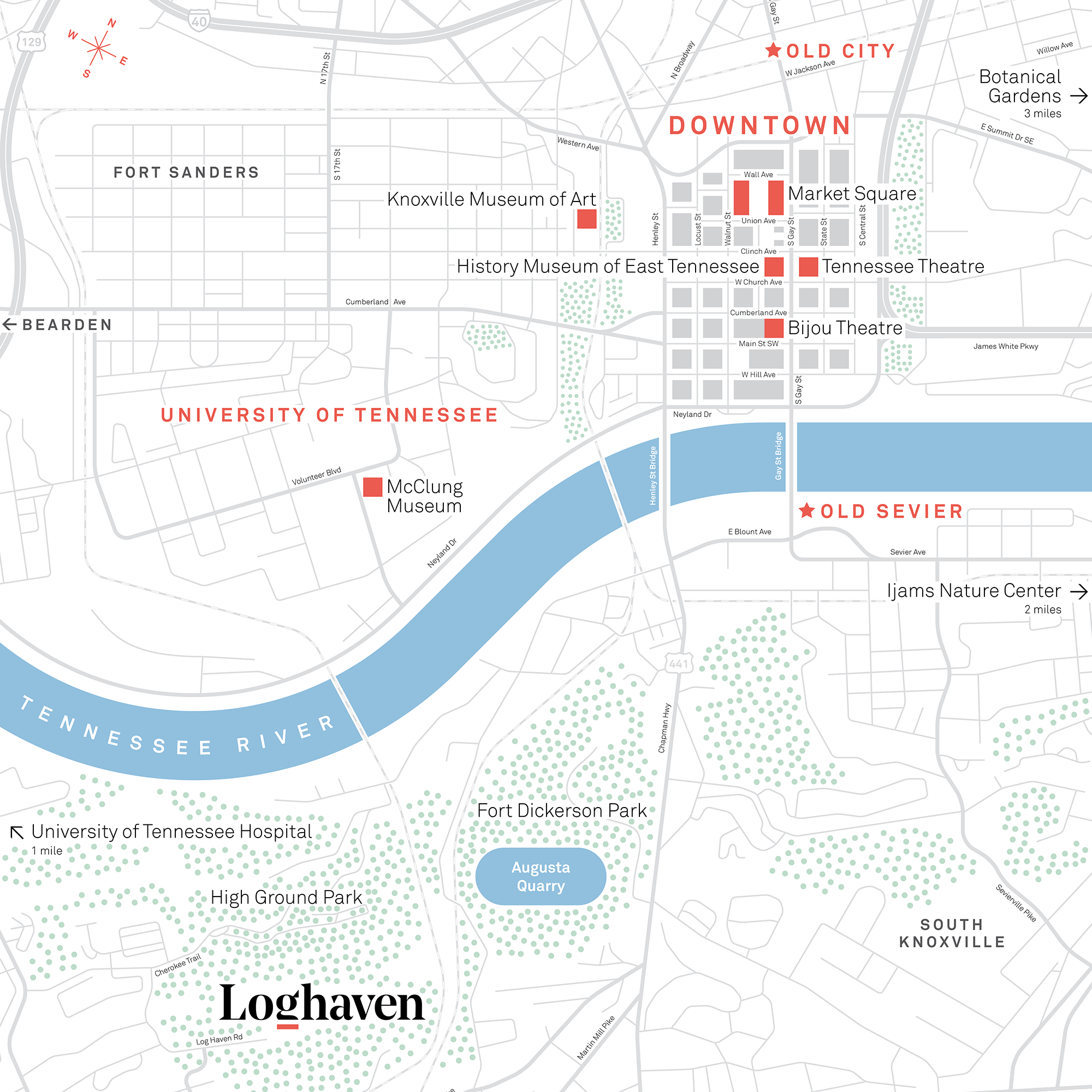
Network Wayfinding Systems
We audit, optimize, and design comprehensive passenger information systems for transport operators around the world.

Digital Mapping Platforms
We bring our expertise in mapping and wayfinding to the leading digital mapping platforms and contribute to the transformation of the world wide web from a 1D to 2D space.

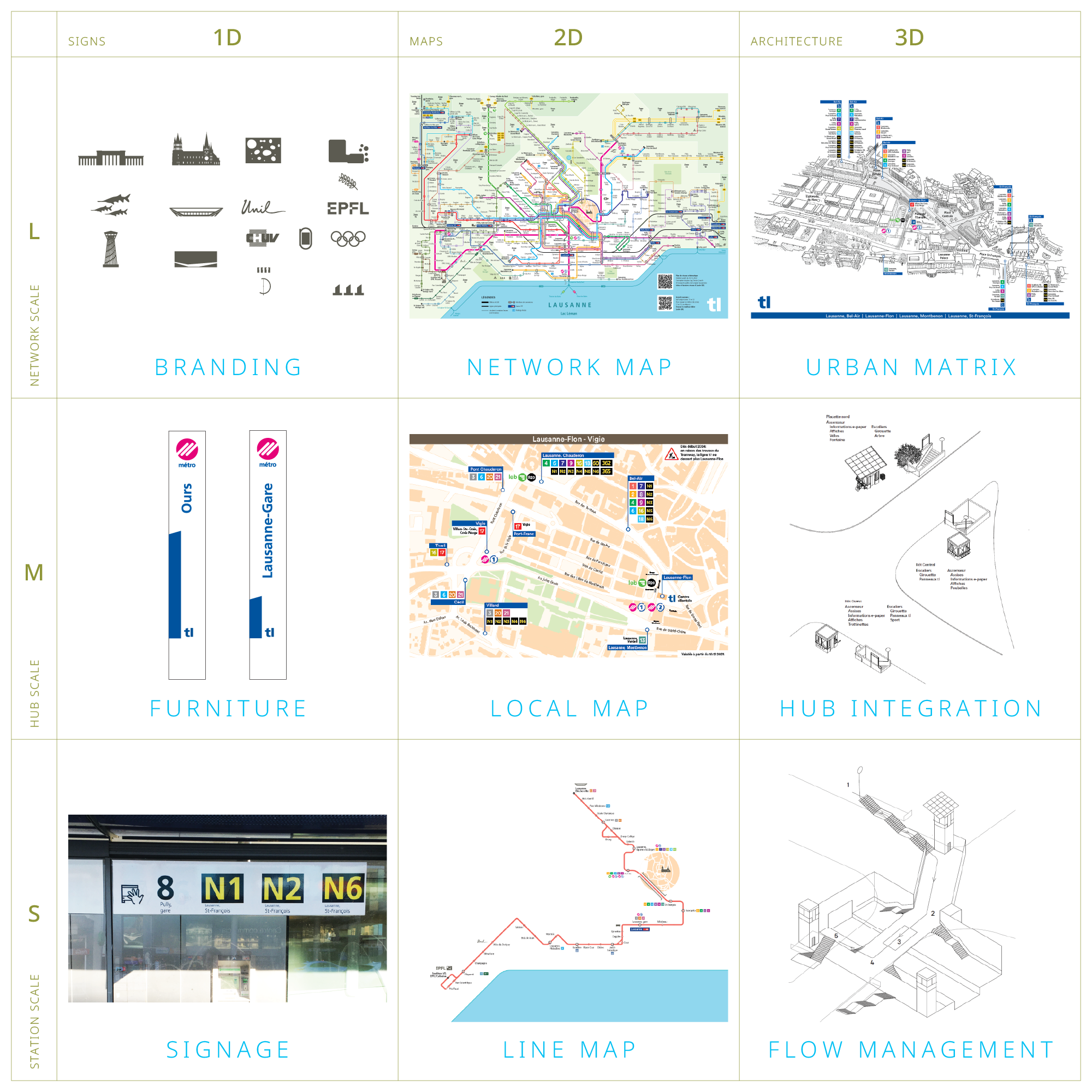
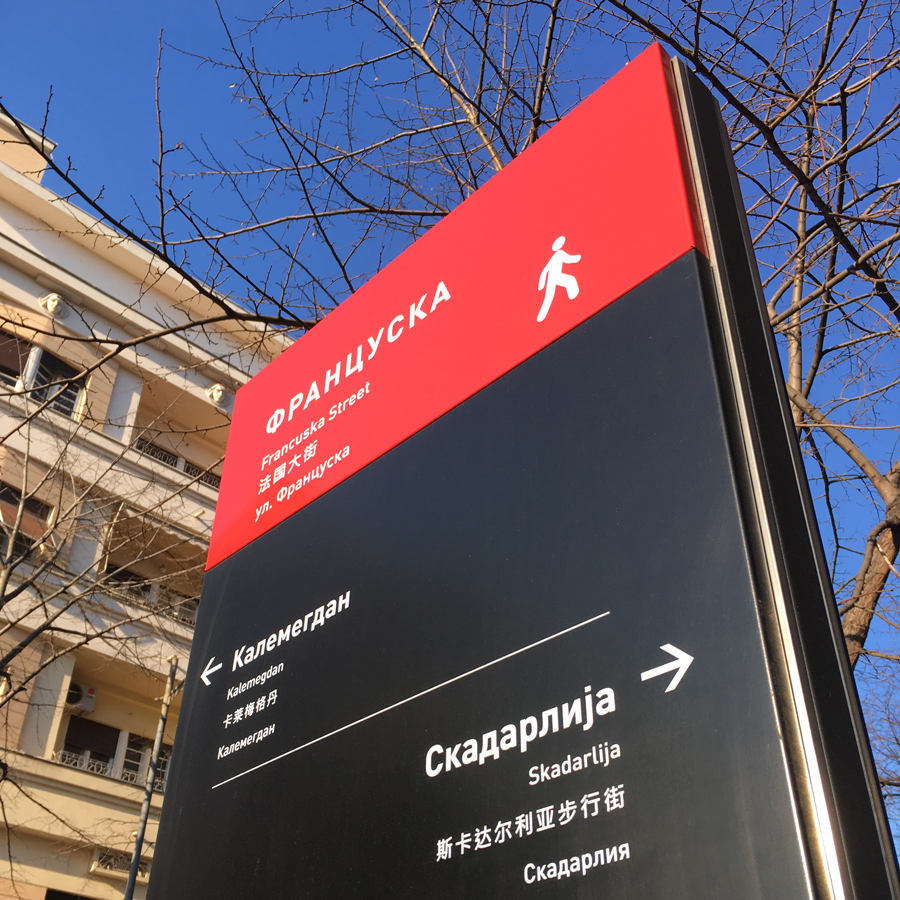
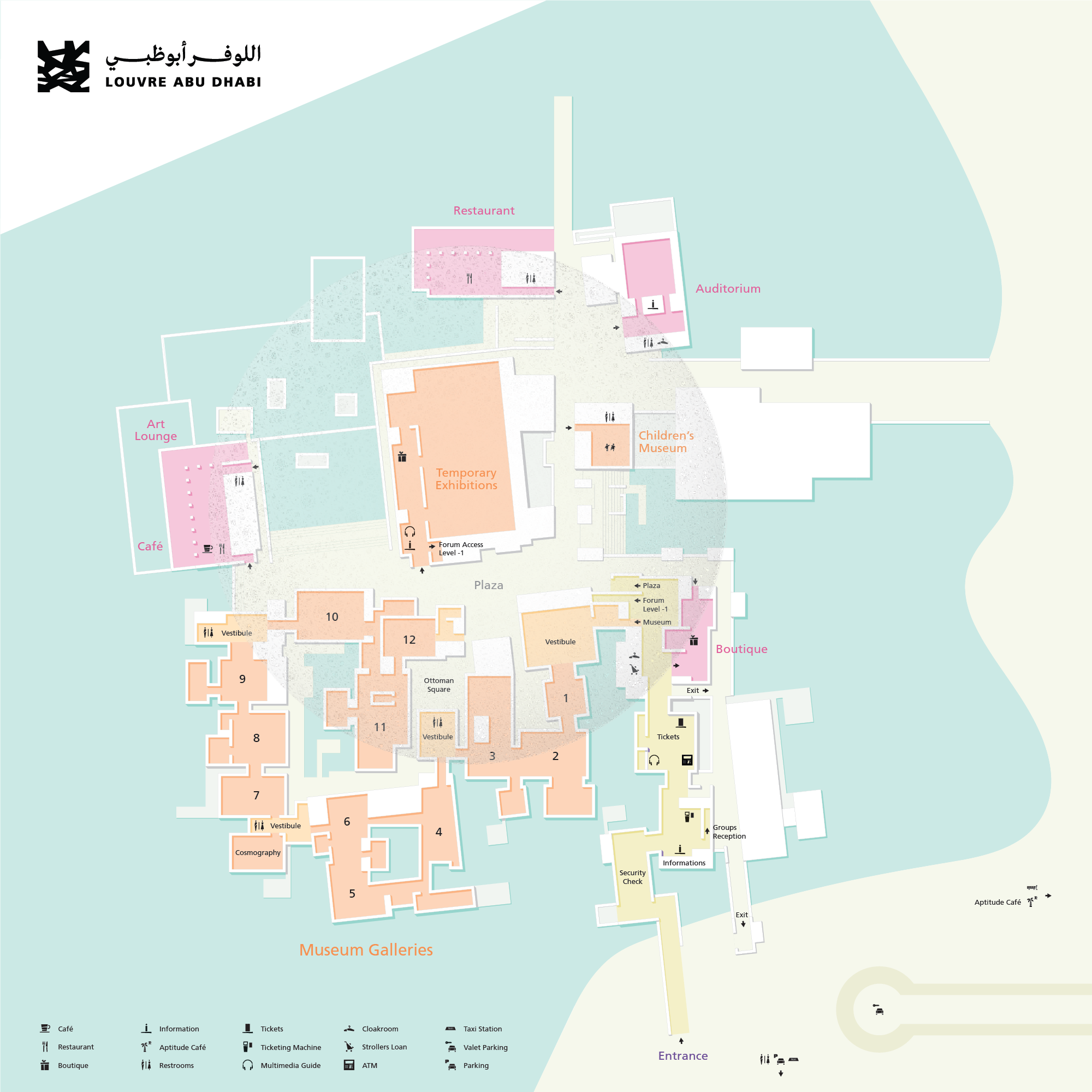
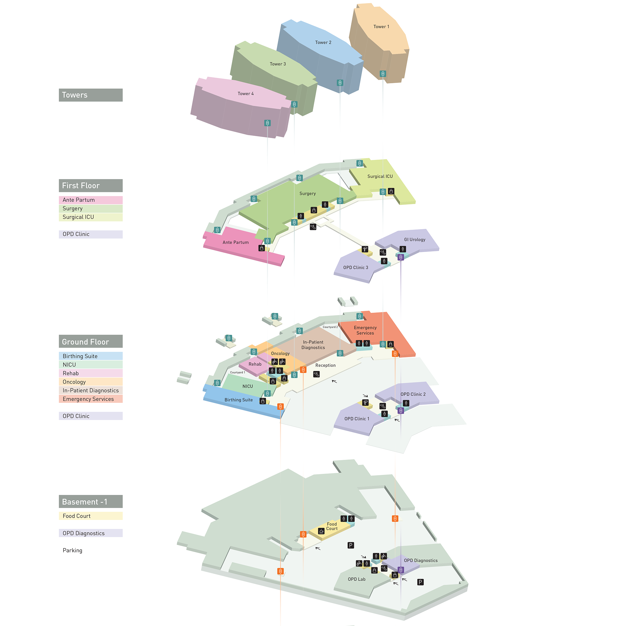
Wayfinding Systems
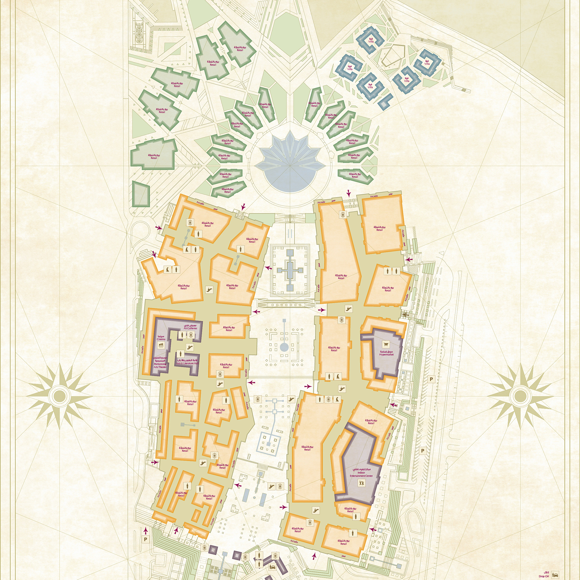
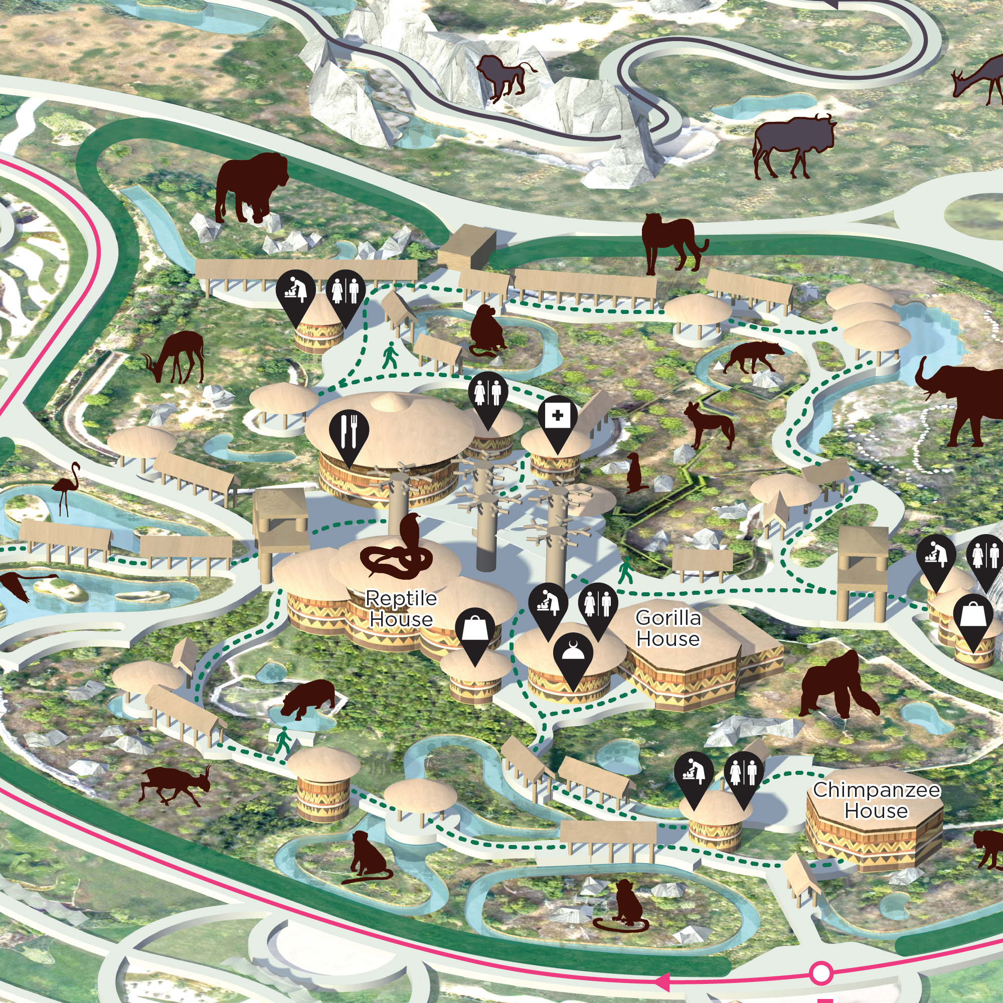
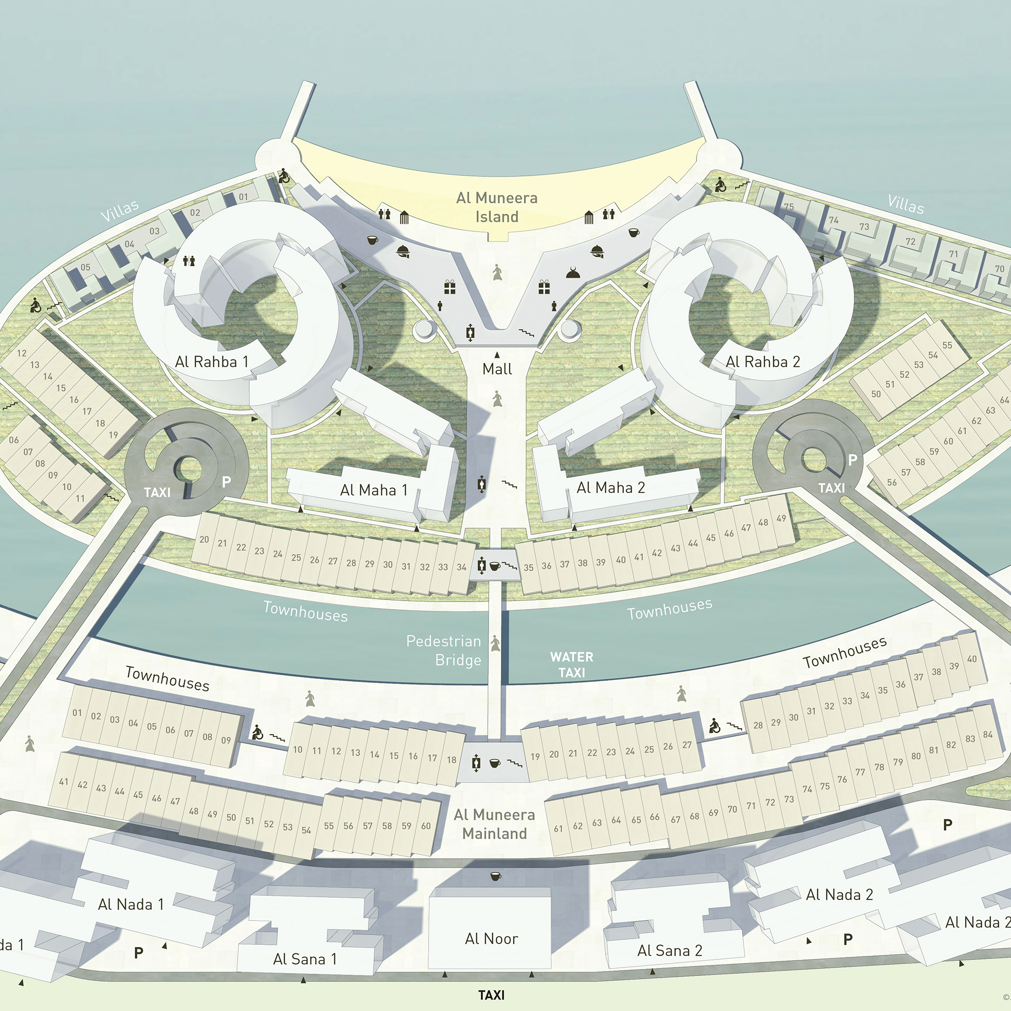
We design, produce and implement wayfinding systems for environments across scales, from a single venue to an entire city.


Research and Development
We dedicate considerable time and resources to research projects of our own choosing.
Metro Maps
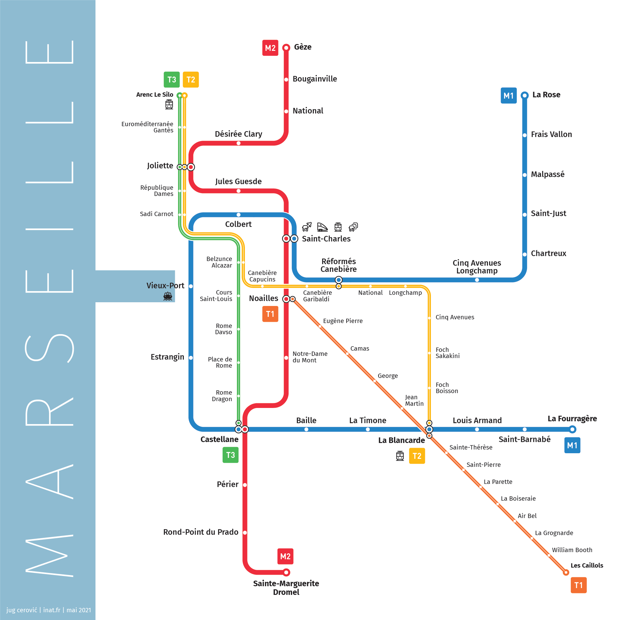
Schematic Transit Maps
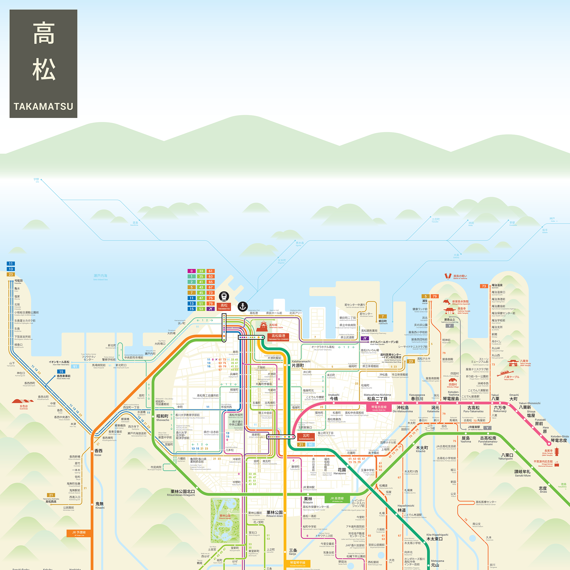

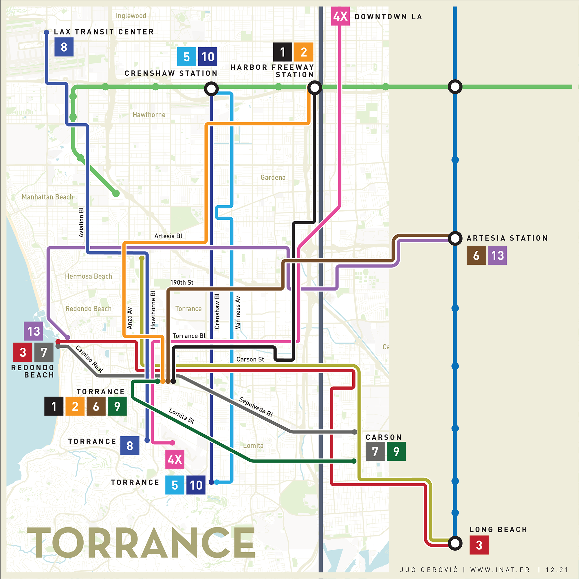
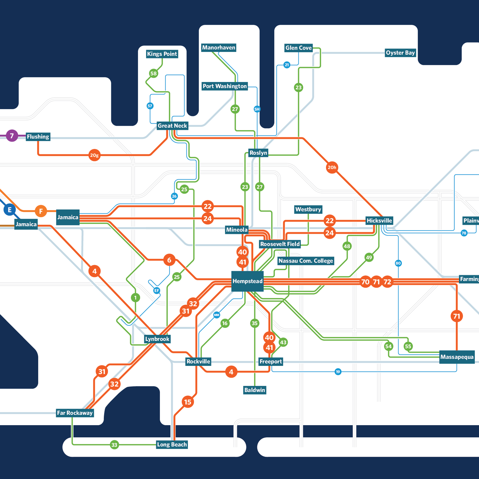
Geographic Transit Maps
Rail Maps
Books


Public Transport Maps
Network Wayfinding Systems
Digital Mapping Platforms
Wayfinding Systems
Research and Innovation :
Metro Maps
Schematic Maps
Geographic Maps
Rail Maps
Books
Portfolio
inat
mapping | wayfinding | architecture