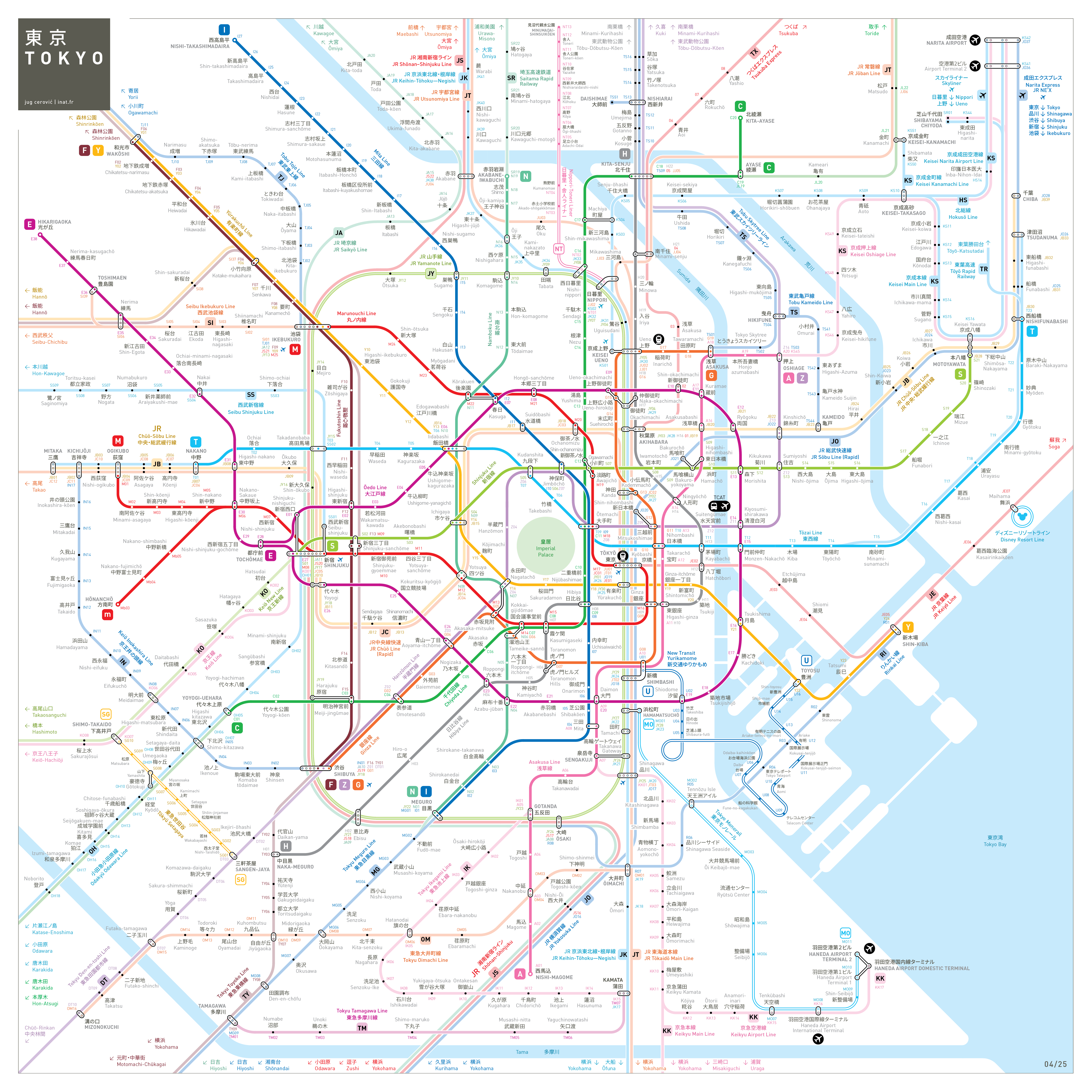
Tokyo Metro Map
東京地下鉄の地図
inat Metro Mapping Standard
2014
Print Shop

Art prints, posters, scarves, pillows...
DESIGN NOTES
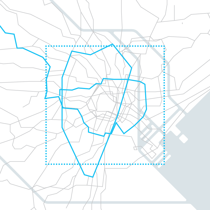
Geography
The map encompasses the entire area served by the metro system, a 30x30 km square. All commuter lines in the area are also represented.
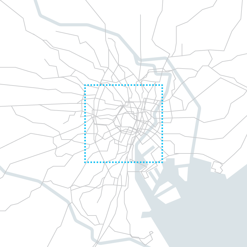
Topology
The dense central urban area is enlarged to make enough room for the display of all necessary information it contains. The periphery is consequently shrunk. Landscape features - rivers, sea - are schematized.
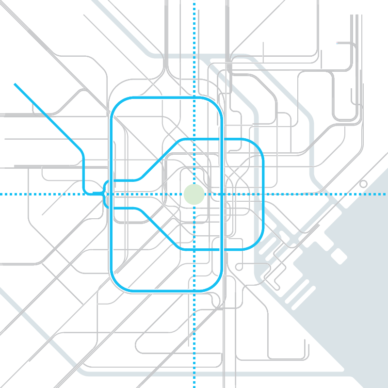
Symbolism
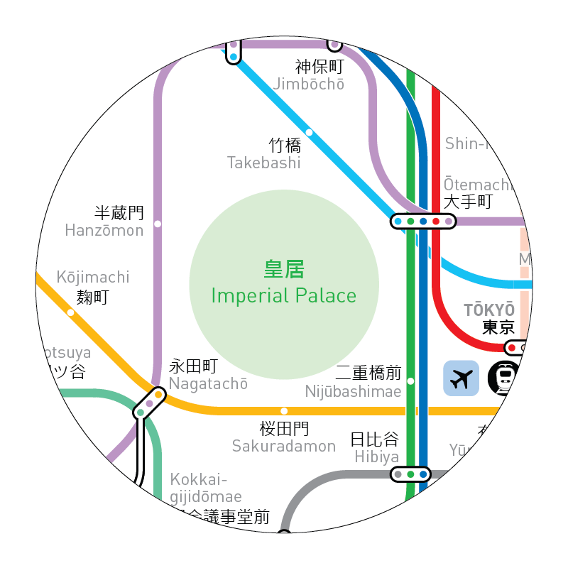
The map is centered on the Imperial Palace compound represented by a green circle.
The 2 main lines marking the Tokyo downtown area are shown with a simple and remarkable shape:
- Yamanote line linking all main railway stations is a rectangle with rounded corners.
- Oedo line is an axially symmetric loop.
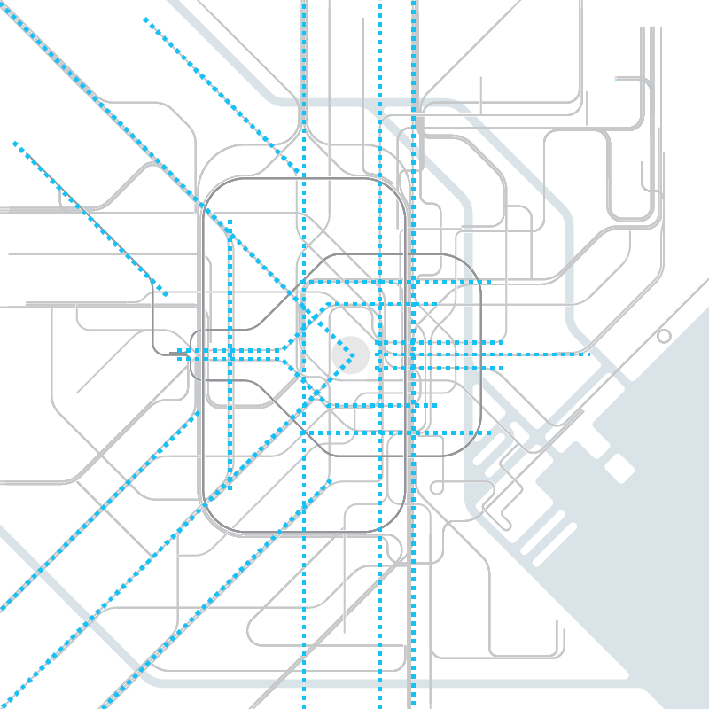
Structure
Lines' shapes are simplified and organized following a regular structure related to symbolic elements:
- Diagonals centered on the imperial palace
- Vertical axis parallel to Yamanote line
- Offset paths parallel to Oedo line
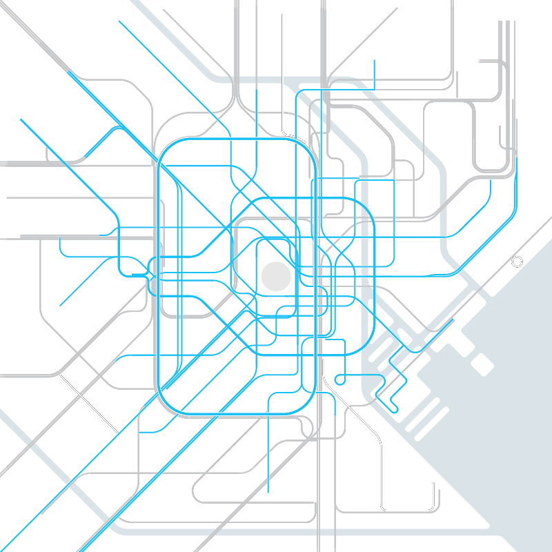
Hierarchy
A hierarchy of information is established to avoid overwhelming the user with data.
There are successive lecture levels:
1. Metro lines with bright shades
2. Commuter lines with pastel shades
3. Light Rail lines with a central white stroke
Details
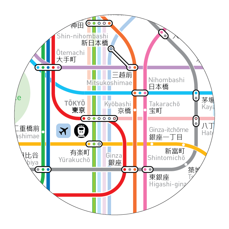
Imperial palace and Downtown Tokyo
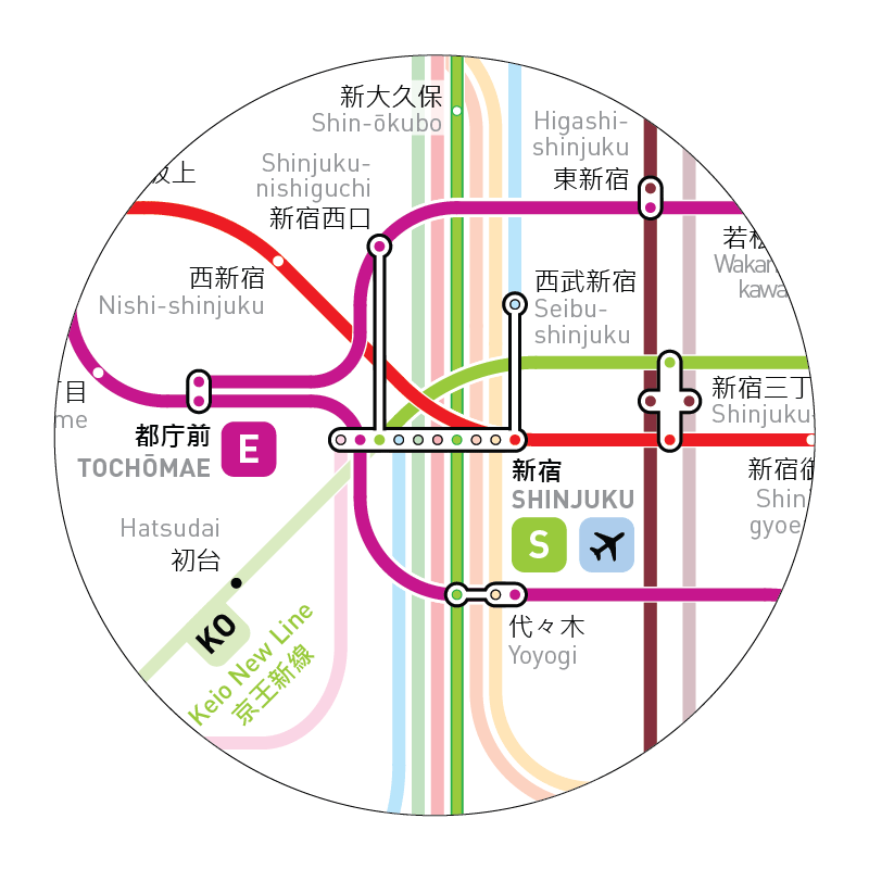
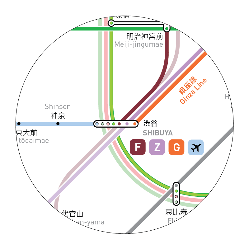
Shinjuku and Shibuya
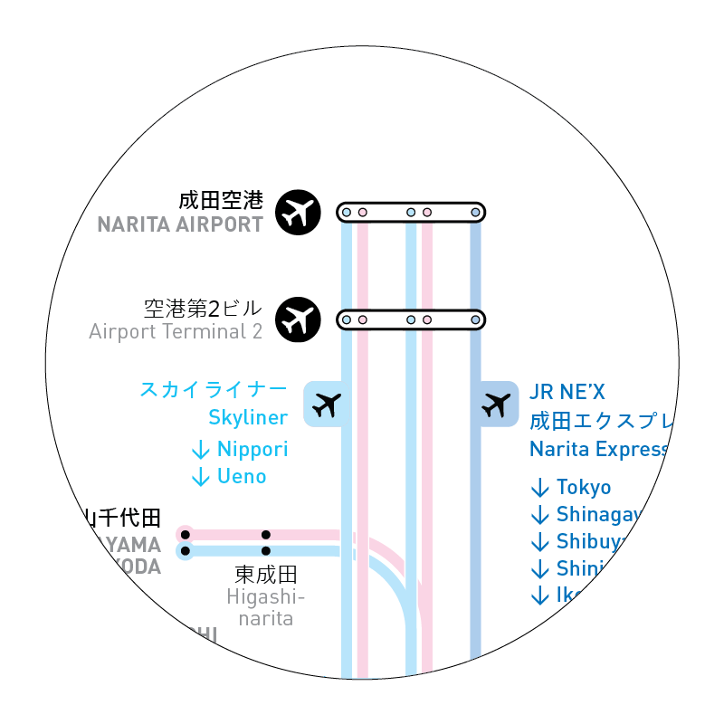
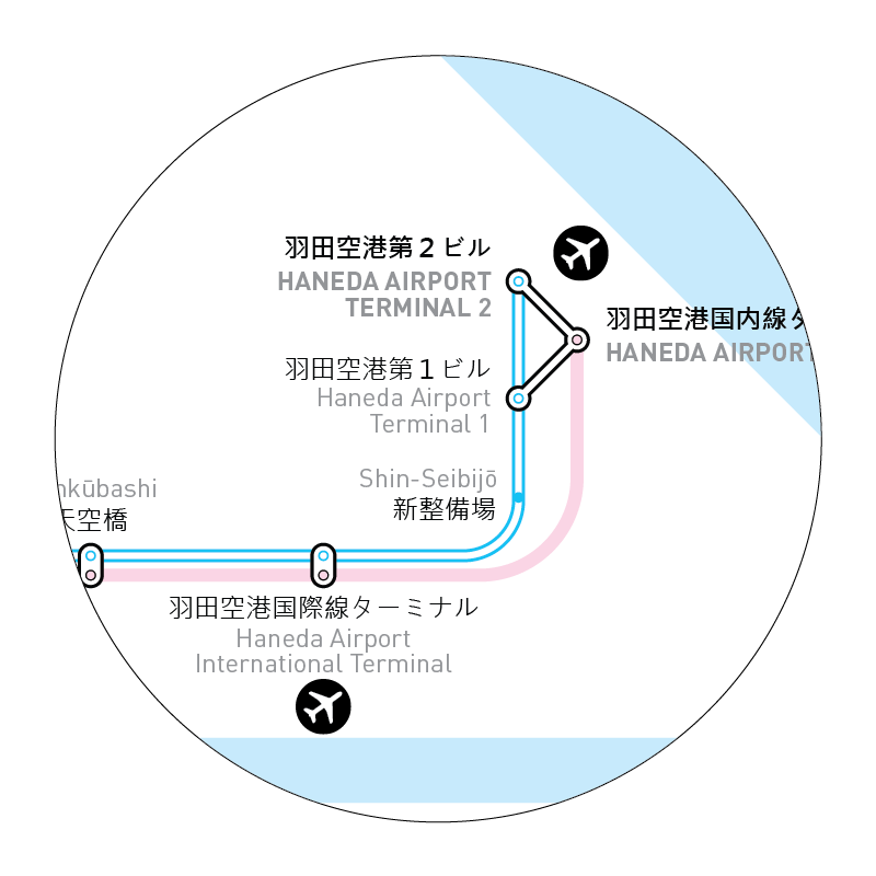
Narita and Haneda Airports