Olympic Games 2024: Grand Paris Metro Map
Download full screen Hi-res PDF
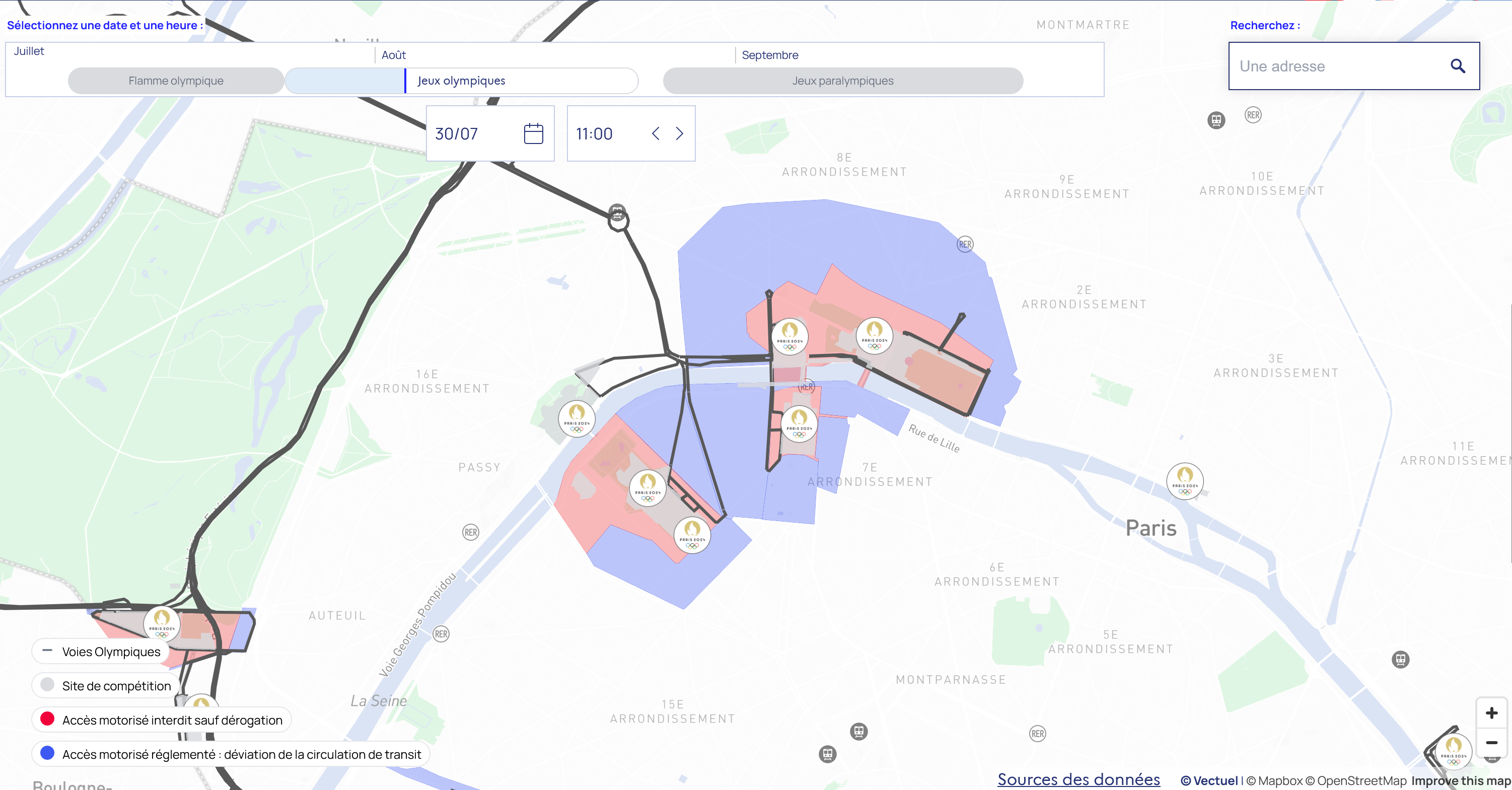
Zoomable map:
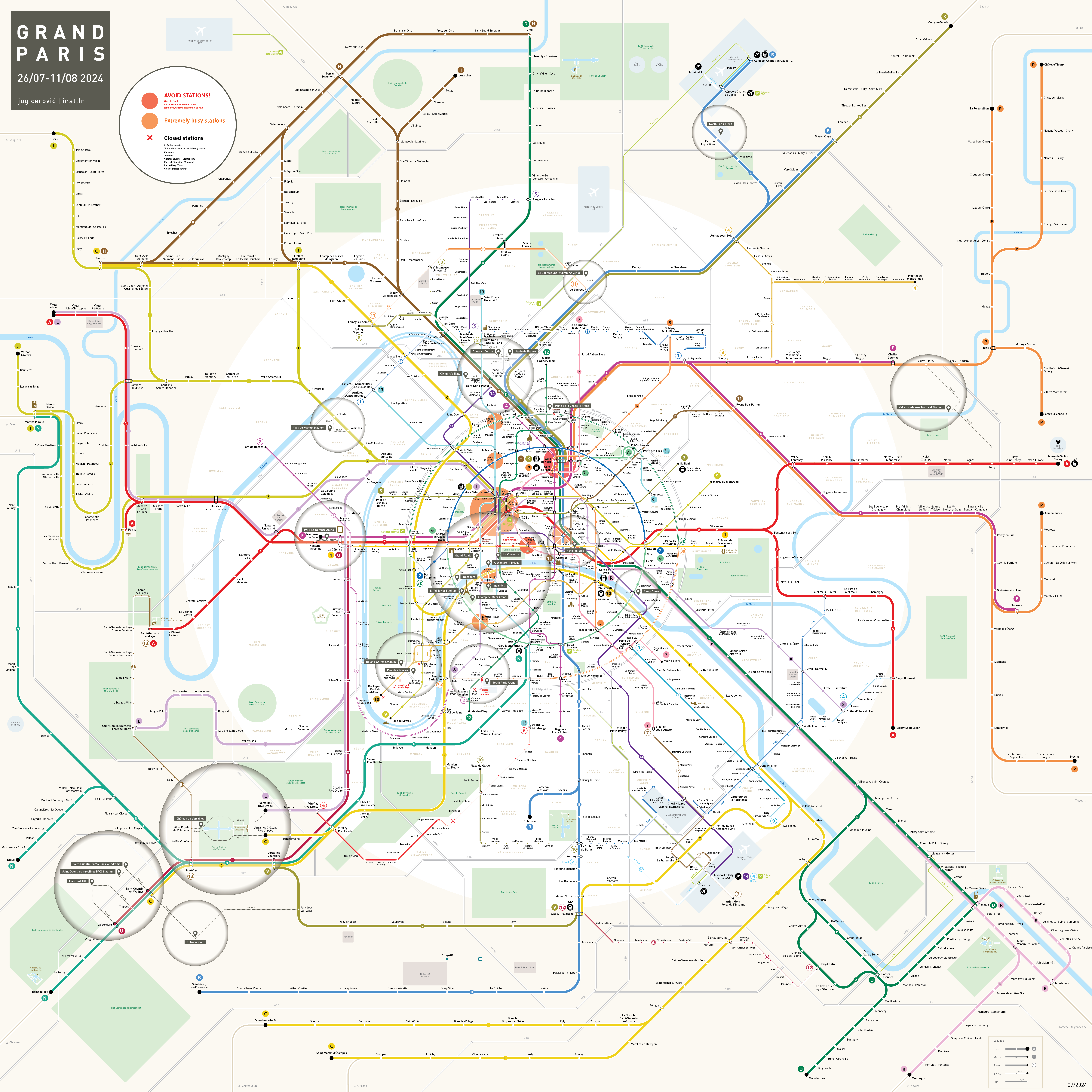
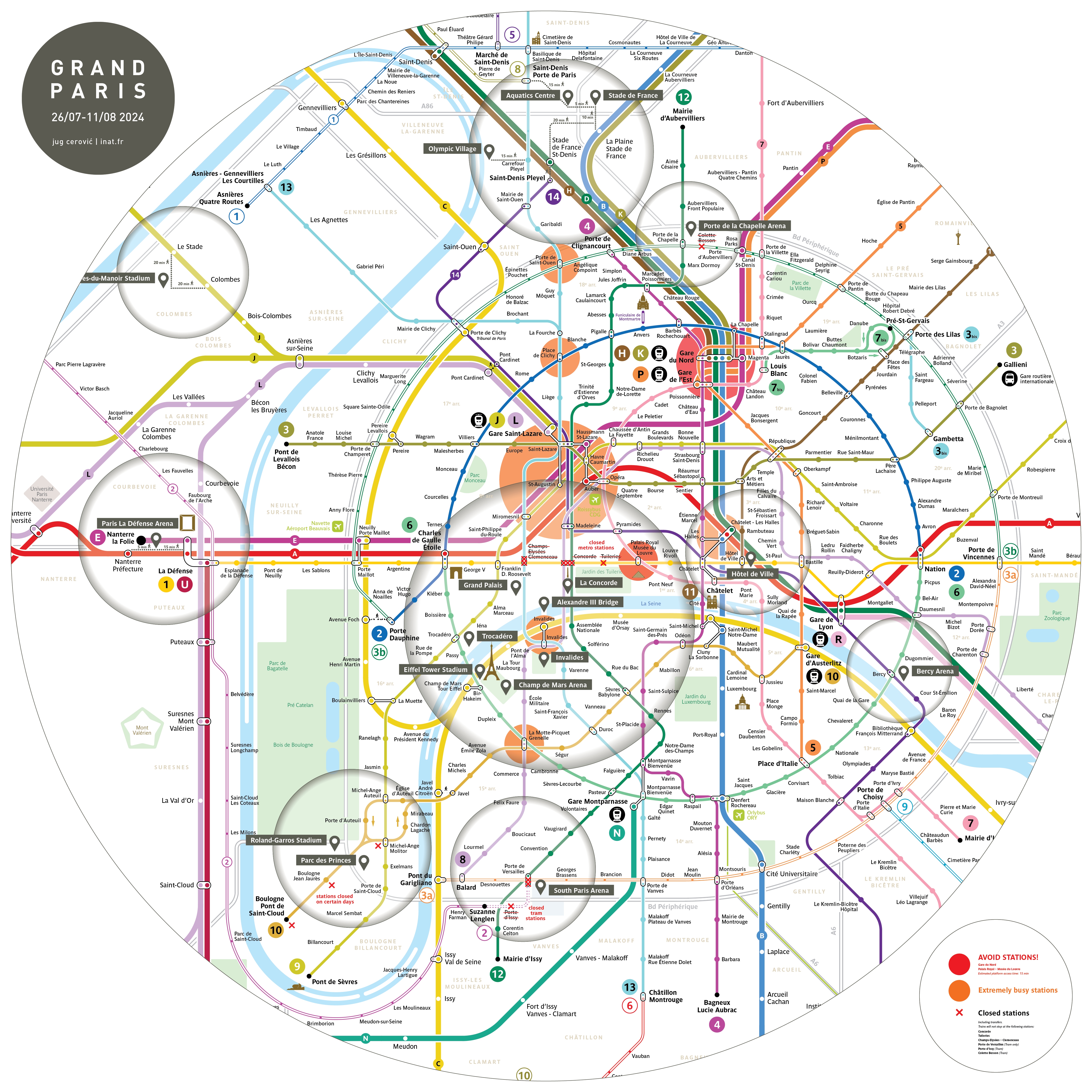
Map of the Grand Paris metro network during the 2024 Olympic Games.
26 July - 11 August 2024
The map shows the locations of Olympic Venues and access by metro and suburban trains.
Millions of visitors are attending the games, the network is extremely crowded, your best mobility solution is ... to walk.
Avoid the western half of Paris, especially line 13 as well as a number of overcrowded stations listed below.
Red circles on the map:
AVOID STATIONS!
Gare du Nord
Palais Royal – Musée du Louvre
Estimated platform access time: 15 min
Orange circles on the map:
Extremely busy stations
Saint-Lazare
Madeleine
La Motte-Picquet-Grenelle
...
Red X on the map
Closed stations, including transfers.
Trains do not stop at the following stations:
X Concorde
X Tuileries
X Champs-Elysées – Clemenceau
X Porte de Versailles (Tram only)
X Porte d’Issy (Tram)
X Colette Besson (Tram)
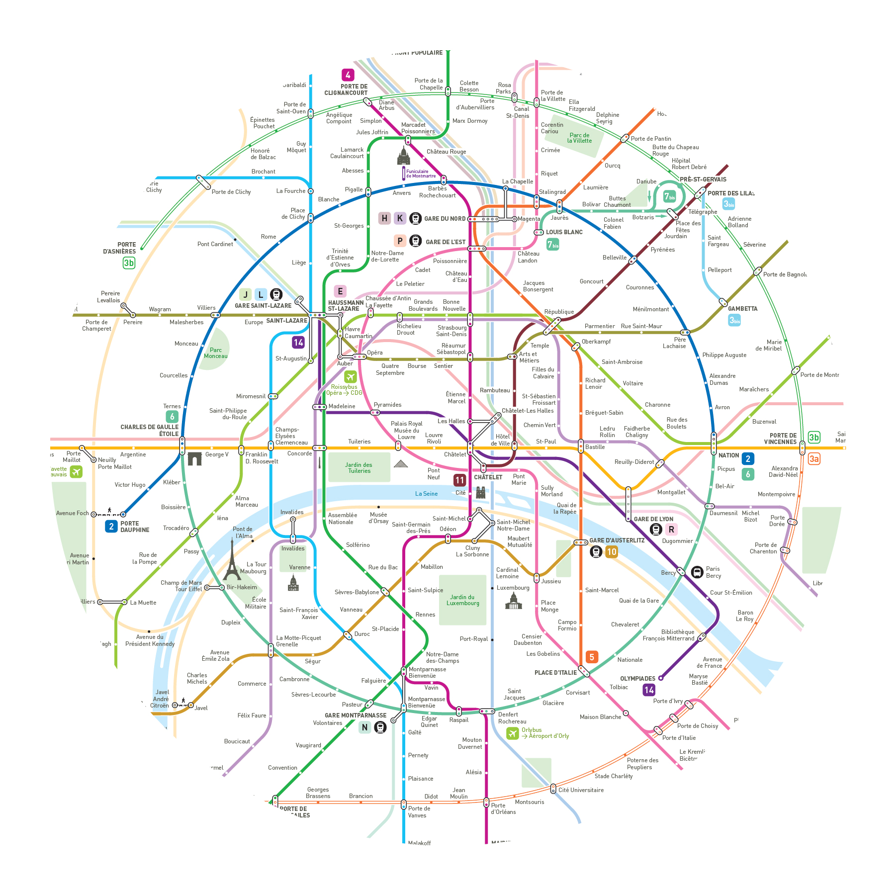
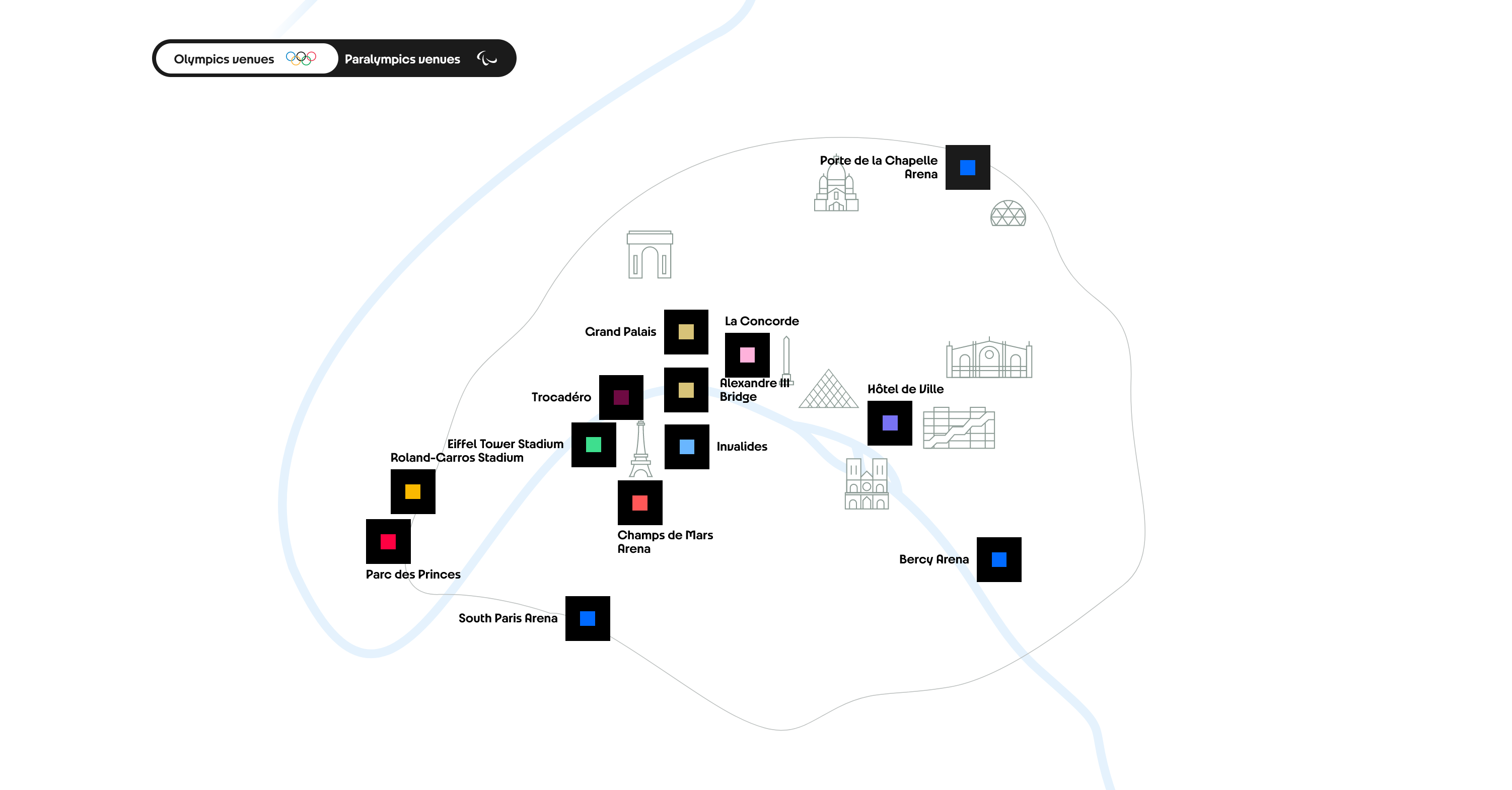
Close up view of the center of Paris:
About the Olympics metro map
This Grand Paris 2024 Olympics metro map is based on our Grand Paris 2030 network map.
Click here to see the original map and design explanations.
Useful ressources to plan your journey
Check how busy stations are going to be by day and hour on the official Ministry of Transportion website:
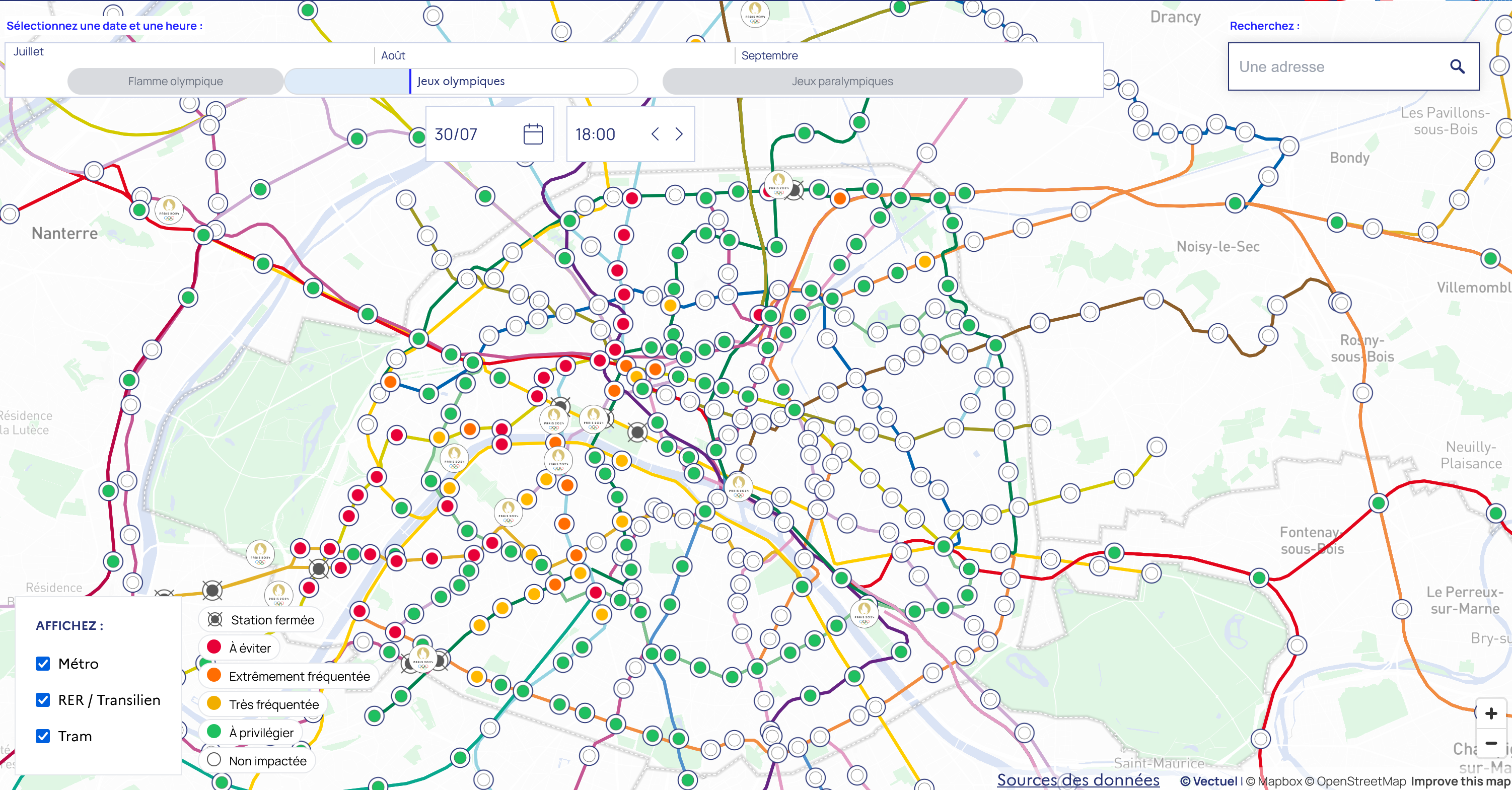
Check restricted areas by day and hour on the official Ministry of Transportion website:
Check venues locations on the official organizer's website:
Olympic Games 2024: Grand Paris Metro Map
Zoomable map: